Armstrong, Ontario
Armstrong (2016 Population 1,166) is a township in the Timiskaming District of Ontario. The only population centre in the township is the community of Earlton.
Armstrong | |
|---|---|
| Township of Armstrong | |
 Earlton | |
 Armstrong | |
| Coordinates: 47°42′30″N 79°49′30″W | |
| Country | Canada |
| Province | Ontario |
| District | Timiskaming |
| Settled | 1900 |
| Incorporated | 1921 |
| Government | |
| • Type | Township |
| • Mayor | Jean Marc Boileau |
| • Governing Body | Armstrong Township Council |
| • MP | Charlie Angus[1] |
| • MPP | John Vanthof[2] |
| Area | |
| • Land | 90.20 km2 (34.83 sq mi) |
| Population (2016)[3] | |
| • Total | 1,166 |
| • Density | 12.9/km2 (33/sq mi) |
| Time zone | UTC−05:00 (EST) |
| • Summer (DST) | UTC−04:00 (EDT) |
| Postal code | P0J 1E0 |
| Area code(s) | 705 (563 exchange) |
| Website | www |
The township is named after Samuel Armstrong,[4] an Independent member of the Legislative Assembly of Ontario for Parry Sound from 1886 to 1890.
History
Earlton began to be settled in 1900 as a lumber community by pioneers mostly from York County, soon followed by French-speaking farmers who cultivated the flat prairie-like land of the surrounding Great Clay Belt. In 1904, its post office was opened. The postmaster, Edward Albert Brasher, named the community after his son Earl.[4]
In 1921, Armstrong Township was incorporated.[4]
Demographics
| Canada census – Armstrong, Ontario community profile | |||
|---|---|---|---|
| 2016 | 2011 | ||
| Population: | 1,166 (-4.1% from 2011) | 1,216 (5.3% from 2006) | |
| Land area: | 90.20 km2 (34.83 sq mi) | 90.33 km2 (34.88 sq mi) | |
| Population density: | 12.9/km2 (33/sq mi) | 13.5/km2 (35/sq mi) | |
| Median age: | 41.2 (M: 40.1, F: 41.9) | 40.5 (M: 38.9, F: 41.9) | |
| Total private dwellings: | 521 | 516 | |
| Median household income: | $65,579 | ||
| References: 2016[5] 2011[6] earlier[7] | |||
| Year | Pop. | ±% |
|---|---|---|
| 1986 | 1,413 | — |
| 1991 | 1,394 | −1.3% |
| 1996 | 1,398 | +0.3% |
| 2001 | 1,223 | −12.5% |
| 2006 | 1,155 | −5.6% |
| 2011 | 1,216 | +5.3% |
| 2016 | 1,166 | −4.1% |
| Source: Statistics Canada | ||
Mother tongue:[3]
- English as first language: 37.6 %
- French as first language: 57.7 %
- English and French as first language: 1.7 %
- Other as first language: 2.6 %
Economy
Major employers:
- Liquor Control Board of Ontario (LCBO)
- Desjardins Group
- Earlton Timber Mart[8]
The community is renowned for its dairy and cash crop farms.
Transportation
Earlton (Timiskaming Regional) Airport is a regional airport located in Earlton, which opened in 1937 as an emergency landing area for Trans-Canada Air Lines. The airport today serves private light aircraft. It was served by NorOntair from 1973 to 1996, and by the Air Defense Command in the 1950s.[9]
Ontario Highway 11 is the major road connecting the community with other areas in Timiskaming and beyond. The retail strip is located along 10th Street North.
See also
References
- "Voter Information Service". Elections Canada. Retrieved 2010-04-15.
- "MPP John Vanthof". Elections Ontario. Retrieved 2012-02-16.
- "Armstrong Census Profile". 2016 Census data. Statistics Canada. Retrieved 2012-02-16.
- "Our Story". www.armstrongtownship.com. Township of Armstrong. Retrieved 17 December 2020.
- "2016 Community Profiles". 2016 Canadian Census. Statistics Canada. February 21, 2017. Retrieved 2020-12-17.
- "2011 Community Profiles". 2011 Canadian Census. Statistics Canada. July 5, 2013. Retrieved 2020-12-17.
- "2001 Community Profiles". 2001 Canadian Census. Statistics Canada. February 17, 2012.
- "Earlton Timber Mart".
- "History". Earlton-Timiskaming Regional Airport. Retrieved July 19, 2019.
External links
 Media related to Armstrong, Ontario at Wikimedia Commons
- Township of Armstrong
Places adjacent to Armstrong, Ontario | |
|---|---|
| City | 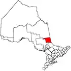 | |
|---|---|---|
| Towns | ||
| Townships | ||
| Village | ||
| Indian Reserves | ||
| Unorganized areas | ||
| Local services boards | ||
| ||
