Hudson, Ontario
Hudson is a township municipality[1] incorporating the congruent geographic township[2] in Timiskaming District in northeastern Ontario, Canada.[3][4] Hudson is located directly west of the city of Temiskaming Shores[5] and has only one named settlement, the community of Hillview.[6]
Hudson | |
|---|---|
| Township of Hudson | |
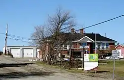 Township hall | |
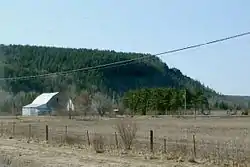
 Hudson | |
| Coordinates: 47°32′14″N 79°49′27″W | |
| Country | Canada |
| Province | Ontario |
| District | Timiskaming |
| Incorporated | 1904 |
| Surveyed | 1887 |
| First settled | 1897 |
| Government | |
| • Reeve | Larry Craig |
| Area | |
| • Total | 90.64 km2 (35.00 sq mi) |
| Elevation | 245 m (804 ft) |
| Population (2016) | |
| • Total | 503 |
| Time zone | UTC-5 (EST) |
| • Summer (DST) | UTC-4 (EDT) |
| Postal code FSA | P0J |
| Area code(s) | 705, 249 |
| Website | hudson |
History
Hudson was surveyed in 1887. However, the first settlers did not arrive until 1897, and the township was incorporated in 1904. The first Census of Canada to take place after settlement, in 1901, recorded the population as 46.[7]
Demographics
The township had a population count of 503 in the Canada 2016 Census, an increase of 5.7% from the 476 recorded in the Canada 2011 Census.[8]
| Canada census – Hudson, Ontario community profile | |||
|---|---|---|---|
| 2016 | 2011 | ||
| Population: | 503 (5.7% from 2011) | 476 (4.6% from 2006) | |
| Land area: | 90.37 km2 (34.89 sq mi) | 90.64 km2 (35.00 sq mi) | |
| Population density: | 5.6/km2 (15/sq mi) | 5.3/km2 (14/sq mi) | |
| Median age: | 50.0 (M: 50.7, F: 48.7) | 48.7 (M: 50.1, F: 47.8) | |
| Total private dwellings: | 280 | 336 | |
| Median household income: | $86,144 | ||
| References: 2016[9] 2011[10] earlier[11] | |||
| Year | Pop. | ±% |
|---|---|---|
| 1986 | 472 | — |
| 1991 | 488 | +3.4% |
| 1996 | 501 | +2.7% |
| 2001 | 490 | −2.2% |
| 2006 | 455 | −7.1% |
| 2011 | 476 | +4.6% |
| 2016 | 503 | +5.7% |
| Source: Statistics Canada | ||
Transportation
Ontario Highway 65 passes through the township on its way from Temiskaming Shores towards Matachewan.[5]
References
- "Hudson". Geographical Names Data Base. Natural Resources Canada. Retrieved 2011-08-16.
- "Hudson". Geographical Names Data Base. Natural Resources Canada. Retrieved 2011-08-16.
- "Hudson". Atlas of Canada. Natural Resources Canada. 2010-02-04. Retrieved 2011-08-16. Shows township limits.
- Restructured municipalities - Ontario map #4 (Map). Restructuring Maps of Ontario. Ontario Ministry of Municipal Affairs and Housing. 2006. Retrieved 2011-08-16.
- Map 12 (PDF) (Map). 1 : 1,600,000. Official road map of Ontario. Ministry of Transportation of Ontario. 2010-01-01. Retrieved 2011-08-16.
- "Hillview". Geographical Names Data Base. Natural Resources Canada. Retrieved 2011-08-16.
- "History". Township of Hudson. 2003. Retrieved 2011-08-16. Excerpted from Hawirko, Norman R; Arnott, Margaret. "I've got to stop here until I'm called for".
- Canada, Government of Canada, Statistics. "Census Profile, 2016 Census - Hudson, Township [Census subdivision], Ontario and Timiskaming, District [Census division], Ontario". www12.statcan.gc.ca. Retrieved 2018-07-15.
- "2016 Community Profiles". 2016 Canadian Census. Statistics Canada. February 21, 2017. Retrieved 2020-12-23.
- "2011 Community Profiles". 2011 Canadian Census. Statistics Canada. July 5, 2013. Retrieved 2020-12-23.
- "2001 Community Profiles". 2001 Canadian Census. Statistics Canada. February 17, 2012.
External links
| Wikimedia Commons has media related to Hudson, Ontario. |
Places adjacent to Hudson, Ontario | |
|---|---|
| City |  | |
|---|---|---|
| Towns | ||
| Townships | ||
| Village | ||
| Indian Reserves | ||
| Unorganized areas | ||
| Local services boards | ||
| ||