Hilliard, Ontario
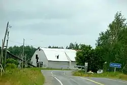
Hilliard is a township in the Canadian province of Ontario, located within the Timiskaming District. Its main community is Hilliardton, located along Secondary Highway 569. The smaller communities of Couttsville and Whitewood Grove are also located within the township.
Hilliard | |
|---|---|
| Township of Hilliard | |
 Hilliardton | |
 Hilliard | |
| Coordinates: 47°43′30″N 79°42′00″W | |
| Country | Canada |
| Province | Ontario |
| District | Timiskaming |
| Government | |
| • Type | Township |
| • Reeve | Laurie Bolesworth |
| • Federal riding | Timmins—James Bay |
| • Prov. riding | Timiskaming—Cochrane |
| Area | |
| • Land | 91.38 km2 (35.28 sq mi) |
| Population (2016)[1] | |
| • Total | 223 |
| • Density | 2.4/km2 (6/sq mi) |
| Time zone | UTC-5 (EST) |
| • Summer (DST) | UTC-4 (EDT) |
| Postal Code | P0J 1S0 |
| Area code(s) | 705 |
The township was named in honour of Daniel Hilliard, member of the Legislative Assembly of Ontario from 1886 to 1888.[2]
Demographics
| Year | Pop. | ±% |
|---|---|---|
| 1991 | 248 | — |
| 1996 | 253 | +2.0% |
| 2001 | 241 | −4.7% |
| 2006 | 222 | −7.9% |
| 2011 | 204 | −8.1% |
| 2016 | 223 | +9.3% |
| [3][4][1] | ||
Private dwellings, excluding seasonal cottages: 90 (total: 95)[1]
Mother tongue:[5]
- English as first language: 75%
- French as first language: 24%
- English and French as first language: 1%
- Other as first language: 0%
References
- "Census Profile, 2016 Census: Hilliard, Township". Statistics Canada. Retrieved July 17, 2019.
- ePodunk: Hilliard community profile
- Statistics Canada: 1996, 2001, 2006, 2011 census
- 2011 Census Profile
- "2006 Community Profile".
Places adjacent to Hilliard, Ontario | |
|---|---|
| City | 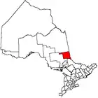 | |
|---|---|---|
| Towns | ||
| Townships | ||
| Village | ||
| Indian Reserves | ||
| Unorganized areas | ||
| Local services boards | ||
| ||
This article is issued from Wikipedia. The text is licensed under Creative Commons - Attribution - Sharealike. Additional terms may apply for the media files.