Artaise-le-Vivier
Artaise-le-Vivier is a commune in the Ardennes department in the Ardennes region of northern France.
Artaise-le-Vivier | |
|---|---|
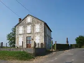 Town Hall | |
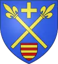 Coat of arms | |
Location of Artaise-le-Vivier 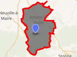
| |
 Artaise-le-Vivier  Artaise-le-Vivier | |
| Coordinates: 49°34′03″N 4°53′27″E | |
| Country | France |
| Region | Grand Est |
| Department | Ardennes |
| Arrondissement | Sedan |
| Canton | Vouziers |
| Intercommunality | CC Portes Luxembourg |
| Government | |
| • Mayor (2014-2020) | Fabien Warzee |
| Area 1 | 8.47 km2 (3.27 sq mi) |
| Population (2017-01-01)[1] | 66 |
| • Density | 7.8/km2 (20/sq mi) |
| Time zone | UTC+01:00 (CET) |
| • Summer (DST) | UTC+02:00 (CEST) |
| INSEE/Postal code | 08023 /08390 |
| 1 French Land Register data, which excludes lakes, ponds, glaciers > 1 km2 (0.386 sq mi or 247 acres) and river estuaries. | |
Geography
Artaise-le-Vivier is located some 25 km south-east of Charleville-Mézières and 15 km south by south-west of Sedan. Access to the commune is by the D24 road from Chémery-sur-Bar in the north-west passing through the commune and the village and continuing to join the D30 south-east of the commune. The D324 road also comes by an indirect route from La Neuville-à-Maire in the west to the village. The southern quarter of the commune is forested with the rest farmland.[2]
The Ruisseau de Terron with its tributaries rises in the south of the commune and flows north-west forming part of the western border before continuing north-west to join the Bar near Malmy. The Ruisseau de Charlier forms part of the eastern border of the commune before flowing west through the centre to join the Ruisseau de Terron on the western border.[2]
Neighbouring communes and villages
Places adjacent to Artaise-le-Vivier | ||||||||||
|---|---|---|---|---|---|---|---|---|---|---|
| ||||||||||
Heraldry
Arms of Artaise-le-Vivier |
Blazon: Azure, two sceptres of Or saltirewise between in chief a crosslet the same, between in base an inescutcheon Gules, 3 fesses of Or. |
Administration
List of Successive Mayors[3]
| From | To | Name | Party | Position |
|---|---|---|---|---|
| 2001 | 2008 | Claude Singlit | ||
| 2008 | 2014 | Thierry Warzee | ||
| 2014 | 2020 | Fabien Warzee |
(Not all data is known)
Demography
In 2017 the commune had 66 inhabitants.
|
| ||||||||||||||||||||||||||||||||||||||||||||||||||||||||||||||||||||||||||||||||||||||||||||||||||||||||||||
| Source: EHESS[4] and INSEE[5] | |||||||||||||||||||||||||||||||||||||||||||||||||||||||||||||||||||||||||||||||||||||||||||||||||||||||||||||
Sites and monuments
- The Church of Saint-Georges contains a Statue of Saint Georges (18th century)
 which is registered as an historical object.[6]
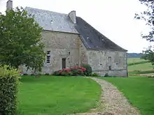
 - The Raminoise fortified house
Picture Gallery
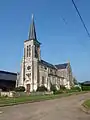 The church
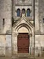 Entrance to the church
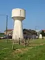 Artaise water tower
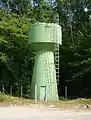 Le Vivier water tower
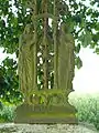 The calvary
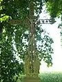 Wayside Cross
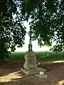 Wayside Cross
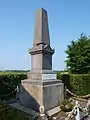 The War Memorial
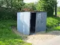 School bus stop
See also
References
- "Populations légales 2017". INSEE. Retrieved 6 January 2020.
- Google Maps
- List of Mayors of France (in French)
- Données Cassini, EHESS
- Population en historique depuis 1968, INSEE
- Ministry of Culture, Palissy PM08000024 Statue: Saint Georges (in French)

External links
- Artaise-le-Vivier on the National Geographic Institute website (in French)
- 3 Cantons official website (in French)
- Artaise-le-Vivier on Lion1906
- Artaise-le-Vivier on Géoportail, National Geographic Institute (IGN) website (in French)
- Artaife and le Vivier on the 1750 Cassini Map
| Wikimedia Commons has media related to Artaise-le-Vivier. |