Rubigny
Rubigny is a commune in the Ardennes department in northern France.
Rubigny | |
|---|---|
_vue_sur_Rubigny.JPG.webp) A general view of Rubigny | |
Location of Rubigny 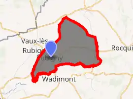
| |
 Rubigny  Rubigny | |
| Coordinates: 49°41′11″N 4°11′44″E | |
| Country | France |
| Region | Grand Est |
| Department | Ardennes |
| Arrondissement | Rethel |
| Canton | Signy-l'Abbaye |
| Intercommunality | Crêtes Préardennaises |
| Government | |
| • Mayor (2008–2014) | Daniel Baudrillard |
| Area 1 | 5.12 km2 (1.98 sq mi) |
| Population (2017-01-01)[1] | 67 |
| • Density | 13/km2 (34/sq mi) |
| Time zone | UTC+01:00 (CET) |
| • Summer (DST) | UTC+02:00 (CEST) |
| INSEE/Postal code | 08372 /08220 |
| 1 French Land Register data, which excludes lakes, ponds, glaciers > 1 km2 (0.386 sq mi or 247 acres) and river estuaries. | |
It is located 60 km north of Reims, at the junction of the D8 and D36 routes. Neighbouring villages are Wadimont and Vaux-les-Rubigny.
Population
| Year | Pop. | ±% |
|---|---|---|
| 1962 | 102 | — |
| 1968 | 104 | +2.0% |
| 1975 | 89 | −14.4% |
| 1982 | 64 | −28.1% |
| 1990 | 76 | +18.8% |
| 1999 | 64 | −15.8% |
| 2008 | 75 | +17.2% |
See also
References
- "Populations légales 2017". INSEE. Retrieved 6 January 2020.
| Wikimedia Commons has media related to Rubigny. |
This article is issued from Wikipedia. The text is licensed under Creative Commons - Attribution - Sharealike. Additional terms may apply for the media files.