Atrai Upazila
Atrai (Bengali: আত্রাই) is an Upazila of Naogaon District in the Division of Rajshahi, Bangladesh.[1]
Atrai
আত্রাই | |
|---|---|
 Atrai Location in Bangladesh | |
| Coordinates: 24°36.8′N 88°58.2′E | |
| Country | |
| Division | Rajshahi Division |
| District | Naogaon District |
| Area | |
| • Total | 284.41 km2 (109.81 sq mi) |
| Population (2011) | |
| • Total | 193,256 |
| • Density | 680/km2 (1,800/sq mi) |
| Time zone | UTC+6 (BST) |
| Website | Official website (in Bengali) |
Geography
_Bangladesh.svg.png.webp)
Atrai has 30570 households and total area 284.41 km2.
Demographics
According to 2011 Bangladesh census, Atrai had a population of 193,256. Males constituted 49.74% of the population and females 50.26%. Muslims formed 90.66% of the population, Hindus 9.31% and others 0.03%. Atrai had a literacy rate of 45.38% for the population 7 years and above.[2]
As of the 1991 Bangladesh census, Atrai has a population of 166978. Males constitute 50.88% of the population, and females 49.12%. The population above the age of eighteen years is 83466.
Administration
Atrai Upazila is divided into eight union parishads: Ashanganj, Bhopra, Bisha, Hatkalupara, Kalikapur, Maniari, Panchupur, and Sahagola. The union parishads are subdivided into 155 mauzas and 200 villages.[3]
References
- Md. Muklesur Rahman (2012). "Atrai Upazila". In Sirajul Islam and Ahmed A. Jamal (ed.). Banglapedia: National Encyclopedia of Bangladesh (Second ed.). Asiatic Society of Bangladesh.
- "Bangladesh Population and Housing Census 2011: Zila Report – Nagaon" (PDF). Table P01 : Household and Population by Sex and Residence, Table P05 : Population by Religion, Age group and Residence, Table P09 : Literacy of Population 7 Years & Above by Religion, Sex and Residence. Bangladesh Bureau of Statistics (BBS), Ministry of Planning, Government of the People’s Republic of Bangladesh. Retrieved 9 December 2018.
- "District Statistics 2011: Naogaon" (PDF). Bangladesh Bureau of Statistics. Archived from the original (PDF) on 13 November 2014. Retrieved 14 July 2014.
Capital: Naogaon | ||
| Upazilas | ||
| Constituencies | ||
| Attractions and sites | ||
| History | ||
| Inhabited areas | ||
| Rivers and transport | ||
| Educational institutions |
| |
Headquarters: Rajshahi | ||
| Bogra District | 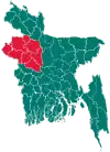 | |
| Joypurhat District | ||
| Naogaon District | ||
| Natore District | ||
| Nawabganj District | ||
| Pabna District | ||
| Rajshahi District | ||
| Sirajganj District | ||