Gurudaspur Upazila
Gurudaspur (Bengali: গুরুদাসপুর) is an upazila of Natore District in the Division of Rajshahi, Bangladesh.
Gurudaspur
গুরুদাসপুর | |
|---|---|
 Gurudaspur Location in Bangladesh | |
| Coordinates: 24°22′N 89°15′E | |
| Country | |
| Division | Rajshahi Division |
| District | Natore District |
| Area | |
| • Total | 199.4 km2 (77.0 sq mi) |
| Population (1991) | |
| • Total | 173,276 |
| • Density | 870/km2 (2,300/sq mi) |
| Time zone | UTC+6 (BST) |
| Website | Official Map of Gurudaspur |
Geography
Gurudaspur Upazila area 199.40 km2, located in between 24°18' and 24°27' north latitudes and in between 88°04' and 89°19' east longitudes. It is bounded by Singra and Tarash upazilas on the north, Baraigram upazila on the south, Tarash and Chatmohar upazilas on the east, Natore Sadar Upazila on the west. It has 32851 households.
Demographics
As of the 1991 Bangladesh census, Gurudaspur has a population of 173276. Males constitute 50.72% of the population, and females 49.28%. This Upazila's eighteen up population is 87290. Gurudaspur has an average literacy rate of 23.4% (7+ years), and the national average of 32.4% literate.[1]
Points of interest
Museum at village Khubjipur (1978), Chalan Beel Museum, Mosque at village Palshura Patpara, Mughal Mosque at village Piplar, Kusumhati Mosque (Sultanate period), Chapila Shahi Mosque, Gopinathpur Jami Mosque.
Administration
Gurudaspur Thana was formed in 1917 and it was turned into an upazila in 1984.
Gurudaspur Upazila is divided into Gurudaspur Municipality and six union parishads: Biaghat, Chapila, Dharabarisha, Khubjipur, Moshinda, and Nazirpur. The union parishads are subdivided into 104 mauzas and 110 villages.[2]
Gurudaspur Municipality is subdivided into 9 wards and 18 mahallas.[2]
| Upazila | ||||||||
|---|---|---|---|---|---|---|---|---|
| Municipality | Union | Mouza | Village | Population | Density (per km2) | Literacy rate (%) | ||
| 1 | 6 | 104 | 108 | Urban | Rural | 974 | Urban | Rural |
| 165118 | 29110 | 46 | 32.9 | |||||
| Municipality | |||||
|---|---|---|---|---|---|
| Area (km2) |
Ward |
Mahalla |
Population |
Density (per km2) |
Literacy rate (%) |
| 13.60 |
9 |
18 |
29110 |
2142 |
46.0 |
| Union | ||||
|---|---|---|---|---|
| Name of union and GO code | Area (acre) | Population | Literacy rate (%) | |
| Male | Female | |||
|
Khubjipur 60 |
5199 |
8423 |
8180 |
37.77 |
|
Chapila 27 |
8768 |
16339 |
15567 |
34.77 |
|
Dharabarisha 40 |
7894 |
14811 |
14583 |
32.11 |
|
Nazirpur 81 |
10678 |
18945 |
18072 |
33.83 |
|
Biaghat 13 |
10984 |
10649 |
10416 |
28.89 |
|
Moshinda 67 |
5769 |
14826 |
14307 |
30.71 |
Source Bangladesh Population Census 2001, Bangladesh Bureau of Statistics.
References
- "Population Census Wing, BBS". Archived from the original on 2005-03-27. Retrieved November 10, 2006.
- "District Statistics 2011: Natore" (PDF). Bangladesh Bureau of Statistics. Archived from the original (PDF) on 13 November 2014. Retrieved 14 July 2014.
External links
- Md Entaj Uddin (2012). "Gurudaspur Upazila". In Sirajul Islam and Ahmed A. Jamal (ed.). Banglapedia: National Encyclopedia of Bangladesh (Second ed.). Asiatic Society of Bangladesh.
| Upazila/Thana: | ||
|---|---|---|
Headquarters: Rajshahi | ||
| Bogra District | 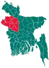 | |
| Joypurhat District | ||
| Naogaon District | ||
| Natore District | ||
| Nawabganj District | ||
| Pabna District | ||
| Rajshahi District | ||
| Sirajganj District | ||
References Bangladesh Population Census 2001, Bangladesh Bureau of Statistics; Cultural survey report of Gurudaspur Upazila 2007.