Niamatpur Upazila
Niamatpur (Bengali: নিয়ামতপুর) is an upazila of Naogaon District in the Division of Rajshahi, Bangladesh.
Niamatpur
নিয়ামতপুর | |
|---|---|
 Niamatpur Location in Bangladesh | |
| Coordinates: 24°51.5′N 88°34′E | |
| Country | |
| Division | Rajshahi Division |
| District | Naogaon District |
| Area | |
| • Total | 449.1 km2 (173.4 sq mi) |
| Population (2011) | |
| • Total | 248,351 |
| • Density | 550/km2 (1,400/sq mi) |
| Time zone | UTC+6 (BST) |
| Website | Official Map of Niamatpur |
Geography
_Bangladesh.svg.png.webp)
Niamatpur is located at 24.8583°N 88.5667°E. It has 35299 households and total area 449.1 km2. Here most of the people are Muslim (sunni). There also have Hindu, Christian and other. The main source of income is agriculture and business.
Demographics
According to 2011 Bangladesh census, Niamatpur had a population of 248,351. Males constituted 49.36% of the population and females 50.64%. Muslims formed 77.57% of the population, Hindus 18.38%, Christians 1.47% and others 2.41%. Niamatpur had a literacy rate of 44.71% for the population 7 years and above.[1]
As of the 1991 Bangladesh census, Niamatpur has a population of 193197. Males constitute 50.37% of the population, and females 49.63%. This Upazila's eighteen up population is 98284. Niamatpur has an average literacy rate of 25.8% (7+ years), and the national average of 32.4% literate.[2]
Administration
Niamatpur Upazila is divided into eight union parishads: Bahadurpur, Bhabicha, Chandan Nagar, Hajinagar, Niamatpur, Parail, Rasulpur, and Sreemantapur. The union parishads are subdivided into 317 mauzas and 344 villages.[3]
References
- "Bangladesh Population and Housing Census 2011: Zila Report – Nagaon" (PDF). Table P01 : Household and Population by Sex and Residence, Table P05 : Population by Religion, Age group and Residence, Table P09 : Literacy of Population 7 Years & Above by Religion, Sex and Residence. Bangladesh Bureau of Statistics (BBS), Ministry of Planning, Government of the People’s Republic of Bangladesh. Retrieved 9 December 2018.
- "Population Census Wing, BBS". Archived from the original on 2005-03-27. Retrieved November 10, 2006.
- "District Statistics 2011: Naogaon" (PDF). Bangladesh Bureau of Statistics. Archived from the original (PDF) on 13 November 2014. Retrieved 14 July 2014.
Capital: Naogaon | ||
| Upazilas | ||
| Constituencies | ||
| Attractions and sites | ||
| History | ||
| Inhabited areas | ||
| Rivers and transport | ||
| Educational institutions |
| |
Headquarters: Rajshahi | ||
| Bogra District | 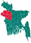 | |
| Joypurhat District | ||
| Naogaon District | ||
| Natore District | ||
| Nawabganj District | ||
| Pabna District | ||
| Rajshahi District | ||
| Sirajganj District | ||
