Sonatala Upazila
Sonatala Upazila (Bengali: সোনাতলা উপজেলা) is an upazila of Bogra District in the Division of Rajshahi, Bangladesh. Sonatala Thana was established in 1981[3] and was converted into an upazila in 1984.[4] It is named after its administrative center, the town of Sonatala.
Sonatala
সোনাতলা | |
|---|---|
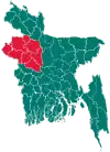
 Sonatala Location in Bangladesh | |
| Coordinates: 25°2′N 89°30′E | |
| Country | |
| Division | Rajshahi Division |
| District | Bogra District |
| Area | |
| • Total | 156.75 km2 (60.52 sq mi) |
| Population (2011 census)[2] | |
| • Total | 186,778 |
| • Density | 1,200/km2 (3,100/sq mi) |
| Time zone | UTC+6 (BST) |
| Postal code | 5826 |
| Website | sonatala |
Geography
Sonatala Upazila has a total area of 156.75 square kilometres (60.52 sq mi).[1] It borders Rangpur Division to the north, Sariakandi Upazila to the east and south, Gabtali Upazila to the south and west, and Shibganj Upazila, Bogra to the west.[4][5]
Beels
Goborchapa Beel
- Gobochanra Beel
- Thengar Beel
- Mohicharan Beel
- Padir Beel
- Satbeel
Chunepacha beel
Demographics
| Year | Pop. (000) | ±% |
|---|---|---|
| 1981 | 153 | — |
| 1991 | 146 | −4.6% |
| 2001 | 168 | +15.1% |
| 2011 | 187 | +11.3% |
| Source: Bangladesh Bureau of Statistics[1] | ||
According to the 2011 Bangladesh census, Sonatala Upazila had 45,869 households and a population of 186,778, 13.2% of whom lived in urban areas.[2] 10.6% of the population was under the age of 5.[6] The literacy rate (age 7 and over) was 43.2%, compared to the national average of 51.8%.[7][8]
Economy
Famous markets (Hat)
- Sonatola Hat
- Balua Hat
- Karamja Hat
- Sayed Ahmed College Hat
- Pakulla Hat
- Horikhali hat
Administration
Sonatala Upazila is divided into Sonatala Municipality and seven union parishads: Balua, Digdair, Jorgachha, Madhupur, Pakulla, Sonatala Sadar, and Tekani Chukainagar. The union parishads are subdivided into 94 mauzas and 131 villages.[1]
Sonatala Municipality is subdivided into 9 wards and 16 mahallas.[1]
Transport
Rail stations Sayeed Ahmed College, Bhelurpara, and Sonatala are on the branch line connecting Santahar and Kaunia. In July 2014 they were served by six or eight intercity and six mail trains a day.[9]
Education
There are three colleges in the upazila. Government Nazir Akhter College, founded in 1967, is the only public one. A private one is Balua Hat Degree College, founded in 1987.[1][10] Sonatola Pilot High School,founded in 1907.
The madrasa education system includes one fazil madrasa.[11]
References
- "District Statistics 2011: Bogra" (PDF). Bangladesh Bureau of Statistics. Archived from the original (PDF) on July 23, 2014. Retrieved July 14, 2014.
- "Population Census 2011: Bogra Table C-01" (PDF). Bangladesh Bureau of Statistics. Archived from the original (PDF) on July 14, 2014. Retrieved July 11, 2014.
- "Upazila Administration Background". Sonatala Upazila. Retrieved 17 July 2014.(in Bengali)
- Harun-or-Rashid, Md. (2012). "Sonatala Upazila". In Islam, Sirajul; Jamal, Ahmed A. (eds.). Banglapedia: National Encyclopedia of Bangladesh (Second ed.). Asiatic Society of Bangladesh.
- "Sonatala Map". Retrieved 11 July 2014.
- "Population Census 2011: Bogra Table C-04" (PDF). Bangladesh Bureau of Statistics. Archived from the original (PDF) on July 28, 2014. Retrieved July 11, 2014.
- "Population Census 2011: Bogra Table C-06" (PDF). Bangladesh Bureau of Statistics. Archived from the original (PDF) on July 28, 2014. Retrieved July 11, 2014.
- "Population and Housing Census 2011: Bangladesh at a Glance" (PDF). Bangladesh Bureau of Statistics. Archived from the original (PDF) on July 28, 2014. Retrieved July 21, 2014.
- "Bogra Schedule". Bangladesh Railways. Retrieved July 21, 2014.
- "Baluyahata Degree College". Sonatala Upazila. Retrieved 18 July 2014.(in Bengali)
- "List of Institutions". Ministry of Education. Retrieved July 15, 2014.
Capital: Bogra | ||
| Upazilas | ||
| Constituencies | ||
| Attractions and sites | ||
| Rivers and transport | ||
| Inhabited areas | ||
| Schools and colleges |
| |
| History | ||