Pabna Sadar Upazila
Pabna Sadar (Bengali: পাবনা সদর) is an upazila of Pabna District in the Division of Rajshahi, Bangladesh.[1]
Pabna Sadar
পাবনা সদর | |
|---|---|
 Pabna Sadar Location in Bangladesh | |
| Coordinates: 24°0.3′N 89°15′E | |
| Country | |
| Division | Rajshahi Division |
| District | Pabna District |
| Area | |
| • Total | 443.9 km2 (171.4 sq mi) |
| Population (1991) | |
| • Total | 431,513 |
| • Density | 970/km2 (2,500/sq mi) |
| Time zone | UTC+6 (BST) |
| Website | Sadar.gif Official Map of Pabna Sadar |
Geography
Pabna Sadar is located at 24.0042°N 89.2500°E. It has 74517 households and total area 443.9 km2.
Demographics
According to the 1991 Bangladesh census, Pabna Sadar had a population of 431,513, of whom 215,133 were aged 18 or over. Males constituted 51.76% of the population, and females 48.24%. Pabna Sadar had an average literacy rate of 29.1% (7+ years), against the national average of 32.4%.[2]
Administration
Pabna Sadar Upazila is divided into Pabna Municipality and ten union parishads: Ataikola, Bharara, Char Tarapur, Dapunia, Dogachhi, Gayeshpur, Hemayetpur, Malanchi, Maligachha, and Sadullahpur. The union parishads are subdivided into 259 mauzas and 291 villages.[3]
Pabna Municipality is subdivided into 15 wards and 46 mahallas.[3]
Chairman: Mosharrof Hossain
Vice Chairman:
Woman Vice Chairman:
Upazila Nirbahi Officer (UNO): Salma Khatun
References
- Md. Habibullah (2012), "Pabna Sadar Upazila", in Sirajul Islam and Ahmed A. Jamal (ed.), Banglapedia: National Encyclopedia of Bangladesh (Second ed.), Asiatic Society of Bangladesh
- "Population Census Wing, BBS". Archived from the original on 2005-03-27. Retrieved November 10, 2006.
- "District Statistics 2011: Pabna" (PDF). Bangladesh Bureau of Statistics. Archived from the original (PDF) on 13 November 2014. Retrieved 14 July 2014.
| Upazila/Thana: | ||
|---|---|---|
Headquarters: Rajshahi | ||
| Bogra District | 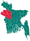 | |
| Joypurhat District | ||
| Naogaon District | ||
| Natore District | ||
| Nawabganj District | ||
| Pabna District | ||
| Rajshahi District | ||
| Sirajganj District | ||