Godagari Upazila
Godagari (Bengali: গোদাগাড়ী) is an Upazila of Rajshahi District in the Division of Rajshahi, Bangladesh.[1] This is the place where Mahananda river fall to Padma or Ganges.
Godagari
গোদাগাড়ী | |
|---|---|
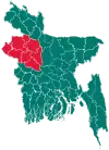
 Godagari Location in Bangladesh | |
| Coordinates: 24°28′N 88°19.8′E | |
| Country | |
| Division | Rajshahi Division |
| District | Rajshahi District |
| Area | |
| • Total | 472.13 km2 (182.29 sq mi) |
| Population (2011) | |
| • Total | 330,924 |
| • Density | 700/km2 (1,800/sq mi) |
| Time zone | UTC+6 (BST) |
| Website | Official Map of Godagari |
Geography
Godagari is located at 24.4667°N 88.3306°E. It has 40011 households and total area 472.13 km2.
Godagari Upazila is bounded by Chapai Nawabganj Sadar Upazila of Chapai Nawabganj district and Tanore Upazila on the north, Tanore and Paba Upazilas on the east, Lalgola, Bhagawangola I and Bhagawangola II CD Blocks, in Murshidabad district, West Bengal, India, all across the Ganges/ Padma, on the south, and Chapai Nawabganj Sadar Upazila on the west.[2][3]
Demographics
According to 2011 Bangladesh census, Godagari had a population of 330,924. Males constituted 50.24% of the population and females 49.76%. Muslims formed 87.78% of the population, Hindus 7.14%, Christians 3.41% and others 1.68%. Godagari had a literacy rate of 46.34% for the population 7 years and above.[4]
As of the 1991 Bangladesh census, Godagari has a population of 217811. Males constitute 50.88% of the population, and females 49.12%. This Upazila's eighteen up population is 108869. Godagari has an average literacy rate of 27.6% (7+ years), and the national average of 32.4% literate.[5]
History
The Deopara Prashasti, an important inscription in Sanskrit poetry describing the Sena dynasty of ancient Bengal, was discovered near the village of Deopara.[6]
Points of interest
Padumsa Dighi (pond) of Raja Bijoy Sen at village Deopara (eleventh century), tomb of Shah Sultan at Sultanganj (fourteenth century), tomb of Ali Kuli Beg at Kumarpur,
Marks of War of Liberation Memorial monument 1 (Sheikherpara).
Administration
Godagari thana was established in 1865 and was turned into an upazila in 1984.
Godagari Upazila is divided into Godagari Municipality, Kakanhat Municipality, and nine union parishads: Basudebpur, Char Ashariadaha, Deopara, Godagari, Gogram, Matikata, Mohanpur, Pakri, and Rishikul. The union parishads are subdivided into 389 mauzas and 398 villages.[7]
Education
According to Banglapedia, Godagari School & College, founded in 1905, is a notable secondary school.[1]
References
- Kaisaruzzaman, AKM (2012). "Godagari Upazila". In Islam, Sirajul; Jamal, Ahmed A. (eds.). Banglapedia: National Encyclopedia of Bangladesh (Second ed.). Asiatic Society of Bangladesh.
- "Godagari Upazila". Banglapedia. Retrieved 15 November 2018.
- "Tehsil Map of Murshidabad". CD Block/ Tehsil. Maps of India. Retrieved 15 November 2018.
- "Bangladesh Population and Housing Census 2011: Zila Report – Rajshahi" (PDF). Table P01 : Household and Population by Sex and Residence, Table P05 : Population by Religion, Age group and Residence, Table P09 : Literacy of Population 7 Years & Above by Religion, Sex and Residence. Bangladesh Bureau of Statistics (BBS), Ministry of Planning, Government of the People’s Republic of Bangladesh. Retrieved 9 December 2018.
- "Population Census Wing, BBS". Archived from the original on 2005-03-27. Retrieved November 10, 2006.
- Aksadul Alam (2012), "Deopara Prashasti", in Sirajul Islam and Ahmed A. Jamal (ed.), Banglapedia: National Encyclopedia of Bangladesh (Second ed.), Asiatic Society of Bangladesh
- "District Statistics 2011: Rajshahi" (PDF). Bangladesh Bureau of Statistics. Archived from the original (PDF) on 13 November 2014. Retrieved 14 July 2014.
| Upazila/Thana: | ||
|---|---|---|