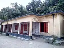
Bagmara Upazila
(Bengali: বাগমারা) is an Upazila of Rajshahi District in the Division of Rajshahi, Bangladesh.[1]
বাগমারা | |
|---|---|
 বাগমারা Location in Bangladesh | |
| Coordinates: 24°33.8′N 88°48.5′E | |
| Country | |
| Division | Rajshahi Division |
| District | Rajshahi District |
| Area | |
| • Total | 363.3 km2 (140.3 sq mi) |
| Population (1991) | |
| • Total | 282,520 |
| • Density | 780/km2 (2,000/sq mi) |
| Time zone | UTC+6 (BST) |
| Website | bagmara |
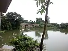
Geography
Bagmara is located at 24.5639°N 88.8083°E. It has 57675 households and total area 363.3 km2.
Demographics
According to 2011 Bangladesh census, Bagmara had a population of 354,664. Males constituted 49.95% of the population and females 50.05%. Muslims formed 95.31% of the population, Hindus 4.65% and others 0.04%. Bagmara had a literacy rate of 46.31% for the population 7 years and above.[2]
As of the 1991 Bangladesh census, Bagmara has a population of 282520. Males constitute 50.01% of the population, and females 49.99%. This Upazila's eighteen up population is 147768. Bagmara has an average literacy rate of 52.9% (7+ years), and the national average of 32.4% literate.[3]
Administration
Bagmara Upazila is divided into Bhawbaniganj Municipality, Tahirpur Municipality, and 16 union parishads: Auchpara, Basupara, Borobihanoli, Dippur, Ganipur, Gobindapara, Gualkandi, Hamirkutsa, Jogipara, Kacharikoalipara, Maria, Nordas, Sonadanaga, Sreepur, Suvodanga, and Zhikra. The union parishads are subdivided into 292 mauzas and 332 villages.[4]
Notable residents
- Abdus Sattar Mondal was Member of Parliament twice for constituencies encompassing Bagmara Upazila.
- Alhajj Md. Nasir Uddin Sarker, Founder of Nasirganj Degree College & Nasirganj Post Office.
- Dr. Abul Hasan,Director, Anti-Corruption Commission (Bangladesh).
References
- Md Asadul Islam (2012), "Baghmara Upazila", in Sirajul Islam and Ahmed A. Jamal (ed.), Banglapedia: National Encyclopedia of Bangladesh (Second ed.), Asiatic Society of Bangladesh
- "Bangladesh Population and Housing Census 2011: Zila Report – Rajshahi" (PDF). Table P01 : Household and Population by Sex and Residence, Table P05 : Population by Religion, Age group and Residence, Table P09 : Literacy of Population 7 Years & Above by Religion, Sex and Residence. Bangladesh Bureau of Statistics (BBS), Ministry of Planning, Government of the People’s Republic of Bangladesh. Retrieved 9 December 2018.
- "Population Census Wing, BBS". Archived from the original on 2005-03-27. Retrieved November 10, 2006.
- "District Statistics 2011: Rajshahi" (PDF). Bangladesh Bureau of Statistics. Archived from the original (PDF) on 13 November 2014. Retrieved 14 July 2014.
| Upazila/Thana: | ||
|---|---|---|
Headquarters: Rajshahi | ||
| Bogra District | 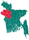 | |
| Joypurhat District | ||
| Naogaon District | ||
| Natore District | ||
| Nawabganj District | ||
| Pabna District | ||
| Rajshahi District | ||
| Sirajganj District | ||