Baheri
Baheri is a tehsil in Bareilly district in the northern Indian state of Uttar Pradesh. It is geographically located near the lower reaches of Gaula river. The Town 300 kilometres (186 mi) north of the state capital, Lucknow, and 300 kilometres (186 mi) east of the national capital, New Delhi.
Baheri
Bheri | |
|---|---|
city | |
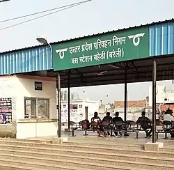 Roadways Bus station, Baheri | |
| Nickname(s): Textile City | |
 Baheri Location in Uttar Pradesh, India  Baheri Baheri (India) | |
| Coordinates: 28.78°N 79.5°E | |
| Country | |
| State | Uttar Pradesh |
| District | Bareilly |
| Government | |
| • Chairman | Fauzul Naseem |
| Area | |
| • Total | 22 km2 (8 sq mi) |
| Area rank | 84 |
| Elevation | 278 m (912 ft) |
| Population (2011) | |
| • Total | 6,841 |
| • Density | 310/km2 (810/sq mi) |
| Demonym(s) | Bahervi |
| Languages | |
| • Official | Khariboli, Hindi, Kumaoni, Urdu, Punjabi |
| Time zone | UTC+5:30 (IST) |
| PIN | Pin Code 243201 |
| Vehicle registration | HT 72 |
| Website | up |
Geography
Baheri is located at 28.78°N 79.5°E.[1] It has an average elevation of 271 metres (889 feet).
Demographics
As of 2011 India census,[2] Baheri had a population of 6841. Males constitute 53% of the population and females 47%. Baheri has an average literacy rate of 85%, higher than the national average of 74%; with 87% of the males and 82% of females literate. 11% of the population is under 6 years of age.
Architecture
The type of architecture here is Anglo-Indian Style.
Economy
The major economy is based on the cultivation and agriculture. There are many food processing industries also here.
References
- Falling Rain Genomics, Inc – Baheri
- "Census of India 2011: Data from the 2011 Census, including cities, villages and towns (Provisional)". Census Commission of India. Archived from the original on 16 June 2004. Retrieved 1 November 2008.