Shravasti district
Shravasti district is one of the districts of the Uttar Pradesh state of India, with Bhinga town as its district headquarters. Shravasti district is a part of Devipatan Division. According to Government of India, it is one of the minority concentrated districts in India on the basis of the 2001 census data on population, socio-economic indicators and basic amenities indicators.[1]
Shravasti district | |
|---|---|
District of Uttar Pradesh | |
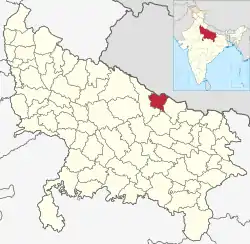 Location of Shravasti district in Uttar Pradesh | |
| Country | India |
| State | Uttar Pradesh |
| Division | Devipatan |
| Headquarters | Bhinga |
| Tehsils | Ikauna, Bhinga Jamunaha |
| Government | |
| • Lok Sabha constituencies | Shravasti |
| • Vidhan Sabha constituencies | Shravasti and Bhinga |
| Area | |
| • Total | 1,640 km2 (630 sq mi) |
| Population (2011) | |
| • Total | 1,117,361 |
| • Density | 680/km2 (1,800/sq mi) |
| Demographics | |
| • Literacy | 46.74 per cent |
| • Sex ratio | 881 |
| Time zone | UTC+05:30 (IST) |
| Major highways | up state highway 26, SH-96A |
| Website | http://shravasti.nic.in |
History
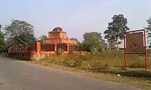
Shravasti, the north-eastern town of Uttar Pradesh, is located near the West Rapti River. This town is closely associated with the life of Gautama Buddha, who is believed to have spent 24 Chaturmases here.[2] Age-old stupas, majestic viharas and several temples near the village of "Sahet-Mahet" establish Buddha's association with Shravasti. According to Nagarjuna, the city had a population of 900,000 in 5th century BCE and it even overshadowed Magadha's capital, Rajgir.
As mentioned in the 'Bruhatkalpa' and various Kalpas of the fourteenth century, the name of the city was Mahid. There are subsequent mentions showing that the name of this city was Sahet-Mahet. It is also mentioned that a vast fort covered this city in which there were many temples having idols of Devkulikas.
Today a great rampart of earth and brick surrounds this city. During excavation in 'Sahet-Mahet' near Shravasti City, many ancient idols and inscriptions were found. They are now kept in museums of Mathura and Lucknow. At present, the archaeological department of the Indian Government is doing excavation to perform allied research.
Shravasti was formed in May 1997 when Bahraich district was divided.
Geography
Shravasti—part of historic Awadh—was carved out from Gonda district on the south and Bahraich district on the west. Shrawasti also borders Balrampur on the east, and Nepal's districts Dang-Deukhuri to the northeast and Banke district nepal to the northwest. Shravasti district headquarters Bhinga is about 170 kilometres from Lucknow [up state headquarter ] the state capital.
Economy
In 2006 the Ministry of Panchayati Raj named Shravasti one of the country's 250 most backward districts (out of a total of 640). It is one of the 34 districts in Uttar Pradesh currently receiving funds from the Backward Regions Grant Fund Programme (BRGF).[3]
Demographics
| Year | Pop. | ±% p.a. |
|---|---|---|
| 1901 | 285,233 | — |
| 1911 | 284,164 | −0.04% |
| 1921 | 288,905 | +0.17% |
| 1931 | 308,159 | +0.65% |
| 1941 | 336,423 | +0.88% |
| 1951 | 365,107 | +0.82% |
| 1961 | 401,234 | +0.95% |
| 1971 | 444,754 | +1.04% |
| 1981 | 543,835 | +2.03% |
| 1991 | 672,898 | +2.15% |
| 2001 | 855,985 | +2.44% |
| 2011 | 1,117,361 | +2.70% |
| source:[4] | ||
According to the 2011 census Shravasti district has a population of 1,117,361, roughly equal to the nation of Cyprus[5] or the US state of Rhode Island.[6] This gives it a ranking of 414th in India (out of a total of 640). The district has a population density of 681 inhabitants per square kilometre (1,760/sq mi). Its population growth rate over the decade 2001-2011 was -5.25%. Shrawasti has a sex ratio of 881 females for every 1000 males, and a literacy rate of 46.74%. Male literacy rate is 57.16% while that of female is 34.78%. 96.54% of district's population lives in rural areas. Approximately 0.11% (1,253 people) of the total population of the district lives on footpath or without any roof cover.
At the time of the 2011 Census of India, 98.78% of the population in the district spoke Hindi and 1.15% Urdu as their first language.[7]
Religions
Religious groups in the 2011 census
According to the 2011 Census, Hindus form majority in the district with a population of 68.79% of the total population. Remaining population is overwhelmingly Muslim. However, in the most populous town of Bhinga, Muslims are in majority with the population of 56.95% of the total town population.[7]
References
- "Press Information Bureau English Releases". Pib.nic.in. Retrieved 23 July 2012.
- http://www.hindustantimes.com/Travel/TravelStories/The-Ananda-Bodhi-at-Shravasti/Article1-905851.aspx%5B%5D
- Ministry of Panchayati Raj (8 September 2009). "A Note on the Backward Regions Grant Fund Programme" (PDF). National Institute of Rural Development. Archived from the original (PDF) on 5 April 2012. Retrieved 27 September 2011.
- Decadal Variation In Population Since 1901
- US Directorate of Intelligence. "Country Comparison:Population". Retrieved 1 October 2011.
Cyprus 1,120,489 July 2011 est.
- "2010 Resident Population Data". U. S. Census Bureau. Archived from the original on 1 January 2011. Retrieved 30 September 2011.
Rhode Island 1,052,567
- 2011 Census of India, Population By Mother Tongue
Places adjacent to Shravasti district | ||||||||||
|---|---|---|---|---|---|---|---|---|---|---|
| ||||||||||