Bagpat district
Bagpat district is one of the 75 districts of the Indian state of Uttar Pradesh with headquarters at the town of Baghpat. Created in 1997, the district has an area of 1,321 square kilometres (510 sq mi) and a population of 1,303,048.
Baghpat district | |
|---|---|
District of Uttar Pradesh | |
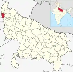 Location of Baghpat district in Uttar Pradesh | |
| Country | India |
| State | Uttar Pradesh |
| Division | Meerut |
| Headquarters | Baghpat |
| Government | |
| • Lok Sabha constituencies | Baghpat |
| • Vidhan Sabha | Chhaprauli, Baraut, Bagpat |
| Area | |
| • Total | 1,321 km2 (510 sq mi) |
| Population (2011) | |
| • Total | 1,303,048 |
| • Density | 990/km2 (2,600/sq mi) |
| Demographics | |
| • Literacy | 72.01 per cent[1] |
| • Sex ratio | 861 |
| Time zone | UTC+05:30 (IST) |
| Major highways | NH 334, NH 709B |
| Website | http://bagpat.nic.in/ |
History
Baghpat city, after which the district takes its name, derives its name either from vyagprastha ("land of tigers") or from vakyaprasth ("place for delivering speeches"). the city was finally named Baghpat, or Bagpat, during the Mughal era. Starting from a small commercial center known as the Mandi, the city grew in importance after the 1857 mutiny and became the headquarters of Baghpat tehsil.[2]
Baghpat district was created in the year 1997 and named after the erstwhile Baghpat tehsil of Meerut district.[3][2]
Geography
The district has an area of 1,321 square kilometres (510 sq mi).[2] Baghpat town lies on the east bank of the Yamuna River,[2] and is within the National Capital Region.
It is 40 kilometres (25 mi) from Delhi, the national capital, 52 kilometres (32 mi) from Meerut, and 55 kilometres (34 mi) from Ghaziabad.[2]
Demographics
| Year | Pop. | ±% p.a. |
|---|---|---|
| 1901 | 347,045 | — |
| 1911 | 342,354 | −0.14% |
| 1921 | 341,292 | −0.03% |
| 1931 | 364,792 | +0.67% |
| 1941 | 431,893 | +1.70% |
| 1951 | 519,483 | +1.86% |
| 1961 | 606,642 | +1.56% |
| 1971 | 701,493 | +1.46% |
| 1981 | 852,462 | +1.97% |
| 1991 | 1,030,399 | +1.91% |
| 2001 | 1,163,991 | +1.23% |
| 2011 | 1,303,050 | +1.13% |
| source:[4] | ||
According to the 2011 census, Bagpat district has a population of 1,303,048,[5] which is roughly equal to that of African nation of Mauritius[6] or the US state of New Hampshire.[7] This gives it a ranking of the 376th most populous districts in India (out of a total of 640).[5] The district has a population density of 986 inhabitants per square kilometre (2,550/sq mi) .[5] Its population growth rate over the decade 2001-2011 was 11.87%.[5] Bagpat has a sex ratio of 858 females for every 1000 males,[5] and a literacy rate of 73.54%. Baghpat is a Hindu-majority district, with about 70% Hindu population and 28% Muslim population.[5] 97.38% of the population of the district spoke Hindi, and 2.54% Urdu, as their first language.[8]
Administration
Legislative constituencies
The current Member of the Legislative Assembly (MLA) of the Uttar Pradesh Vidhan Sabha for Baghpat is Yogesh Dhama; the MLA for Baraut is Krishan Pal Malik; and the MLA for Chhaprauli is Sahender Singh Ramala. All of these state-legislature constituencies are part of the Baghpat Lok Sabha constituency, whose MP is Satya Pal Singh.
Tehsils and blocks
Bagpat district is divided into 3 tehsils: Baghpat, Baraut, and Khekra. Baghpat tehsil comprises two blocks – Baghpat and Pilana; while Baraut comprises three – Binauli, Chhaprauli, and Baraut. Khekra tehsil comprises only the Khekra block. Baghpat, Baraut, Doghat Rural and Khekada are the major towns in the district.[9][10]
Blocks
- Baghpat
- Baraut
- Binauli
- Chhaprauli
- Khekra
- Pilana
Villages and the respective gram pradhans
Notable villages of Bagpat district are Chhaprauli (from which prime minister Charan Singh hailed), Asara, Baoli, and Bharal.
| Sr. No. | Tehsil | Sr.No. | Block | Sr. No. | Village | Name of Gram Pradhan |
|---|---|---|---|---|---|---|
| 001 | Baghpat | 001 | Baghpat | 001 | Doulcha | Gulsan Yadav |
| 002 | Naurojpur Gujar | Omparkash Nain | ||||
| 003 | Budhera | Dharamvati Devi | ||||
| 004 | Santoshpur | Raman S/o CH Prem Dedha | ||||
| 005 | Baghu | Sumit S/O Surendra DevDhar | ||||
| 006 | Vinaypur | Satyaveer Singh | ||||
| 007 | Baleni | Manoj Yadav | ||||
| 008 | Gyasri urf Gaadhi | Chaman lal sharma | ||||
| 009 | Habibpur Nagla | Babbu Pardhan | ||||
| 010 | Chauhalda | Roshni Devi |
Economy
Baghpat town has an agriculture-based economy where sugarcane is a main crop. There are sugar mills in Baghpat, Ramala and Malakpur. Wheat, mustard, and vegetables are also extensively grown.[2][11]
Education
Colleges located in Baghpat include:
Notable people
- Nitin Tomar, professional Indian kabaddi player, native of Malakpur
References
- "District-specific Literates and Literacy Rates, 2001". Registrar General, India, Ministry of Home Affairs. Retrieved 10 October 2010.
- "About District". Government of Uttar Pradesh: Bagpat district. Retrieved 2 February 2019.
- "Census of India 2011 – Uttar Pradesh – District Census Handbook – Baghpat" (PDF). Office of the Registrar General & Census Commissioner, India. 2011. p. 9. Retrieved 7 July 2016.
- Decadal Variation In Population Since 1901
- "Baghpat (Bagpat) District : Census 2011 data". Census2011.co.in. 2011. Retrieved 24 June 2018.
- US Directorate of Intelligence. "Country Comparison:Population". Retrieved 1 October 2011.
Gurjars hold Baghpat, they have a large population in Baghpat and Khekra tehsils, and Jats hold Baraut and have a large population in Baraut and Chhaprauli towns. Mauritius 1,303,717, July 2011 est.
- "2010 Resident Population Data". U. S. Census Bureau. Archived from the original on 20 December 2012. Retrieved 24 October 2016.
New Hampshire 1,316,470
- 2011 Census of India, Population By Mother Tongue
- "Tehsils". Government of Uttar Pradesh: Bagpat district. Retrieved 2 February 2019.
- "Blocks". Government of Uttar Pradesh: Bagpat district. Retrieved 2 February 2019.
- "Economy". Government of Uttar Pradesh: Baghpat district. Retrieved 26 March 2018.
External links
| Wikimedia Commons has media related to Bagpat district. |
Places adjacent to Bagpat district | |
|---|---|