Pratapgarh district, Uttar Pradesh
The Pratapgarh district is one of the districts of Uttar Pradesh state of India, and Pratapgarh town is the district headquarters. The district is a part of Prayagraj division.
Pratapgarh district | |
|---|---|
District of Uttar Pradesh | |
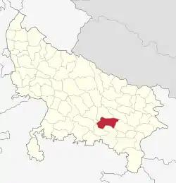 Location of Pratapgarh district in Uttar Pradesh | |
| Coordinates (Pratapgarh, Uttar Pradesh): 25.897°N 81.945°E | |
| Country | India |
| State | Uttar Pradesh |
| Division | Prayagraj |
| Headquarters | Pratapgarh, Uttar Pradesh |
| Tehsils | Raniganj, Kunda, Lalganj, Patti, Sadar |
| Government | |
| • Lok Sabha constituencies | Pratapgarh (Lok Sabha constituency) |
| • Vidhan Sabha constituencies | 1. Babaganj 2. Kunda 3. Patti 4. Sadar 5. Rampur Khas 6. Raniganj 7. Vishwanathganj |
| Area | |
| • Total | 3,717 km2 (1,435 sq mi) |
| Population (2011) | |
| • Total | 3,209,141 |
| • Density | 860/km2 (2,200/sq mi) |
| Demographics | |
| • Literacy | 73.1 % |
| Time zone | UTC+05:30 (IST) |
| Major highways | NH-96, NH-236 |
| Website | http://pratapgarh.nic.in/ |
Wildlife
The district has Ganga Dolphins in its river.[1]
Economy
In 2006 the Ministry of Panchayati Raj named Pratapgarh one of the country's 250 most backward districts (out of a total of 640).[2] It is one of the 34 districts in Uttar Pradesh currently receiving funds from the Backward Regions Grant Fund Programme (BRGF).[2]
Demographics
According to the 2011 census Pratapgarh district, Uttar Pradesh has a population of 3,209,141,[4] roughly equal to the nation of Mongolia[5] or the US state of Iowa.[6] This gives it a ranking of 109th in India (out of a total of 640).[4] The district has a population density of 854 inhabitants per square kilometre (2,210/sq mi).[4] Its population growth rate over the decade 2001-2011 was 16.2%.[4] Pratapgarh has a sex ratio of 994 females for every 1000 males,[4] and a literacy rate of 73.1%.[4]
At the time of the 2011 Census of India, 90.7% of the population in the district spoke Hindi, 6.0% Awadhi (which is very similar to Hindi) and 3.13% Urdu as their first language.[7]
| Pratapgarh district: mother-tongue of population, according to the 2011 Census.[7] | |||
|---|---|---|---|
| Mother tongue code | Mother tongue | People | Percentage |
| 002007 | Bengali | 308 | 0.01% |
| 006030 | Awadhi | 193,030 | 6.02% |
| 006102 | Bhojpuri | 428 | 0.01% |
| 006142 | Chhattisgarhi | 1,198 | 0.04% |
| 006240 | Hindi | 2,911,957 | 90.74% |
| 015043 | Odia | 260 | 0.01% |
| 016038 | Punjabi | 363 | 0.01% |
| 022015 | Urdu | 100,588 | 3.13% |
| 040001 | English | 181 | 0.01% |
| N.A. | Others | 828 | 0.03% |
| Total | 3,209,141 | 100.00% | |
| Year | Pop. | ±% p.a. |
|---|---|---|
| 1901 | 908,105 | — |
| 1911 | 895,279 | −0.14% |
| 1921 | 850,752 | −0.51% |
| 1931 | 901,618 | +0.58% |
| 1941 | 1,036,496 | +1.40% |
| 1951 | 1,106,805 | +0.66% |
| 1961 | 1,252,196 | +1.24% |
| 1971 | 1,422,707 | +1.28% |
| 1981 | 1,801,049 | +2.39% |
| 1991 | 2,210,700 | +2.07% |
| 2001 | 2,731,174 | +2.14% |
| 2011 | 3,209,141 | +1.63% |
| source:[8] | ||
Education
Notable persons
- Munishwar Dutt Upadhyay, freedom fighter, later became only member of Constituent Assembly from Pratapgarh and twice elected Member of Parliament from Pratapgarh.
- Swami Karpatri Maharaj, spiritual leader and founder of Ramrajya party
- Rajesh Kumar Mishra, leader and politician at Kisaan Morcha, BJP
- Bajrang Bahadur Singh, founder vice chancellor of Pant Nagar University and later the first Governor of Himachal Pradesh state of India
- Jagadguru Kripalu Maharaj (1922 - 2013), Hindu spiritual leader and saint from Mangarh, Pratapgarh
- Dinesh Singh (1925-1995), Deputy Minister in the ministry of external affairs and served as a member of parliament
- Harivansh Rai Bachchan (1907-2003) poet and professor of Allahabad University, best known for his early work Madhushala; father of Bollywood star Amitabh Bachchan
- Raghuraj Pratap Singh (born 1969) known as Raja Bhaiya, politician, independent member of legislative assembly and MLA of Pratapgarh district Uttar Pradesh
- Anupam Shyam Ojha (born 1957), film and television actor, who usually plays villainous role on international films set in India
- Babulal Gaur (born 1930) BJP Leader and Ex. Chief Minister of Madhya Pradesh also hails from Pratapgarh.
- Shweta Tiwari (born 1980), Bollywood and Bhojpuri film actress and winner of the fourth season of the reality show Bigg Boss
- Rajkumari Ratna Singh (born 1959), politician from Indian National Congress Party, member of parliament.
- Pramod Tiwari (born 1956), senior leader of Congress Party and EX MLA from (Rampur Khas), and current MP of Rajya Sabh Pratapgarh, Uttar Pradesh.
- Lal Pratap Singh (1931-2011), Senior leader of Congress Party and Two time MLA (1980-1989) from Pratapgarh Sadar.
- Ajit Pratap Singh
References
- "Gangetic Dolphin Beaten To Death In UP, 3 Arrested As Video Goes Viral". NDTV.com. 8 January 2021. Retrieved 8 January 2021.
- Ministry of Panchayati Raj (8 September 2009). "A Note on the Backward Regions Grant Fund Programme" (PDF). National Institute of Rural Development. Archived from the original (PDF) on 5 April 2012. Retrieved 27 September 2011.
- http://www.census2011.co.in/data/religion/district/544-pratapgarh.html
- "District Census 2011". Census2011.co.in. 2011. Retrieved 30 September 2011.
- US Directorate of Intelligence. "Country Comparison:Population". Retrieved 1 October 2011.
Mongolia 3,133,318 July 2011 est.
- "2010 Resident Population Data". U. S. Census Bureau. Retrieved 30 September 2011.
Iowa 3,046,355
- C-16 Population By Mother Tongue – Uttar Pradesh (Report). Office of the Registrar General & Census Commissioner, India. Retrieved 15 July 2020.
- Decadal Variation In Population Since 1901
External links
| Wikisource has the text of a 1911 Encyclopædia Britannica article about Pratapgarh district, Uttar Pradesh. |
Places adjacent to Pratapgarh district, Uttar Pradesh | |
|---|---|