Amethi district
Amethi district is the 72nd district of the state of Uttar Pradesh in northern India. This district is part of Faizabad division. It covers an area of 3,070 km². Gauriganj is the administrative headquarters of the district.
Amethi district | |
|---|---|
District of Uttar Pradesh | |
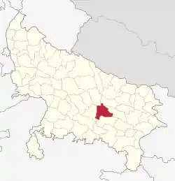 Location of Amethi district in Uttar Pradesh | |
| Country | India |
| State | Uttar Pradesh |
| Division | Faizabad division |
| Headquarters | Gauriganj |
| Tehsils | 4 |
| Government | |
| • Lok Sabha constituencies | Amethi (Lok Sabha constituency) |
| • Vidhan Sabha constituencies | |
| • District Magistrate | Arun Kumar, IAS[2] |
| Area | |
| • Total | 3,063 km2 (1,183 sq mi) |
| Population | |
| • Total | 2,549,935 |
| • Density | 830/km2 (2,200/sq mi) |
| Time zone | UTC+05:30 (IST) |
| Website | http://amethi.nic.in/ |
It is better known due to being the seat of power of the Indian Nehru-Gandhi political dynasty since 1980. The former prime minister Jawaharlal Nehru, his grandsons Sanjay and Rajiv Gandhi (the sons of Indira Gandhi), Rajiv Gandhi's widow Sonia Gandhi and son Rahul Gandhi, have at one time or the other, represented its constituency.[3] However, this changed in 2019 when Rahul Gandhi was defeated in the Lok Sabha elections by Smriti Irani, a former TV actress.
General characteristics of the district
Amethi was the 72nd district of Uttar Pradesh which came into existence on 1 July 2010 by merging three tehsils of the erstwhile Sultanpur district namely Amethi, Gauriganj and Musafirkhana and two tehsils of the erstwhile Raebareli district, namely, Salon and Tiloi and was named as Chhatrapati Shahuji Maharaj Nagar. However, its name was changed back to Amethi when the ruling party changed.
Amethi is a major town of district and also a municipal board.
History
Amethi lies on the Raebareli-Amethi-Sultanpur road about 40 km south-west of Sultanpur city. Also called as Raipur-Amethi, of which Raipur belonged to the Raja of Amethi who lived at Ram Nagar. His ancestors used to live in Raipur-Phulwari where the old fort is still found. Here is also a temple called Hanumangarhi and a mosque both built about hundred years ago. About three kilometres north of Ram Nagar there is a tomb of famous poet, Saint Malik Muhammad Jayasi where he died, and the fort was built by Bachghoti Rajas.[4]
Location
District Amethi lies at the latitude 26°9’ north and longitude 81°49’ east at an average elevation of 101 metres(331 feet) from mean sea level. The total geographic area of the districts is about 3063 km2. The surface is generally level, being broken only by ravines in the neighbourhood of the rivers. The principal river is Gomti, which passes through the centre of the district. North side of this district is bounded by Faizabad District; South side is bounded by Pratapgarh District. West side is bounded by Bara-Banki District and Rai Baeilly District and the East side is bounded by Sultanpur district.
Topography
The land of Amethi district is generally plane except some regions around the Gomti River which drains almost the whole district. It may be called an agrarian area as agriculture is the main occupation of the people. Amethi district has a wet and dry climate with average temperatures ranging between 23 °C to 28 °C. Amethi experiences three distinct seasons: summer, monsoon and a mild autumn. Typical summer months are from March to May, with maximum temperatures ranging from 36° to 44 °C. The rainy season in the districts falls between June and September and July being the wettest month of the year. Winter starts from November. The daytime temperature hovers around 22 °C while night temperature is below 8 °C during December and January, often dropping to 2°to 3 °C.
Change of status and name
Amethi was recently changed to district and officially named after Chhatrapati Shahuji Maharaj, by B.S.P. Govt., and is 72nd district in the state of Uttar Pradesh in northern India (previous it was in Sultanpur District). Recently the name Chatrapati Shahuji Maharaj Nagar changed back to Amethi as SP govt. came in the power in 2012.
In Lucknow on 7 October 2013,the State Cabinet revoked the earlier notification regarding renaming of Amethi as Chhatrapati Shahu Ji Maharaj Nagar. Now the Amethi will be known as its previous name, told Chief Secretary Mr. Akhand Pratap Singh in a media. Amethi contains a hospital (Sanjay Gandhi Hospital) at Munshiganj. The NGO, Society for Animal Health Agriculture Science and Humanity is located at Munshiganj.
Demographics
Amethi district: mother-tongue of population, according to the 2011 Census.[5]
In the 2011 Indian census used the old district definitions, and so did not list Amethi district.[5] The sub-districts (tehsils) that form Amethi district had the following populations:
| Population of the subdistricts that form Amethi district i the 2011 census. [5] | |||
|---|---|---|---|
| Sub-district name | Population in 2011 census | District at the time of the 2011 census | Division at the time of the 2011 census |
| Amethi | 447,330 | Sultanpur | Faizabad |
| Gauriganj | 390,935 | Sultanpur | Faizabad |
| Musafirkhana | 709,816 | Sultanpur | Faizabad |
| Salon | 499,802 | Rae Bareli | Lucknow |
| Tiloi | 502,052 | Rae Bareli | Lucknow |
| Total | 2,549,935 | – | – |
In 2013 it was proposed that Salon sub-district be moved from Amethi district back to Rae Bareli district in Lucknow division.[6]
| Amethi district: mother-tongue of population, according to the 2011 Census.[5] (Amethi, Gauriganj, Musafirkhana, Salon, Tiloi sub-districts) | |||
|---|---|---|---|
| Mother tongue code | Mother tongue | People | Percentage |
| 002007 | Bengali | 333 | 0.01% |
| 006030 | Awadhi | 373,193 | 14.64% |
| 006102 | Bhojpuri | 1,188 | 0.05% |
| 006125 | Bundeli/Bundel khandi | 150 | 0.01% |
| 006142 | Chhattisgarhi | 1,863 | 0.07% |
| 006240 | Hindi | 2,123,069 | 83.26% |
| 015043 | Odia | 316 | 0.01% |
| 016038 | Punjabi | 283 | 0.01% |
| 022015 | Urdu | 48,216 | 1.89% |
| 028001 | Arabic/Arbi | 394 | 0.02% |
| – | Others | 930 | 0.04% |
| Total | 2,549,935 | 100.00% | |
Transport
Amethi is connected to the major cities in Uttar Pradesh and North-Eastern India via Indian Railways and roads. It has direct trains connecting with major cities like Delhi, Lucknow, Kanpur, Dehradun, Haridwar, Allahabad, Varanasi, Kolkata, Puri, Bhopal, Mumbai and Bangalore. The closest airport is Allahabad Airport which is 95 kilometers (59 miles) from Amethi.
A number of Uttar Pradesh State Road Transport Corporation buses ply from Amethi.[7]
Education
University and Colleges
Basic Education
Amethi district contains 1,431 government primary schools, 433 government upper primary schools, 33 government-aided primary schools, 42 madrasas and 15 intermediate schools, including one government inter-college.
Industries
- Amethi has the Avionics Division of Hindustan Aeronautics Limited, the organisation responsible for manufacture of Aircraft for Indian Airforce. One Ordnance Factory has been established in 2009 by Congress Government to manufacture small arms and weapons.
- The district also contains a unit of Indo Gulf Fertilisers.
Divisions
The district comprises 4 tehsils, 13 development blocks, 14 police stations and 401 lekhpal areas.[8] These tehsils are: Gauriganj, Amethi, Musafirkhana and Tiloi. Amethi is the largest city in this district.
The district comprises 4 Vidhan Sabha constituencies, namely, Gauriganj, Jagdishpur, Amethi & Tiloi. All of these are part of Amethi Lok Sabha constituency.[9] It is surrounded by the constituency districts of Faizabad, Sultanpur and Barabanki.
The district magistrate is Arun Kumar.[2]
References
- "District wise assembly seats of Uttar Pradesh". Myneta.info. Retrieved 6 December 2018.
- "District Amethi,Government of Uttar Pradesh | Famous for Moonj Production | India". amethi.nic.in. Retrieved 5 September 2020.
- "Rahul Gandhi says will change face of Amethi, dangles jobs carrot". The Indian Express. PTI. 13 June 2013. Retrieved 8 December 2016.
- "About Amethi". Archived from the original on 4 September 2019. Retrieved 5 March 2014.
- C-16 Population By Mother Tongue – Uttar Pradesh (Report). Office of the Registrar General & Census Commissioner, India. Retrieved 15 July 2020.
- Verma, Lalmani (7 June 2013). "Amethi to remain district, but with one less tehsil". The Indian Express. Retrieved 1 June 2014.
- "Rahul Gandhi never raised Amethi's problems in Parl: Kumar Vishwas". One India News. 12 January 2014. Retrieved 5 March 2014.
- Khan, Atiq (1 July 2010). "Uttar Pradesh gets one more district". The Hindu. Archived from the original on 20 October 2012. Retrieved 18 August 2010.
- "Constituencies of Amethi". Retrieved 6 December 2018.
Places adjacent to Amethi district | ||||||||||
|---|---|---|---|---|---|---|---|---|---|---|
| ||||||||||