Raebareli district
Raebareli district also spelled Rae Bareli district, is a district of Uttar Pradesh state in northern India. The city of Raebareli is the district headquarters. The district is part of Lucknow Division.
Raebareli District | |
|---|---|
District of Uttar Pradesh | |
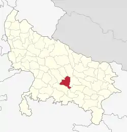 Location of Raebareli district in Uttar Pradesh | |
| Coordinates (Raebareli): 26°13′48″N 81°14′24″E | |
| Country | India |
| State | Uttar Pradesh |
| Division | Lucknow |
| Headquarters | Raebareli |
| Government | |
| • Lok Sabha constituencies |
|
| • Vidhan Sabha constituencies[1] | |
| Area | |
| • Total | 4,609 km2 (1,780 sq mi) |
| Population (2011) | |
| • Total | 3,405,559 |
| • Density | 740/km2 (1,900/sq mi) |
| Demographics | |
| • Literacy | 81% |
| • Sex ratio | 941 |
| Time zone | UTC+05:30 (IST) |
| Major highways | NH30, NH31, NH330A, NH128, NH335 |
| Website | http://raebareli.nic.in/ |
Geography
The district had an area of 4,609 km2. The principal rivers of the district are the Ganges and the Sai: the former skirts it for 54 miles near Dalmau and is everywhere navigable for boats of 40 tons; the latter traverses it from N.W. to S.E. The principal crops are rice, pulse, wheat, barley, millet, and poppy. Rae Bareli town is connected with Lucknow by a branch of the Oudh and Rohilkhand railway, which in 1898 was extended to Benares.
Economy
In 2006 the Ministry of Panchayati Raj named Raebareli one of the country's 250 most backward districts (out of a total of 640).[2] It is one of the 34 districts in Uttar Pradesh currently receiving funds from the Backward Regions Grant Fund Programme (BRGF).[2]
Raebareli has also been nominated by the state government for receiving aid through central government's Smart Cities in India Programme.
Powerplant at Unchahar (National Thermal Power Limited, NTPC)[3]
Demographics
According to the 2011 census Raebareli district has a population of 3,405,559, roughly equal to the nation of Panama[4] or the US state of Connecticut.[5] This gives it a ranking of 97th in India (out of a total of 640). The district has a population density of 739 inhabitants per square kilometre (1,910/sq mi) . Its population growth rate over the decade 2001-2011 was 18.51%. Rae Bareli has a sex ratio of 941 females for every 1000 males, and a literacy rate of 69.04%.
| Year | Pop. | ±% p.a. |
|---|---|---|
| 1901 | 1,033,571 | — |
| 1911 | 1,016,689 | −0.16% |
| 1921 | 936,442 | −0.82% |
| 1931 | 974,237 | +0.40% |
| 1941 | 1,065,296 | +0.90% |
| 1951 | 1,157,461 | +0.83% |
| 1961 | 1,316,095 | +1.29% |
| 1971 | 1,504,187 | +1.34% |
| 1981 | 1,879,248 | +2.25% |
| 1991 | 2,309,928 | +2.08% |
| 2001 | 2,872,335 | +2.20% |
| 2011 | 3,405,559 | +1.72% |
| source:[6] | ||
Languages
Rae Bareli district: mother-tongue of population, according to the 2011 Census.[7]
At the time of the 2011 Census of India, 98.31% of the population in the district spoke Hindi (or a related language) and 1.60% Urdu as their first language.[7]
Languages spoken in the district include Awadhi, a vernacular in the Hindi continuum spoken by over 38 million people, mainly in the Awadh region.[8]
| Rae Bareli district: mother-tongue of population, according to the 2011 Census.[7] | |||
|---|---|---|---|
| Mother tongue code | Mother tongue | People | Percentage |
| 002007 | Bengali | 418 | 0.01% |
| 006030 | Awadhi | 137,411 | 4.03% |
| 006142 | Chhattisgarhi | 731 | 0.02% |
| 006240 | Hindi | 3,209,172 | 94.23% |
| 015043 | Odia | 292 | 0.01% |
| 016038 | Punjabi | 1,169 | 0.03% |
| 019014 | Sindhi | 512 | 0.02% |
| 022015 | Urdu | 54,050 | 1.59% |
| – | Others | 1,804 | 0.05% |
| Total | 3,405,559 | 100.00% | |
Transportation
Raebareli is on the route of National Highway 30, between Lucknow and Allahabad. Ring Road Raebareli is an outer bypass road and crosses the Sharda River.[9]
Closest major airport to Raebareli is in Lucknow at about 78 kilometres (49 mi) distance on the National Highway 30. Other major airport is in Allahabad at 128 kilometres (79 mi) distance on National Highway 30.
A rail line is being built from Raebareli to Akbarganj, on the Northern Railways network.[10]
References
- "Constituencies". Retrieved 6 December 2018.
- Ministry of Panchayati Raj (8 September 2009). "A Note on the Backward Regions Grant Fund Programme" (PDF). National Institute of Rural Development. Archived from the original (PDF) on 5 April 2012. Retrieved 27 September 2011.
- "Explosion at Indian Coal Power Plant Kills 29, Injures 85". Bloomberg.com. 2 November 2017.
- US Directorate of Intelligence. "Country Comparison:Population". Retrieved 1 October 2011.
Panama 3,460,462 July 2011 est.
- "2010 Resident Population Data". U. S. Census Bureau. Retrieved 30 September 2011.
Connecticut 3,574,097
- Decadal Variation In Population Since 1901
- C-16 Population By Mother Tongue – Uttar Pradesh (Report). Office of the Registrar General & Census Commissioner, India. Retrieved 15 July 2020.
- M. Paul Lewis, ed. (2009). "Awadhi: A language of India". Ethnologue: Languages of the World (16th ed.). Dallas, Texas: SIL International. Retrieved 28 September 2011.
- "Rae Bareli District Map". mapsofindia.com. Retrieved 31 January 2015.
- "Sonia launches radio channel, roads, rail line in Rae Bareli". The Hindu. 2 December 2013. Retrieved 31 January 2015.
External links
Places adjacent to Raebareli district | ||||||||||
|---|---|---|---|---|---|---|---|---|---|---|
| ||||||||||