Barabanki, Uttar Pradesh
Barabanki is a city in the state of Uttar Pradesh in India. It is the administrative headquarters of Barabanki District. The city is about 30 km east of Lucknow, the state capital.
Barabanki | |
|---|---|
City | |
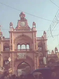 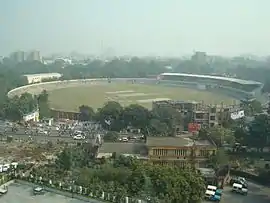  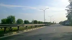   Clockwise from top: Barabanki clocktower, Dewa, Parijaat tree, Anand Bhawan School, National Highway 28, K. D. Singh Babu Stadium, Barabanki | |
 Barabanki Location in Uttar Pradesh, India  Barabanki Barabanki (India) | |
| Coordinates: 26.92°N 81.2°E | |
| Country | India |
| State | Uttar Pradesh |
| District | Barabanki |
| Elevation | 125 m (410 ft) |
| Population (2011) | |
| • Total | 146,831 |
| • Density | 331/km2 (860/sq mi) |
| Language | |
| • Official | Hindi[1] |
| • Additional official | Urdu[1] |
| Time zone | UTC+5:30 (IST) |
| PIN | 225 001 |
| Telephone code | 05248 |
| Vehicle registration | UP-41 |
| District Magistrate | Adarsh Singh, IAS |
| Website | barabanki |
Administration
Barabanki city comprises:
Demographics
As per provisional data of the 2011 census, the Barabanki urban agglomeration had a population of 146,831, with 77,766 males and 69,065 females. The literacy rate was 81.85%.[3]
Barabanki District is classified by the national government as a "Minority Concentrated District in India"[4] and Barabanki city is classified as a Muslim-majority city in the government files.[5]
Climate
Barabanki has tropical savanna climate (koppen Aw). The summers here are extremely hot due to proximity to tropics. The temperatures in the summer soar up to 40 to 45. Monsoon last from mid June to mid September. Winters are mild as it has tropical climate. In winters day time temperature rises up to 26 to 29, and at night drop up to 11 degrees.
| Climate data for Barabanki, Uttar Pradesh (1989–2010, extremes 1989–2010) | |||||||||||||
|---|---|---|---|---|---|---|---|---|---|---|---|---|---|
| Month | Jan | Feb | Mar | Apr | May | Jun | Jul | Aug | Sep | Oct | Nov | Dec | Year |
| Record high °C (°F) | 29.0 (84.2) |
35.5 (95.9) |
40.5 (104.9) |
44.5 (112.1) |
45.5 (113.9) |
47.0 (116.6) |
44.5 (112.1) |
38.0 (100.4) |
38.4 (101.1) |
38.0 (100.4) |
35.5 (95.9) |
30.5 (86.9) |
47.0 (116.6) |
| Average high °C (°F) | 21.8 (71.2) |
26.1 (79.0) |
31.9 (89.4) |
38.0 (100.4) |
39.0 (102.2) |
37.2 (99.0) |
33.8 (92.8) |
33.0 (91.4) |
32.8 (91.0) |
32.8 (91.0) |
29.2 (84.6) |
24.4 (75.9) |
31.7 (89.1) |
| Average low °C (°F) | 8.0 (46.4) |
10.9 (51.6) |
15.1 (59.2) |
20.1 (68.2) |
24.2 (75.6) |
26.0 (78.8) |
26.2 (79.2) |
25.9 (78.6) |
24.7 (76.5) |
20.0 (68.0) |
13.8 (56.8) |
9.2 (48.6) |
18.7 (65.7) |
| Record low °C (°F) | 2.0 (35.6) |
3.0 (37.4) |
7.5 (45.5) |
8.7 (47.7) |
15.7 (60.3) |
20.3 (68.5) |
22.2 (72.0) |
20.6 (69.1) |
17.5 (63.5) |
13.0 (55.4) |
6.3 (43.3) |
2.0 (35.6) |
2.0 (35.6) |
| Average rainfall mm (inches) | 16.0 (0.63) |
15.9 (0.63) |
7.7 (0.30) |
6.6 (0.26) |
38.8 (1.53) |
122.2 (4.81) |
236.3 (9.30) |
191.4 (7.54) |
170.4 (6.71) |
36.2 (1.43) |
5.9 (0.23) |
9.1 (0.36) |
856.5 (33.72) |
| Average rainy days | 1.2 | 1.6 | 0.9 | 0.6 | 2.4 | 5.5 | 10.9 | 9.5 | 7.0 | 1.5 | 0.4 | 0.6 | 42.0 |
| Average relative humidity (%) (at 17:30 IST) | 62 | 52 | 41 | 33 | 41 | 55 | 74 | 78 | 77 | 66 | 61 | 63 | 59 |
| Source: India Meteorological Department[6] | |||||||||||||
Notable people
- Khumar Barabankvi, poet
- Mohsina Kidwai, politician
- Rafi Ahmed Kidwai, politician
- C.M. Naim, scholar of Urdu language and literature
- Naseeruddin Shah, film actor
- K. D. Singh, hockey player
- Beni Prasad Verma, politician, Member of Parliament
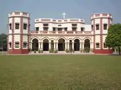
Gallery
 Barabanki UPSRTC Bus Station
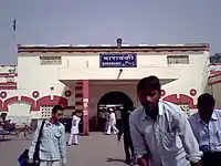 Exterior of Barabanki Jn Railway Station
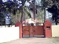
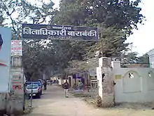 Office of District Magistrate/Collector
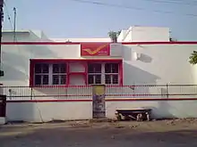 Barabanki Head Post Office
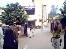 Barabanki Kotwaali
 Office of Tehsildar of Tehsil Nawabganj, Barabanki on Lucknow-Faizabad Road (NH-28)
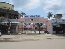 Nagar Parishad Nawabganj
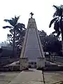 Shahid Smarak (a World War II memorial)
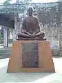 Statue of Mahatma Gandhi at Baapu Bhawan at Dewa Road
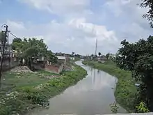 Jamuriya Nala (a brook) from Railway Station Road Bridge. This brook flows through the city and divides it into two halves.
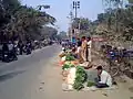 Evening vegetable bazaar along Court Road
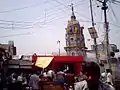
_procession_Barabanki_India_(Jan_2009).jpg.webp)
References
| Wikisource has the text of the 1911 Encyclopædia Britannica article Bara Banki. |
- "52nd Report of the Commissioner for Linguistic Minorities in India" (PDF). nclm.nic.in. Ministry of Minority Affairs. Archived from the original (PDF) on 25 May 2017. Retrieved 21 December 2018.
- "252 Bomb disposal Company (Barabanki)". Wikimapia.org. Archived from the original on 5 October 2012. Retrieved 17 June 2012.
- "Urban Agglomerations/Cities having population 1 lakh and above" (PDF). Provisional Population Totals, Census of India 2011. Archived (PDF) from the original on 13 November 2011. Retrieved 7 July 2012.
- "Identification of Minority Concentration Districts". Press Information Bureau (Government of India). 22 June 2007. Archived from the original on 28 October 2009. Retrieved 31 October 2009.
- Ashok, Akash Deep (6 December 2013). "Babri Masjid anniversary: A few more things that were demolished that day". India Today. New Delhi. Archived from the original on 6 December 2013. Retrieved 7 December 2013.
- "Station: Barabanki Climatological Table 1981–2010" (PDF). Climatological Normals 1981–2010. India Meteorological Department. January 2015. pp. 95–96. Archived from the original (PDF) on 5 February 2020. Retrieved 6 May 2020.