Fatehpur, Barabanki
Fatehpur is a town in Barabanki district in the state of Uttar Pradesh in India.[1] It is also a nagar panchayat and tehsil. It is the biggest town of Barabanki district.[3] The town is about 55 km north-east of Lucknow, the state capital.
Fatehpur, Barabanki | |
|---|---|
Town | |
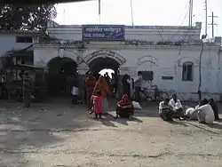 Tehsil Fatehpur railway station | |
 Fatehpur, Barabanki Location in Uttar Pradesh, India  Fatehpur, Barabanki Fatehpur, Barabanki (India) | |
| Coordinates: 27.17°N 81.22°E | |
| Country | |
| State | Uttar Pradesh |
| District | Barabanki |
| Government | |
| • Type | Nagar panchayat |
| Elevation | 140 m (460 ft) |
| Population (2011)[1] | |
| • Total | 35,582 |
| Language | |
| • Official | Hindi[2] |
| • Additional official | Urdu[2] |
| Time zone | UTC+5:30 (IST) |
| PIN | 225305 |
| Telephone code | 05240 |
| Vehicle registration | UP-41 |
| Website | barabanki |
Geography
Fatehpur is located at 27.17°N 81.22°E.[4] It has an average elevation of 140 metres (460 feet).
Demographics
As of 2011 India census, Fatehpur (NP) had a population of 35,582, of which males were 18,649 and females 16,933. Population within the age group of 0 to 6 years was 4,963. The total number of literates in Fatehpur was 20,956, which constituted 58.9% of the population with male literacy of 61.6% and female literacy of 55.9%. The effective literacy rate of 7+ population of Barabanki was 68.4%, of which male literacy rate was 71.6% and female literacy rate was 65.1%. The Scheduled Caste population was 1,767 and the total number of households was 5617.[1]
Administration
Fatehpur tehsil has three Block Panchayats,[5] they are:
- Fatehpur
- Nindura
- Suratganj
Block Panchayat Fatehpur
Block Panchayat Fatehpur has 86 Village Panchayats,[6] they are[7],:[8]
| Achaicha | Asohana | Aurangabad | Banar | Banni Sulemabad |
| Basantpur | Basara | Batiya | Belhara | Bhagauli |
| Bhaisuriya Mujahidpur | Bhatuamau | Bihura | Bilauli Mahraj | Bilauli Hazratpur |
| Bishunpur | Devkhariya | Dhadhsi | Dhamsadh | Dhausar |
| Fatehpur Dehat | Gang Gaula | Gangchauli | Gangemau | Gaura Gajni |
| Gaura Karaundi | Gaura Sailak | Gauri Baniyani | Gheri | Gudauli |
| Gursel | Haiderganj | Hasanpur Tanda | Hazratpur | Ishepur |
| Israuli | Jagsenda | Jarkha | Kaitha | Kandraula |
| Katghara | Khaira | Khapurwa Khanpur | Kiratpur | Kuan Danda |
| Kutbapur | Kutlupur | Madanpur | Majhgawan Sharif | Mawaiya |
| Meernagar | Mithwara | Mohammadipur | Mohammadpur | Mundera |
| Munderi | Naandkui | Naktauli | Nandna Kala | Nandrasi |
| Pakariyapur | Patna | Rahilamau | Ralbhari | Rariya |
| Rasool Panah | Rasoolpur | Rauja | Sadhemau | Sadrapur |
| Safipur | Saili Kiratpur | Salempur | Sandupur | Saraiya Matbar Nagar |
| Sarwa | Sauranga | Shahpur | Sihali | Taalgaon |
| Tadwa Gadmanpur | Tadwa Naankari | Tanda Nizam Ali | Terhwa | Tikapur |
| Ujarwara |
Transportation
Road connectivity
Fatehpur has connectivity to Lucknow, Barabanki, Mahmoodabad, Burhwal, Dewa, Suratganj, Hetmapur, Rampur Mathura, Lalpur Kirauta. It has regular bus service from Lucknow and Barabanki.
Rail connectivity
Fatehpur railway station is two kilometer away from the town area, block development office (BDO), and Munshiganj. It is located on Burhwal-Sitapur chord section Of North Eastern Railway (NER) zone which connects directly to Delhi, Punjab and Jammu via Shahjahanpur, Rampur, Moradabad and has one platform with three running lines including one main line with interlocking signaling system.
Health services
Tehsil Fatehpur has five Health centers, three Primary health centres and seven Sub-centers.[9]
Energy park programme
Fatehpur was identified in 2006 as an area for development under the Non-Conventional Energy program of the Non-Conventional Energy Development Agency (Neda).[10]
References
- "Census of India: Fatehpur". www.censusindia.gov.in. Retrieved 8 October 2019.
- "52nd Report of the Commissioner for Linguistic Minorities in India" (PDF). nclm.nic.in. Ministry of Minority Affairs. Archived from the original (PDF) on 25 May 2017. Retrieved 5 April 2019.
- Administration. Barabanki.nic.in. Retrieved on 12 August 2012.
- Indiastat.com Revealing India Statistically Archived 6 October 2011 at the Wayback Machine. Indiademographics.com. Retrieved on 12 August 2012.
- Block Panchayats of BARABANKI,UTTAR PRADESH. offerings.nic.in
- "Health Facilities in District Barabanki, UP" (PDF). jsk.gov.in. Archived from the original (PDF) on 16 January 2016. Retrieved 10 July 2019.
- NON-CONVENTIONAL ENERGY DEVELOPMENT AGENCY (NEDA) U.P. Archived 10 April 2009 at the Wayback Machine barabanki.nic.in