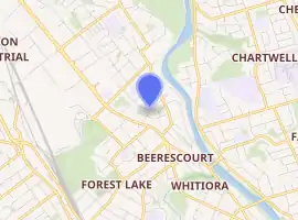
Beerescourt
Beerescourt is a suburb in western Hamilton, New Zealand. It is named after Capt. G. B. Beere, who was granted land in the military settlement at the conclusion of the New Zealand Wars. He set up a fort, and the area became known as Beere's Fort. The name was eventually changed to Beerescourt.[1]
Beerescourt | |
|---|---|
Suburb | |
 Beerescourt, Hamilton from the Waikato River. | |
| |
| Country | New Zealand |
| Local authority | Hamilton, New Zealand |
| Electoral ward | Hamilton West |
| Established | 1949 |
| Population (2018 Census) | |
| • Total | 2,220 |
| Te Rapa | Queenwood | |
| Nawton |
|
River Road |
| Whitiora | Claudelands |
The suburb became a part of Hamilton in 1949 with the 5th boundary extension. The suburb is centred on a low hill, the location of the original fort and lies between State Highway 1 and the Waikato river giving ready access to the central business district and the riverside walkway. The hill and the riverside area give good elevated views. There is a small local shopping centre as well as quick access to shops along Te Rapa Straight.
Demographics
| Year | Pop. | ±% p.a. |
|---|---|---|
| 2006 | 2,034 | — |
| 2013 | 2,136 | +0.70% |
| 2018 | 2,220 | +0.77% |
| Source: [2] | ||
Beerescourt had a population of 2,220 at the 2018 New Zealand census, an increase of 84 people (3.9%) since the 2013 census, and an increase of 186 people (9.1%) since the 2006 census. There were 813 households. There were 1,068 males and 1,152 females, giving a sex ratio of 0.93 males per female. The median age was 37.6 years, with 432 people (19.5%) aged under 15 years, 429 (19.3%) aged 15 to 29, 963 (43.4%) aged 30 to 64, and 396 (17.8%) aged 65 or older.
Ethnicities were 79.3% European/Pākehā, 15.9% Māori, 4.5% Pacific peoples, 11.6% Asian, and 1.9% other ethnicities (totals add to more than 100% since people could identify with multiple ethnicities).
The proportion of people born overseas was 20.7%, compared with 27.1% nationally.
Although some people objected to giving their religion, 45.9% had no religion, 41.5% were Christian, 2.4% were Hindu, 0.8% were Muslim, 0.7% were Buddhist and 3.0% had other religions.
Of those at least 15 years old, 507 (28.4%) people had a bachelor or higher degree, and 228 (12.8%) people had no formal qualifications. The median income was $39,300. The employment status of those at least 15 was that 906 (50.7%) people were employed full-time, 264 (14.8%) were part-time, and 63 (3.5%) were unemployed.[2]
Education
Vardon School is a coeducational state primary school for years 1 to 6, with a roll of 304 as of March 2020.[3][4] The school opened in 1956.[5]
See also
References
- Hamilton Street Name Index, Hamilton Public Library
- "Statistical area 1 dataset for 2018 Census". Statistics New Zealand. March 2020. Beerescourt (177600). 2018 Census place summary: Beerescourt
- "New Zealand Schools Directory". New Zealand Ministry of Education. Retrieved 26 April 2020.
- Education Counts: Vardon School
- Vardon School 1956-2006 - A Place and Its People. Vardon School. Retrieved 17 October 2020.