St James Park, New Zealand
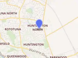
St James Park is a name used for a suburb in north-eastern Hamilton in New Zealand by a 2010 map.[1] It was developed by Chedworth/Grasshopper Joint Venture in 2001. In 2012 Hamilton Libraries described it as being in Huntington,[2] as do some valuers[3] and land agents. St James shopping area is in the centre of Rototuna, with a Countdown supermarket, a gym and a Palmers Garden Centre.[4]
St James Park | |
|---|---|
Suburb | |
| |
| Country | New Zealand |
| Local authority | Hamilton, New Zealand |
| Electoral ward | Hamilton East |
| Population (2018) | |
| • Total | 1,938 |
| Gordonton | ||
| Rototuna |
|
Puketaha |
| Huntington |
Demographics
| Year | Pop. | ±% p.a. |
|---|---|---|
| 2006 | 1,029 | — |
| 2013 | 1,710 | +7.53% |
| 2018 | 1,938 | +2.53% |
| Source: [5] | ||
St James had a population of 1,938 at the 2018 New Zealand census, an increase of 228 people (13.3%) since the 2013 census, and an increase of 909 people (88.3%) since the 2006 census. There were 576 households. There were 960 males and 978 females, giving a sex ratio of 0.98 males per female. The median age was 35.2 years (compared with 37.4 years nationally), with 501 people (25.9%) aged under 15 years, 336 (17.3%) aged 15 to 29, 912 (47.1%) aged 30 to 64, and 189 (9.8%) aged 65 or older.
Ethnicities were 70.6% European/Pākehā, 10.2% Māori, 2.0% Pacific peoples, 24.9% Asian, and 2.9% other ethnicities (totals add to more than 100% since people could identify with multiple ethnicities).
The proportion of people born overseas was 33.1%, compared with 27.1% nationally.
Although some people objected to giving their religion, 47.8% had no religion, 37.5% were Christian, 3.1% were Hindu, 2.2% were Muslim, 1.4% were Buddhist and 1.7% had other religions.
Of those at least 15 years old, 525 (36.5%) people had a bachelor or higher degree, and 147 (10.2%) people had no formal qualifications. The median income was $39,300, compared with $31,800 nationally. The employment status of those at least 15 was that 816 (56.8%) people were employed full-time, 228 (15.9%) were part-time, and 42 (2.9%) were unemployed.[5]
References
- "Hamilton Map". Hamilton City Council. Archived from the original on 23 September 2010. Retrieved 18 September 2010.
- "Gracefield Place". ketehamilton.peoplesnetworknz.info. Retrieved 14 April 2020.
- "Property details for Saint James Drive, Huntington, Hamilton, 3210". www.qv.co.nz. Retrieved 14 April 2020.
- "Discover Rototuna Properties Hamilton - Lodge Real Estate". www.lodge.co.nz. Retrieved 14 April 2020.
- "Statistical area 1 dataset for 2018 Census". Statistics New Zealand. March 2020. St James (176700). 2018 Census place summary: St James