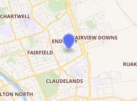
Enderley
Enderley is a suburb of Hamilton, New Zealand. It became a part of Hamilton in the 5th boundary extension in 1949. It is the highest ranking suburb for socio-economic deprivation in eastern Hamilton.[1]
Enderley | |
|---|---|
Suburb | |
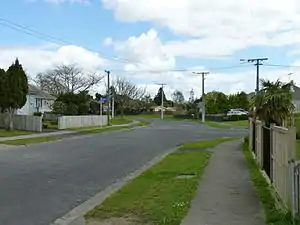 Poets Corner in Enderley, Hamilton. | |
| |
| Country | New Zealand |
| Local authority | Hamilton, New Zealand |
| Electoral ward | Hamilton East |
| Established | 1949 |
| Population (2018 Census) | |
| • Total | 5,259 |
| Chartwell | Chedworth Park | |
| Fairfield |
|
Fairview Downs |
| Claudelands | Ruakura |
Etymology
Enderley is named after a postman's 1899 house. Edward Shoard bought a small farm in 1899,[2] east of Peachgrove Road, between what is now Southwell School and Enderley Avenue,[3] and built a "capacious dwelling-house" called Enderley.[4] It isn't clear why he chose that name, but possibly it was from an 1856 novel, set in an area near his native Bristol.[3] In 1913 the farm was subdivided into 19 residential-sized properties and three streets, one of which was Enderley Avenue.[3] Edward Shoard retired in 1915 after 31 years with the post office[5] and may have moved to Grey Street where he lived in 1920.[6] He moved to Auckland in 1929[7] and died in 1943.[3]
History
Tramway Road, the eastern boundary of Enderley, was shown as a proposed tramway on an 1865 map.[8] It seems to have been of double width to accommodate a tramway to Cambridge[9] and to have first been discussed by Kirikiriroa Road Board in 1872,[10] though clearing and gravelling didn't start until 1891.[11]
Insoll Avenue was named in 1908 after T.B. Insoll, the owner of the property and a former clerk to the then local council, Waikato County.[12] John Street,[13] Fifth[14] and Enderley Avenues were created in 1913, Enderley being Muriel Street until 1915,[15] when Halifax Street was added.[16] There was little development until the 1920s,[17] electricity being supplied from 1925.[18]
From the start drainage was a problem,[19][20][21] as it was in 1930[22] and remains a problem.[15]
Poets Corner (see below) was a 1959 Housing Corporation project. The area north of Insoll Road was another Housing Corporation development from 1964[23] to 1968.[24]
The Orchard Avenue area was built in 1968, on the site of an orchard.[20] [21]
Also, there is a building project off Tramway Road, to the south-east in Ruakura, where 500 new homes will be built in the area for the new $3.3 billion transport hub being operated by Tainui Group Holdings (TGH). The area now has many middle income homeowners moving in and renovating the older properties as they are seen as good investments and solid first homes being from the 1960s and 1970s.
Around the Fifth Ave area of Enderley there are some streets that mainly have privately owned homes that have been renovated; as this has happened the streets have changed to become safer areas.
Locations
Poets Corner
Enderley neighbourhood Poets' Corner (so called due to many of the streets being named after poets such as Tennyson, Wordsworth, Blake and Eliot) was developed by the Housing Corporation in 1959[7] and known for its high crime rate. New Zealand Post ceased deliveries to residential addresses in Enderley for a short time after a shootout between members of the Mongrel Mob and Black Power in 2007. After this happened Housing NZ pulled down all the state-owned houses that had been housing the gang members in 2009. Crime rates and gang membership have decreased in the last few years.[25][26] There was a $17m housing project, rebuilding on the old Housing NZ site that was pulled down in 2009, which was planned to have a mix of rental and owned homes,[15] but suffered setbacks in 2018[12] and 2019.[13]
Five Cross Roads
Five Cross Roads is a shopping area on the edge of Poets Corner.[14] In 2018 it was expanded to take in a former plant nursery site.[16]
Enderley Park
Enderley Park has a sports field and Enderley Park Community Centre.[8]
Demographics
| Year | Pop. | ±% p.a. |
|---|---|---|
| 2006 | 4,476 | — |
| 2013 | 4,692 | +0.68% |
| 2018 | 5,259 | +2.31% |
| Source: [27] | ||
Enderley, comprising the statistical areas of Enderley North and Enderley South, had a population of 5,259 at the 2018 New Zealand census, an increase of 567 people (12.1%) since the 2013 census, and an increase of 783 people (17.5%) since the 2006 census. There were 1,635 households. There were 2,580 males and 2,679 females, giving a sex ratio of 0.96 males per female, with 1,332 people (25.3%) aged under 15 years, 1,302 (24.8%) aged 15 to 29, 2,019 (38.4%) aged 30 to 64, and 606 (11.5%) aged 65 or older.
Ethnicities were 42.8% European/Pākehā, 46.8% Māori, 12.9% Pacific peoples, 11.3% Asian, and 3.7% other ethnicities (totals add to more than 100% since people could identify with multiple ethnicities).
The proportion of people born overseas was 19.9%, compared with 27.1% nationally.
Although some people objected to giving their religion, 45.0% had no religion, 36.6% were Christian, 2.4% were Hindu, 3.0% were Muslim, 1.1% were Buddhist and 5.1% had other religions.
Of those at least 15 years old, 621 (15.8%) people had a bachelor or higher degree, and 873 (22.2%) people had no formal qualifications. The employment status of those at least 15 was that 1,524 (38.8%) people were employed full-time, 504 (12.8%) were part-time, and 387 (9.9%) were unemployed.[27]
Individual census areas
Enderley includes two census areas, North and South. In 2018 the census area boundaries were reduced from the previous Insoll and Enderley.[6] The Index of Socioeconomic Deprivation, ranked 1-10 from lowest to most deprived areas, listed Enderley and Insoll at 10/10 (highest level of deprivation) in 2013.[1] The population is growing slowly, but they remain much poorer and younger than the 37.4 years of the national average, as shown below (2013 boundary figures in brackets) -
| North (formerly Insoll) | South (formerly Enderley) | National median income | |||||||
|---|---|---|---|---|---|---|---|---|---|
| Year | Population | Median age | Households | Median income | Population | Median age | Households | Median income | |
| 1996 | (2,604) | (747) | (3,876) | (1,383)[4] | |||||
| 2001 | (2,562) | (28.2) | (741) | ($11,600) | (3,981) | (28.8) | (1,401) | ($14,300) | $18,500 |
| 2006 | 2,238 (2,580) | (27.5) | (741) | ($15,500) | 2,238 (3,897) | (30.3) | (1,434) | ($19,900) | $24,100 |
| 2013 | 2,241 (2,565) | (30.2) | (747) | ($16,800) | 2,451 (4,182) | (30.8) | (1,509) | ($22,500) | $27,900[5] |
| 2018 | 2,523 | 29.2 | 693 | $19,600[22] | 2,736 | 30.6 | 945 | $22,100[19] | $31,800 |
In 2018 the main ethnic groups were -
| Area | European | Māori | Pacific | Asian |
|---|---|---|---|---|
| North | 42% | 48.6% | 14.4% | 8.8% |
| South | 43.5% | 45.1% | 11.6% | 13.6% |
Education
Insoll Avenue School is a state contributing primary school for years 1 to 6, with a roll of 324.[28]
Te Kura Kaupapa Māori o Te Ara Rima is a state full primary school for years 1 to 8, with a roll of 200.[29] It teaches in the Māori language.
Both schools are coeducational. Rolls are as of March 2020.[30]
See also
References
- "Index of Socioeconomic Deprivation for Areas within the Hamilton East Electorate". Parliament New Zealand. Retrieved 19 October 2020.
- "WAIKATO ARGUS". paperspast.natlib.govt.nz. 10 June 1899. Retrieved 7 May 2020.
- "History: The dead tell tales". Stuff. Retrieved 7 May 2020.
- "DEATHS. AUCKLAND STAR". paperspast.natlib.govt.nz. 27 September 1899. Retrieved 7 May 2020.
- "WAIKATO TIMES". paperspast.natlib.govt.nz. 3 September 1915. Retrieved 7 May 2020.
- "Page 4 Advertisements Column 5 WAIKATO TIMES". paperspast.natlib.govt.nz. 7 December 1920. Retrieved 7 May 2020.
- "Page 2 Advertisements Column 5 WAIKATO TIMES". paperspast.natlib.govt.nz. 13 February 1929. Retrieved 7 May 2020.
- "Plan of the Military settlements in the Upper Waikato District". ap01.alma.exlibrisgroup.com. Retrieved 26 April 2020.
- "THE CAMBRIDGE BRANCH RAILWAY. WAIKATO TIMES". paperspast.natlib.govt.nz. 5 July 1879. Retrieved 2 May 2020.
- "WAIKATO TIMES". paperspast.natlib.govt.nz. 27 July 1872. Retrieved 16 April 2020.
- "KIRIKIRIROA ROAD BOARD. WAIKATO TIMES". paperspast.natlib.govt.nz. 8 December 1891. Retrieved 2 May 2020.
- "Insoll Avenue". ketehamilton.peoplesnetworknz.info. Retrieved 2 May 2020.
- "John Street". ketehamilton.peoplesnetworknz.info. Retrieved 2 May 2020.
- "Fifth Avenue". ketehamilton.peoplesnetworknz.info. Retrieved 2 May 2020.
- "Enderley Avenue". ketehamilton.peoplesnetworknz.info. Retrieved 2 May 2020.
- "Halifax Street". ketehamilton.peoplesnetworknz.info. Retrieved 2 May 2020.
- "WAIKATO COUNTY. WAIKATO TIMES". paperspast.natlib.govt.nz. 10 October 1923. Retrieved 2 May 2020.
- "HYDRO-ELECTRICITY. WAIKATO TIMES". paperspast.natlib.govt.nz. 15 January 1925. Retrieved 2 May 2020.
- "KIRIKIRIROA ROAD BOARD. WAIKATO TIMES". paperspast.natlib.govt.nz. 3 August 1915. Retrieved 7 May 2020.
- "KIRIKIRIROA ROAD BOARD. WAIKATO TIMES". paperspast.natlib.govt.nz. 5 March 1918. Retrieved 7 May 2020.
- "KIRIKIRIROA ROAD BOARD. WAIKATO TIMES". paperspast.natlib.govt.nz. 2 September 1919. Retrieved 7 May 2020.
- "WAIKATO COUNTY. WAIKATO TIMES". paperspast.natlib.govt.nz. 9 September 1930. Retrieved 7 May 2020.
- Lanum, John. "Springfield Crescent". ketehamilton.peoplesnetworknz.info. Retrieved 2 May 2020.
- Lanum, John. "Magee Place". ketehamilton.peoplesnetworknz.info. Retrieved 2 May 2020.
- "Community cop wins support". Waikato Times. Retrieved 8 September 2010.
- "Poets Corner Community Renewal". Community Outcomes. Archived from the original on 1 June 2010. Retrieved 8 September 2010.
- "Statistical area 1 dataset for 2018 Census". Statistics New Zealand. March 2020. Enderley North (178400) and Enderley South (179100). 2018 Census place summary: Enderley North 2018 Census place summary: Enderley South
- Education Counts: Insoll Avenue School
- Education Counts: Te Kura Kaupapa Māori o Te Ara Rima
- "New Zealand Schools Directory". New Zealand Ministry of Education. Retrieved 26 April 2020.
