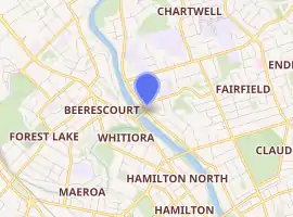
River Road, Hamilton
River Road is a residential suburb of Hamilton, sited on the eastern bank of the Waikato River. The namesake road runs from Claudelands Bridge north to Pukete Bridge[2] and beyond, to Ngāruawāhia,[3] but the main part of the suburb is between Boundary Road and Donny Park. Properties close to the river are much more expensive than those further away.[2] Most of River Road was shown on an 1865 map,[4] though it was some years later before it was built and, by 1866, only one bridge had been built.[5]
River Road | |
|---|---|
Suburb | |
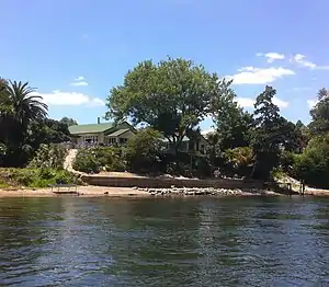 Houses on the bank of the Waikato River | |
| |
| Country | New Zealand |
| Local authority | Hamilton |
| Population (2018)[1] | |
| • Total | 3,186 |
| St Andrews | Queenwood | Chartwell |
| Beerescourt |
|
Fairfield |
| Whitiora | Hamilton North | Claudelands |
A walking path runs along the river bank, but it does not cover the entire length of the area.[6]
Demographics
| Year | Pop. | ±% p.a. |
|---|---|---|
| 2006 | 2,991 | — |
| 2013 | 3,177 | +0.87% |
| 2018 | 3,186 | +0.06% |
| Source: [1] | ||
The statistical area of Miropiko, which corresponds to River Road, had a population of 3,186 at the 2018 New Zealand census, an increase of 9 people (0.3%) since the 2013 census, and an increase of 195 people (6.5%) since the 2006 census. There were 1,185 households. There were 1,530 males and 1,656 females, giving a sex ratio of 0.92 males per female. The median age was 39.3 years (compared with 37.4 years nationally), with 597 people (18.7%) aged under 15 years, 645 (20.2%) aged 15 to 29, 1,464 (46.0%) aged 30 to 64, and 480 (15.1%) aged 65 or older.
Ethnicities were 82.1% European/Pākehā, 14.3% Māori, 4.3% Pacific peoples, 8.0% Asian, and 3.2% other ethnicities (totals add to more than 100% since people could identify with multiple ethnicities).
The proportion of people born overseas was 20.2%, compared with 27.1% nationally.
Although some people objected to giving their religion, 46.5% had no religion, 43.0% were Christian, 1.1% were Hindu, 0.5% were Muslim, 0.8% were Buddhist and 2.6% had other religions.
Of those at least 15 years old, 933 (36.0%) people had a bachelor or higher degree, and 279 (10.8%) people had no formal qualifications. The median income was $41,400, compared with $31,800 nationally. The employment status of those at least 15 was that 1,359 (52.5%) people were employed full-time, 390 (15.1%) were part-time, and 69 (2.7%) were unemployed.[1]
Although the statistical area is called Miropiko, Miropiko Pā, one of the six pās in Hamilton,[7] lay just to the south in Claudelands.[8]
Education
Waikato Diocesan School is a private girls secondary school (years 9-13) with boarding facilities. It has a roll of 690 as of March 2020.[9][10] It opened in 1928 and moved to its current site in 1930.[11]
Notable buildings
- Bankwood House, 660 River Road, is a residence designed by Thomas Henry White and built in 1892 on what was then rural land.[12]
References
- "Statistical area 1 dataset for 2018 Census". Statistics New Zealand. March 2020. Miropiko (177700). 2018 Census place summary: Miropiko
- Colleen Hawkes and Anabela Rea (2 April 2018). "Elite Streets: In Hamilton they're all street proud, but the water views win". Stuff.CS1 maint: uses authors parameter (link)
- "River Rd". Google Maps. Retrieved 29 October 2020.
- "Plan of the Military settlements in the Upper Waikato District sheet No.2". 1865.
- "UPPER WAIKATO. HAMILTON. DAILY SOUTHERN CROSS". paperspast.natlib.govt.nz. 4 April 1866. Retrieved 29 October 2020.
- "River paths". Hamilton City Council. 2013.
- "Hamilton City River Plan: Archaeological Assessment" (PDF). Hamilton City Council. September 2015.
- "Zoning Map 37A - Hamilton City Council". www.hamilton.govt.nz. Retrieved 29 October 2020.
- "New Zealand Schools Directory". New Zealand Ministry of Education. Retrieved 26 April 2020.
- Education Counts: Waikato Diocesan School
- "History of Dio". Waikato Diocesan School. Retrieved 19 October 2020.
- "Bankwood House". Register of Historic Places. Heritage New Zealand. Retrieved 29 October 2020.