Cartersville, Georgia
Cartersville is a city in Bartow County in the U.S. state of Georgia; it is located within the northwest edge of the Atlanta metropolitan area. As of the 2010 census, the city had a population of 19,731.[9] Cartersville is the county seat of Bartow County.[10]
Cartersville, Georgia | |
|---|---|
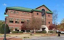 Cartersville City Hall | |
| Motto(s): "Be Charmed, Be Prosperous, Belong"[1] | |
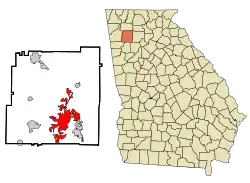 Location in Bartow County, Georgia | |
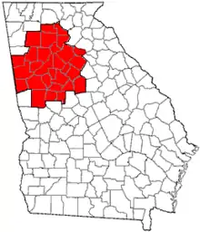
 Cartersville Location of Cartersville in Metro Atlanta | |
| Coordinates: 34°11′N 84°48′W | |
| Country | United States |
| State | Georgia |
| County | Bartow |
| Incorporated | 1850 |
| Named for | Farish Carter[2][3] |
| Government | |
| • Mayor | Matt Santini |
| Area | |
| • Total | 29.14 sq mi (75.46 km2) |
| • Land | 29.00 sq mi (75.11 km2) |
| • Water | 0.14 sq mi (0.35 km2) |
| Elevation | 787 ft (240 m) |
| Population | |
| • Total | 19,731 |
| • Estimate (2019)[6] | 21,760 |
| • Density | 750.34/sq mi (289.71/km2) |
| Time zone | UTC−5 (Eastern Time) |
| • Summer (DST) | UTC−4 (Eastern Daylight Time) |
| ZIP Codes | 30120, 30121 |
| Area code(s) | 770/678/470 |
| FIPS code | 13-13688[7] |
| GNIS feature ID | 0355017[8] |
| Website | www |
History
Cartersville was first known as Birmingham to its original English settlers.[11] The town was incorporated as Cartersville in 1854.[11] The present name is for Col. Farish Carter of Milledgeville, the owner of a large plantation.[12][13] Cartersville was the long-time home of Amos Akerman, U.S. Attorney General under President Ulysses S. Grant; in that office he spearheaded the federal prosecution of members of the Ku Klux Klan and was one of the most important and courageous public servants of the Reconstruction era.[14]
Cartersville was designated the seat of Bartow County in 1867 following the destruction of Cassville by Sherman in the American Civil War. Cartersville was incorporated as a city in 1872.[15]
Geography
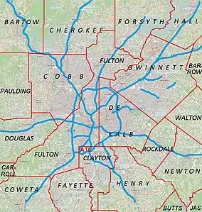
Cartersville is located in south-central Bartow County, 42 miles (68 km) northwest of downtown Atlanta and 76 miles (122 km) southeast of Chattanooga, Tennessee.
The Etowah River flows through a broad valley south of the downtown, leading west to Rome, where it forms the Coosa River, a tributary of the Alabama River. The city limits extend eastward, upriver, as far as Allatoona Dam, which forms Lake Allatoona, a large U.S. Army Corps of Engineers reservoir. Red Top Mountain State Park sits on a peninsula in the lake, just outside the city limits. Nancy Creek also flows in the vicinity. The highest point in the city is 1,562 feet (476 m) at the summit of Pine Mountain.[16]
According to the U.S. Census Bureau, Cartersville has a total area of 29.3 square miles (75.9 km2), of which 29.2 square miles (75.5 km2) is land and 0.15 square miles (0.4 km2), or 0.59%, is water.[17]
Transportation
Interstate 75, the major north-south route through the area, passes through the eastern edge of the city, with access from five exits: Exit 285 just south of the city limits in Emerson, Exit 288 (East Main Street) closest to downtown, and exits 290, 293, and 296 along the city's northern outskirts. U.S. Highway 41, which is concurrent with State Route 3, is an older, parallel highway to Interstate 75 that goes through the eastern edge of downtown, leading north to Calhoun and Dalton and south to Marietta. U.S. Highway 411 passes through the northern edge of the city, leading west to Rome and north to Chatsworth. State Route 20 runs west to Rome concurrent with U.S. Highway 411 and runs east to Canton. State Route 61 runs north to White concurrent with U.S. Highway 411 and runs south to Dallas, Georgia. State Route 113 runs southwesterly to Rockmart. State Route 293 runs west-northwest to Kingston.
Cartersville area communities
The following communities border the city:
- Adairsville (north-northwest)
- Cassville (north)
- Emerson (south)
- Euharlee (west)
- Kingston (northwest)
- Stilesboro (southwest)
- White (northern)
- Grassdale Road (west)
Demographics
| Historical population | |||
|---|---|---|---|
| Census | Pop. | %± | |
| 1870 | 2,232 | — | |
| 1880 | 2,037 | −8.7% | |
| 1890 | 3,171 | 55.7% | |
| 1900 | 3,135 | −1.1% | |
| 1910 | 4,067 | 29.7% | |
| 1920 | 4,350 | 7.0% | |
| 1930 | 5,250 | 20.7% | |
| 1940 | 6,141 | 17.0% | |
| 1950 | 7,270 | 18.4% | |
| 1960 | 8,668 | 19.2% | |
| 1970 | 10,138 | 17.0% | |
| 1980 | 9,247 | −8.8% | |
| 1990 | 12,035 | 30.2% | |
| 2000 | 15,925 | 32.3% | |
| 2010 | 19,731 | 23.9% | |
| 2019 (est.) | 21,760 | [6] | 10.3% |
| U.S. Decennial Census[18] | |||
As of the census[7] of 2010, there were 19,010 people, 5,870 households, and 4,132 families residing in the city. The population of Cartersville is growing significantly. The population density was 680.7 people per square mile (262.9/km2). There were 6,130 housing units at an average density of 262.0 per square mile (101.2/km2). The racial makeup of the city was 63.93% White, 29.64% African American, 0.82% Asian, 0.28% Native American, 0.04% Pacific Islander, 3.76% from other races, and 1.53% from two or more races. Hispanic or Latino people of any race were 7.28% of the population.
There were 5,870 households, out of which 33.3% had children under the age of 18 living with them, 52.6% were married couples living together, 13.6% had a female householder with no husband present, and 29.6% were non-families. 25.9% of all households were made up of individuals, and 11.7% had someone living alone who was 65 years of age or older. The average household size was 2.59 and the average family size was 3.10.
In the city, the population was spread out, with 25.9% under the age of 18, 8.7% from 18 to 24, 30.2% from 25 to 44, 20.8% from 45 to 64, and 14.4% who were 65 years of age or older. The median age was 36 years. For every 100 females, there were 95.4 males. For every 100 females age 18 and over, there were 92.1 males.
The median income for a household in the city was $41,162, and the median income for a family was $48,219. Males had a median income of $35,092 versus $25,761 for females. The per capita income for the city was $19,977. About 8.9% of families and 11.4% of the population were below the poverty line, including 13.7% of those under age 18 and 15.4% of those age 65 or over.
Points of interest
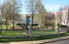
- The Booth Western Art Museum is on North Museum Drive in Cartersville.[19] The Booth is the second-largest art museum in Georgia, and houses the largest permanent exhibition space for Western art in the country. It is a Smithsonian Institution Affiliate.
- The Etowah Indian Mounds is an archaeological Native American site in Bartow County, south of Cartersville.
- Tellus Science Museum, formerly the Weinman Mineral Museum, is a Smithsonian Institution Affiliate and features the first digital planetarium in North Georgia. NASA has installed a camera that tracks meteors at the museum.[20]
- The world's first outdoor Coca-Cola sign, painted in 1894, is located in downtown Cartersville on Young Brothers Pharmacy's wall.[21]
- Rose Lawn, a house museum, is the former home of noted evangelist Samuel Porter Jones,[22] for whom the Union Gospel Tabernacle (Ryman Auditorium) in Nashville was built, later to become the Grand Ole Opry.
- The Bartow History Museum is located in the Old Cartersville Courthouse, c. 1870, in downtown Cartersville on East Church Street.[23]
Education
The schools that comprise the Cartersville City School System are:
- Cartersville Primary School
- Cartersville Elementary School
- Cartersville Middle School
- Cartersville High School
There are also two private Christian schools:
- Excel Christian Academy
- The Trinity School
There is also a private Montessori school:
- Lifesong Montessori School
Cartersville also has a college campus:
Economy
Manufacturing, tourism, and services play a part in the economy of the city. The city's employers include:
- Anheuser-Busch
- Georgia Power
- Komatsu
- Shaw Industries, a major flooring manufacturer
The city is home to Cartersville Medical Center and The Hope Center, making it a minor healthcare hub for the surrounding area.
Notable people
- Amos Akerman (February 23, 1821 – December 21, 1880) was an American politician who served as United States Attorney General under President Ulysses S. Grant from 1870 to 1871.
- Bill Arp (Charles Henry Smith; 1826–1903), nationally syndicated columnist[24]
- Robert Benham, the first African-American Georgia Supreme Court justice
- Ronnie Brown, National Football League (NFL) running back
- Bob Burns (1950–2015), founding member and original drummer of Lynyrd Skynyrd
- Rebecca Latimer Felton (1835–1930), the first female United States Senator
- Andre Fluellen, NFL defensive tackle
- W. J. Gordy, potter
- Corra Harris, author
- Joe Frank Harris (1936–), former governor of Georgia
- Keith Henderson, former NFL running back
- Samuel Porter Jones (1847–1906), evangelist
- Cledus T. Judd, country music singer
- Wayne Knight (1955–), actor
- Trevor Lawrence, quarterback at Cartersville High School (2014-2017) and Clemson University (2018–Present).
- Robert Lavette, professional football player
- Lottie Moon, Baptist missionary to China
- Chloë Grace Moretz, actress and model
- Donavan Tate, 3rd overall pick chosen by the San Diego Padres in the 2009 Major League Baseball draft
- Mark Thompson, NASCAR driver
- Benjamin Walker, actor
- Butch Walker (1969–), singer-songwriter and producer
- Hedy West (1938–2005), folk singer and songwriter
- Rudy York (1913–1970), professional baseball player
References
- "The City of Cartersville, Georgia". The City of Cartersville, Georgia. Retrieved September 6, 2012.
- "Profile for Cartersvile, Georgia, GA". ePodunk. Retrieved September 6, 2012.
- "City of Cartersville". State of Georgia. Retrieved 2011-11-12.
- "2019 U.S. Gazetteer Files". United States Census Bureau. Retrieved July 9, 2020.
- "Cartersville, Georgia (GA) profile: population, maps, real estate, averages, homes, statistics, relocation, travel, jobs, hospitals, schools, crime, moving, houses, news, sex offenders". www.city-data.com.
- "Population and Housing Unit Estimates". United States Census Bureau. May 24, 2020. Retrieved May 27, 2020.
- "U.S. Census website". United States Census Bureau. Retrieved 2008-01-31.
- "US Board on Geographic Names". United States Geological Survey. 2007-10-25. Retrieved 2008-01-31.
- "Archived copy". Archived from the original on 2011-11-04. Retrieved 2011-11-19.CS1 maint: archived copy as title (link)
- "Find a County". National Association of Counties. Archived from the original on 2011-05-31. Retrieved 2011-06-07.
- "Cartersville". Calhoun Times. September 1, 2004. p. 18. Retrieved 24 April 2015.
- Krakow, Kenneth K. (1975). Georgia Place-Names: Their History and Origins (PDF). Macon, GA: Winship Press. p. 35. ISBN 0-915430-00-2.
- Gannett, Henry (1905). The Origin of Certain Place Names in the United States. Govt. Print. Off. p. 70.
- Eric Foner (2014). "Reconstruction:America's Unfinished Revolution 1863 - 1877. Harper Collins. ISBN 978-0-06-235451-8.
- Hellmann, Paul T. (May 13, 2013). Historical Gazetteer of the United States. Routledge. p. 223. ISBN 978-1135948597. Retrieved 30 November 2013.
- Pine Mountain Recreation Area. City of Cartersville. 5 April 2017. Retrieved 5 April 2017.
- "Geographic Identifiers: 2010 Demographic Profile Data (G001): Cartersville city, Georgia". U.S. Census Bureau, American Factfinder. Archived from the original on February 12, 2020. Retrieved November 1, 2013.
- "Census of Population and Housing". Census.gov. Retrieved June 4, 2015.
- Lee Walburn (June 2005). Best Western — The Booth Western Art Museum in Cartersville brings the old west to northwestern Georgia triggering celluloid-tinted memories of cowboys, standoffs, and frogs. Atlanta Magazine. Retrieved 2011-11-12.
- Marie Nesmith. "NASA installs 'fireball' camera at Tellus Science Museum". The Daily Tribune. Archived from the original on 2012-04-25. Retrieved 2011-11-12.
- Amy Gillis Lowry; Abbie Tucker Parks (May 1997). North Georgia's Dixie Highway. Arcadia Publishing. p. 99. ISBN 978-0-7385-4431-1.
- William Pencak (October 2009). Encyclopedia of the Veteran in America, Volume 1. Greenwood Publishing Group. p. 615. ISBN 978-0-313-34009-3.
- Matt Shinall. "Bartow History Museum reflects on past as transition into new home begins". The Daily Tribune. Archived from the original on 2012-04-25. Retrieved 2011-11-12.
- A book about the life of Bill Arp was written by another Cartersville resident: Parker, David B. (1991). Alias Bill Arp: Charles Henry Smith and the South's "Goodly Heritage". Athens: University of Georgia Press.
External links
| Wikimedia Commons has media related to Cartersville, Georgia. |
- Official website
- Cartersville at New Georgia Encyclopedia
- Cartersville-Bartow County Convention & Visitors Bureau
- Cartersville-Bartow County Chamber of Commerce
- The Daily Tribune, newspaper based in Cartersville
- News Talk AM 1270, radio station based in Cartersville
|  | |||||
|
| ||||||
Municipalities and communities of Bartow County, Georgia, United States | ||
|---|---|---|
| Cities | 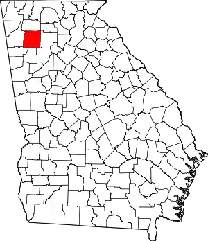 Map of Georgia highlighting Bartow County | |
| Town | ||
| Unincorporated communities | ||
| Ghost towns | ||
| Footnotes | ‡This populated place also has portions in an adjacent county or counties | |
| ||
| Authority control |
|---|