Henry County, Georgia
Henry County is located in the north central portion of the U.S. state of Georgia. Per the 2010 census,[1] the population of Henry County is 203,922. The county seat is McDonough.[2] The county was named for Patrick Henry.[3]
Henry County | |
|---|---|
 Henry County Courthouse and Confederate monument | |
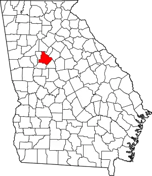 Location within the U.S. state of Georgia | |
 Georgia's location within the U.S. | |
| Coordinates: 33°28′N 84°10′W | |
| Country | |
| State | |
| Founded | May 15, 1821 |
| Named for | Patrick Henry |
| Seat | McDonough |
| Largest city | Stockbridge |
| Area | |
| • Total | 327 sq mi (850 km2) |
| • Land | 322 sq mi (830 km2) |
| • Water | 4.4 sq mi (11 km2) 1.4%% |
| Population | |
| • Estimate (2019) | 234,561 |
| • Density | 704/sq mi (272/km2) |
| Time zone | UTC−5 (Eastern) |
| • Summer (DST) | UTC−4 (EDT) |
| Congressional districts | 3rd, 10th, 13th |
| Website | www |
Henry County is part of the Atlanta-Sandy Springs-Roswell, GA metropolitan statistical area. It is home to the Atlanta Motor Speedway in Hampton. The Henry County Courthouse is listed on the National Register of Historic Places. In 1995, Henry County was the sixth-fastest-growing county in the United States.[4]
History
Henry County, Georgia was created by the Georgia State Legislature in 1821 from land acquired from the Creek Indian Nation by the First Treaty of Indian Springs. Henry's original land area was much larger than it is today, stretching from near Indian Springs (present-day Indian Springs State Park) in the south to the Chattahoochee River near Sandy Springs in the north; encompassing most of present-day Metropolitan Atlanta. Before one year passed the size of the County was diminished through the separation of land areas which, in whole or in part, became present day DeKalb, Fulton, Fayette and Newton Counties. Later divisions resulted in Clayton, Spalding, Rockdale and Butts counties.
In the beginning Henry County was a virgin wilderness, having just been ceded from the Creek Nation. Prior to 1821, the Creeks and a few trappers and traders were the only residents of this area. The Creek Indians left their mark through place names, a few small Indian Mounds scattered around the County and through the arrowheads and broken pottery which can be found throughout Henry County.
Jesse Johnson, son of John Johnson and great-grandfather of U.S. President Lyndon Baines Johnson, was a "first settler" of Henry County. He was a prosperous farmer, the second sheriff (1822–1835), and judge, before he moved to Texas.[5]
Geography
According to the U.S. Census Bureau, the county has a total area of 327 square miles (850 km2), of which 322 square miles (830 km2) is land and 4.4 square miles (11 km2) (1.4%) is water.[6]
The vast majority of Henry County is located in the Upper Ocmulgee River sub-basin of the Altamaha River basin, with just a very small western corner, west of Hampton, located in the Upper Flint River sub-basin of the ACF River Basin (Apalachicola-Chattahoochee-Flint River Basin).[7]
Adjacent counties
- DeKalb County – north
- Rockdale County – northeast
- Newton County – east
- Butts County – southeast
- Spalding County – southwest
- Clayton County – west
Government and politics
The Henry County Board of Commissioners is responsible for administering county government to residents. Four commissioners are elected by voters in individual districts, while the commission chairman is elected countywide and serves as the county's chief executive. June Wood, the former commission chair, was the first African-American to serve in the position after being elected in a December 2016 run-off election. She left office in December of 2020 after losing re- election. As of December 2020, the following individuals serve the county on the Board of Commissioners:
| Name | Party | District | |
|---|---|---|---|
| Carlotta Harris- Harrell | Democratic | Chairman (at-large) | |
| Johnny Wilson | Republican | 1 | |
| Dee Clemmons | Democratic | 2 | |
| Gary Barham | Republican | 3 | |
| Vivian Thomas | Democratic | 4 | |
| Bruce Holmes | Democratic | 5 | |
Prior to 1984, Henry County had a presidential voting pattern typical of any other Solid South county in Georgia, consistently awarding landslide margins to Democrats. In 1920, it was one of three counties in the state (alongside Bleckley and Columbia) to give 100% of the vote to Democratic nominee James M. Cox.[9] The first Republican to win Henry County was Richard Nixon in 1972, doing so with 77.93% of the vote,[10] though it returned to the Democratic column when native Georgian Jimmy Carter won it in 1976 and 1980.
After this period of dealignment, it became a Republican stronghold from 1984 to 2004, consistent with several other suburban counties in the Atlanta metropolitan area and across the country.[11] Strong margins in Henry County and other Atlanta suburbs were vital to Republicans' performance, offsetting strongly Democratic Black voters in Atlanta proper.[12] Republican dominance peaked in 1988, when George H.W. Bush won 71.11% of the vote to Michael Dukakis' 28.41%, a 42.7% margin of victory.[13]
However, an increasing minority population and the leftward shift taken by suburban voters has derailed former Republican dominance.[11] While Democrat Barack Obama failed to win the county in either of his two national victories, his margins of defeat were only in the single digits (a 7.44% loss in 2008 against John McCain[14] and 3.29% in 2012 against Mitt Romney[15]), thanks in part to explosive population growth that brought an influx of Democratic-leaning minority voters into the county. In the 2000 Census, the racial makeup of the county was 81.38% white and 14.68% African American.[16] The Black population shot up to 36.9% in 2010, and the white population fell to a mere 55.0%. By the 2019 American Community Survey, the Black population outnumbered the white population, 47.88% to 45.58%. As a consequence, in 2016, the county swung into the Democratic column, voting for Hillary Clinton by a 4.36 percentage point margin of victory for the first time in 36 years in spite of the rightward shift taken by the rest of the country.[17] This trend remained in 2018 when it voted for Democrat Stacey Abrams for governor by a margin of 15.34% against Republican then-Secretary of State Brian Kemp.[18] In 2020, it swung 16.11 points deeper into the Democratic column, the largest Democratic swing of any county in the country,[19] culminating in Joe Biden winning the county by 20.47 percentage points, and by extension, the state of Georgia.
| Year | Republican | Democratic | Third parties |
|---|---|---|---|
| 2020 | 39.2% 48,259 | 59.7% 73,443 | 1.1% 1,296 |
| 2016 | 46.0% 45,724 | 50.4% 50,057 | 3.6% 3,586 |
| 2012 | 51.1% 46,774 | 47.8% 43,761 | 1.1% 996 |
| 2008 | 53.3% 47,157 | 45.9% 40,567 | 0.9% 762 |
| 2004 | 66.6% 42,759 | 32.8% 21,096 | 0.6% 380 |
| 2000 | 66.4% 25,815 | 30.8% 11,971 | 2.8% 1,081 |
| 1996 | 58.4% 16,968 | 32.7% 9,498 | 9.0% 2,608 |
| 1992 | 52.0% 12,634 | 32.2% 7,817 | 15.8% 3,833 |
| 1988 | 71.1% 10,882 | 28.4% 4,348 | 0.5% 74 |
| 1984 | 69.1% 9,142 | 30.9% 4,096 | |
| 1980 | 47.3% 5,326 | 50.0% 5,635 | 2.7% 307 |
| 1976 | 31.4% 2,622 | 68.6% 5,717 | |
| 1972 | 77.9% 5,155 | 22.1% 1,460 | |
| 1968 | 25.4% 2,017 | 29.2% 2317 | 45.4% 3,604 |
| 1964 | 46.6% 3,125 | 53.4% 3,583 | 0.0% 1 |
| 1960 | 26.0% 1,041 | 74.0% 2,957 | |
| 1956 | 24.3% 848 | 75.7% 2,636 | |
| 1952 | 17.6% 553 | 82.4% 2,589 | |
| 1948 | 12.4% 229 | 75.8% 1,400 | 11.8% 217 |
| 1944 | 9.4% 152 | 90.6% 1,461 | |
| 1940 | 6.1% 101 | 93.8% 1,551 | 0.1% 2 |
| 1936 | 7.8% 116 | 91.9% 1,362 | 0.3% 4 |
| 1932 | 1.4% 21 | 97.7% 1,496 | 1.0% 15 |
| 1928 | 32.1% 360 | 67.9% 763 | |
| 1924 | 7.4% 53 | 83.2% 594 | 9.4% 67 |
| 1920 | 0.0% 0 | 100.0% 608 | |
| 1916 | 8.6% 89 | 83.9% 868 | 7.5% 78 |
| 1912 | 18.1% 122 | 79.6% 536 | 2.2% 15 |
| 1908 | 30.2% 369 | 57.5% 369 | 12.1% 78 |
| 1904 | 8.1% 64 | 59.4% 464 | 32.3% 253 |
| 1900 | 35.3% 378 | 59.7% 639 | 4.8% 52 |
| 1896 | 46.5% 568 | 46.6% 569 | 6.8% 83 |
| 1892 | 30.9% 578 | 38.5% 718 | 30.5% 569 |
| 1888 | 30.6% 512 | 67.9% 1,136 | 1.4% 25 |
| 1884 | 42.6% 694 | 57.3% 933 | |
| 1880 | 42.2% 506 | 57.7% 691 |
Transportation
Major highways
 Interstate 75
 Interstate 675
 U.S. Route 19
 U.S. Route 23
 U.S. Route 41
 State Route 3
 State Route 20
 State Route 42
 State Route 81
 State Route 138
 State Route 155
 State Route 401 (unsigned designation for I-75)
 State Route 413 (unsigned designation for I-675)
 Georgia State Route 920 (unsigned designation for Jonesboro Road)
Pedestrians and cycling
- Reeves Creek Trail[21]
Transit systems
- Henry County operates its own reservation-based transit service for use by county residents.[22] In addition, Xpress, a regional commuter bus service operated by the Georgia Regional Transportation Authority, serves park-and-ride lots in Stockbridge, Hampton, and McDonough.
Demographics
| Historical population | |||
|---|---|---|---|
| Census | Pop. | %± | |
| 1830 | 10,566 | — | |
| 1840 | 11,756 | 11.3% | |
| 1850 | 14,726 | 25.3% | |
| 1860 | 10,702 | −27.3% | |
| 1870 | 10,102 | −5.6% | |
| 1880 | 14,193 | 40.5% | |
| 1890 | 16,220 | 14.3% | |
| 1900 | 18,602 | 14.7% | |
| 1910 | 19,927 | 7.1% | |
| 1920 | 20,420 | 2.5% | |
| 1930 | 15,924 | −22.0% | |
| 1940 | 15,119 | −5.1% | |
| 1950 | 15,857 | 4.9% | |
| 1960 | 17,619 | 11.1% | |
| 1970 | 23,724 | 34.7% | |
| 1980 | 36,309 | 53.0% | |
| 1990 | 58,741 | 61.8% | |
| 2000 | 119,341 | 103.2% | |
| 2010 | 203,922 | 70.9% | |
| 2019 (est.) | 234,561 | [23] | 15.0% |
| U.S. Decennial Census[24] 1790-1960[25] 1900-1990[26] 1990-2000[27] 2010-2019[28] | |||
2010 Census
As of the 2010 United States Census, there were 203,922 people, 70,255 households, and 54,445 families residing in the county.[29] The population density was 633.0 inhabitants per square mile (244.4/km2). There were 76,533 housing units at an average density of 237.6 per square mile (91.7/km2).[30] The racial makeup of the county was 55.0% white, 36.9% black or African American, 2.9% Asian, 0.3% American Indian, 0.1% Pacific islander, 2.4% from other races, and 2.4% from two or more races. Those of Hispanic or Latino origin made up 5.8% of the population.[29] In terms of ancestry, 10.7% were American, 9.3% were Irish, 9.2% were German, and 8.2% were English.[31]
Of the 70,255 households, 45.6% had children under the age of 18 living with them, 55.9% were married couples living together, 16.4% had a female householder with no husband present, 22.5% were non-families, and 18.5% of all households were made up of individuals. The average household size was 2.89 and the average family size was 3.29. The median age was 35.3 years.[29]
The median income for a household in the county was $63,923 and the median income for a family was $70,972. Males had a median income of $50,198 versus $39,785 for females. The per capita income for the county was $25,773. About 6.3% of families and 8.3% of the population were below the poverty line, including 11.7% of those under age 18 and 5.8% of those age 65 or over.[32]
2000 Census
As of the census of 2000,[16] there were 119,341 people, 41,373 households, and 33,305 families residing in the county. The population density was 370 people per square mile (143/km2). There were 43,166 housing units at an average density of 134 per square mile (52/km2). The racial makeup of the county was 81.38% White, 14.68% Black or African American, 0.23% Native American, 1.76% Asian, 0.04% Pacific Islander, 0.79% from other races, and 1.13% from two or more races. 2.26% of the population were Hispanic or Latino of any race. Census Estimates from the 2008 American Community Survey indicate that the African-American population is 32.6%.
There were 41,373 households, out of which 42.90% had children under the age of 18 living with them, 66.40% were married couples living together, 10.30% had a female householder with no husband present, and 19.50% were non-families. 15.40% of all households were made up of individuals, and 4.00% had someone living alone who was 65 years of age or older. The average household size was 2.87 and the average family size was 3.19.
In the county, the population was spread out, with 29.20% under the age of 18, 7.40% from 18 to 24, 34.90% from 25 to 44, 21.00% from 45 to 64, and 7.40% who were 65 years of age or older. The median age was 33 years. For every 100 females, there were 97.30 males. For every 100 females age 18 and over, there were 93.80 males.
The median income for a household in the county was $57,309, and the median income for a family was $61,607. Males had a median income of $41,449 versus $29,211 for females. The per capita income for the county was $22,945. About 3.70% of families and 4.90% of the population were below the poverty line, including 5.50% of those under age 18 and 7.80% of those age 65 or over.
Economy
Goya Foods has its Atlanta offices in an unincorporated area near McDonough.[33]
Additionally a pair of warehouses used to exist along US 23 south of McDonough. One of which was owned by Whirlpool Corporation, and the other by Toys 'R' Us.
Media
WKKP is the local radio media outlet. It broadcasts 24 hours a day on 100.9 FM and 1410 AM, and has a classic country format.
The Henry Herald and the Henry County Times are the local county news print media.
Sports
The semi-professional soccer team Georgia Revolution FC plays in the National Premier Soccer League at the Warhawk Stadium.
Atlanta Motor Speedway is located in Henry County and hosts an annual NASCAR race and many other events throughout the year, including the 2021 Publix Atlanta Marathon, which moved to the Speedway premises.
Education
Local public schools are operated by the Henry County Schools.
Enriched Virtual Program
Alternative schools
- EXCEL Academy
- Mainstay Academy (GNETS - Special Education)
Private schools
- ABC Montessori (Toddler - 12)
- Bible Baptist Christian School (K4–12)
- Community Christian School (Nursery–12)
- Creekside Christian Academy
- Eagle's Landing Christian Academy (K3–12)
- Lake Dow Christian Academy
- New Creation Christian Academy
- North Henry Academy (K3–8)
- Strong Rock Christian School (K–12)
- Peoples Baptist Academy
- Heritage Baptist Christian School
- The Sharon School
- McDonough Methodist Academy
Higher education
Mercer University has a Regional Academic Center in McDonough. The center, opened in 2003, offers programs through the university's College of Continuing and Professional Studies and Mercer's Tift College of Education. Clayton State University and Gordon College also offer a range of college courses at the Academy for Advanced Studies in McDonough.
Southern Crescent Technical College's Henry County Center (in McDonough) offers programs in Allied Health, Business Technology, Logistics and Supply Chain Management, Computer Information Systems, Personal Services, Public Safety, and Drafting Technology.[34]
Communities
Cities
Census-designated place
- Heron Bay (part)
Other unincorporated communities
- Blacksville
- Ellenwood (part)
- Flippen
- Kelleytown
- Luella
- Ola
References
- "Henry County QuickFacts from the US Census Bureau". quickfacts.census.gov. Retrieved March 24, 2018.
- "Find a County". National Association of Counties. Archived from the original on May 31, 2011. Retrieved June 7, 2011.
- Gannett, Henry (1905). The Origin of Certain Place Names in the United States. Govt. Print. Off. pp. 155.
- "Fastest-growing counties, 1990-95". usatoday30.usatoday.com. Retrieved February 23, 2016.
- Caro, Robert A. (1983). The Path to Power. The Years of Lyndon Johnson. New York: Alfred A. Knopf. p. 15. ISBN 0394499735. LCCN 90201781.
- "US Gazetteer files: 2010, 2000, and 1990". United States Census Bureau. February 12, 2011. Retrieved April 23, 2011.
- "Georgia Soil and Water Conservation Commission Interactive Mapping Experience". Georgia Soil and Water Conservation Commission. Retrieved November 19, 2015.
- "Henry County Board of Commissioners | Board of Commissioners". www.co.henry.ga.us. Retrieved March 20, 2018.
- Scammon, Richard M. (compiler); America at the Polls: A Handbook of Presidential Election Statistics 1920-1964; pp. 96-98 ISBN 0405077114
- "1972 Presidential General Election Results - Georgia". Dave Leip's Atlas of U.S. Presidential Elections. Retrieved January 13, 2021.
- Tavernise, Sabrina; Gebeloff, Robert (October 25, 2019). "Are the Suburbs Turning Democratic?". The New York Times. Retrieved January 13, 2021.
- Savicki, Drew (October 26, 2020). "The Road to 270: Georgia". 270toWin. Retrieved January 13, 2021.
- "1988 Presidential General Election Results - Georgia". Dave Leip's Atlas of U.S. Presidential Elections. Retrieved January 13, 2021.
- "2008 Presidential General Election Results - Henry County, GA". Dave Leip's Atlas of U.S. Presidential Elections. Retrieved January 13, 2021.
- "2012 Presidential General Election Results - Henry County, GA". Dave Leip's Atlas of U.S. Presidential Elections. Retrieved January 13, 2021.
- "U.S. Census". United States Census Bureau. Retrieved May 14, 2011.
- "2016 Presidential General Election Results - Henry County, GA". Dave Leip's Atlas of U.S. Presidential Elections. Retrieved January 13, 2021.
- "GA - Election Night Reporting". Archived from the original on January 5, 2021. Retrieved October 13, 2020.
- "2020 Presidential Election Statistics". Dave Leip's Atlas of U.S. Presidential Elections. Retrieved January 13, 2021.
- Leip, David. "Dave Leip's Atlas of U.S. Presidential Elections". uselectionatlas.org. Retrieved March 20, 2018.
- "Loading site please wait..." www.cityofstockbridge.com.
- "Henry County Board of Commissioners > Departments > S - Z > Transit Department". www.co.henry.ga.us. Retrieved March 20, 2018.
- "Population and Housing Unit Estimates". Retrieved March 26, 2020.
- "U.S. Decennial Census". United States Census Bureau. Retrieved June 23, 2014.
- "Historical Census Browser". University of Virginia Library. Retrieved June 23, 2014.
- "Population of Counties by Decennial Census: 1900 to 1990". United States Census Bureau. Retrieved June 23, 2014.
- "Census 2000 PHC-T-4. Ranking Tables for Counties: 1990 and 2000" (PDF). United States Census Bureau. Retrieved June 23, 2014.
- "State & County QuickFacts". United States Census Bureau. Archived from the original on July 3, 2011. Retrieved June 23, 2014.
- "DP-1 Profile of General Population and Housing Characteristics: 2010 Demographic Profile Data". United States Census Bureau. Archived from the original on February 13, 2020. Retrieved December 30, 2015.
- "Population, Housing Units, Area, and Density: 2010 - County". United States Census Bureau. Archived from the original on February 13, 2020. Retrieved December 30, 2015.
- "DP02 SELECTED SOCIAL CHARACTERISTICS IN THE UNITED STATES – 2006-2010 American Community Survey 5-Year Estimates". United States Census Bureau. Archived from the original on February 13, 2020. Retrieved December 30, 2015.
- "DP03 SELECTED ECONOMIC CHARACTERISTICS – 2006-2010 American Community Survey 5-Year Estimates". United States Census Bureau. Archived from the original on February 13, 2020. Retrieved December 30, 2015.
- "Contact Us." Goya Foods. Retrieved on March 26, 2016. "Goya Foods of Atlanta 4005 Haworth Parkway McDonough, GA 30253"
- "Archived copy". Archived from the original on March 4, 2016. Retrieved February 23, 2016.CS1 maint: archived copy as title (link)
External links
- Henry County Board of Commissioners
- Henry County Chamber of Commerce
- Taste of Henry An annual fundraiser that showcases many of Henry County's best restaurants.
- Kelleytown, GA Website run by Mr. Beau Kelley, a descendant of the original family to which the community is named.
- A Friend's House Henry County's emergency shelter for abused, neglected, and abandoned children.
- Howard, John. "The Sub Series: Henry County, Georgia." Southern Spaces, January 26, 2010.
- Henry County historical marker
Places adjacent to Henry County, Georgia | ||||||||||
|---|---|---|---|---|---|---|---|---|---|---|
| ||||||||||
Municipalities and communities of Henry County, Georgia, United States | ||
|---|---|---|
| Cities | Map of Georgia highlighting Henry County | |
| CDP | ||
| Unincorporated communities | ||
| Ghost towns | ||
| Footnotes | ‡This populated place also has portions in an adjacent county or counties | |
| ||
|  | |||||
|
| ||||||

| Authority control |
|---|