Mableton, Georgia
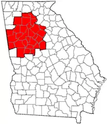
Mableton is a town and census-designated place in Cobb County, Georgia, United States. As of the 2010 census, Mableton had a population of 37,115. When Brookhaven became a city in December 2012, Mableton became the largest unincorporated CDP in Metro Atlanta.
Mableton, Georgia | |
|---|---|
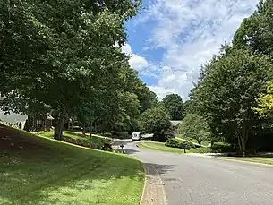 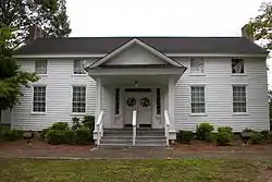   From top to bottom, left to right: a residential street in Mableton, Robert Mable's home built in 1843, the Mableton Post Office, the Atlanta skyline from Mt. Harmony Memorial Gardens in Mableton | |
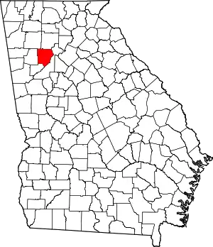
 Location in Cobb County and the state of Georgia | |
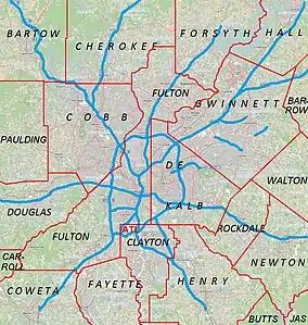 Mableton Location within the Atlanta Metropolitan Area | |
| Coordinates: 33°48′48″N 84°34′18″W | |
| Country | |
| State | |
| County | Cobb |
| Settled | September 11, 1843 |
| Incorporated (town) | August 19, 1912 - August 17, 1916 |
| Government | |
| • District Commissioner | Monique Sheffield |
| • Body | Cobb County Board of Commissioners |
| Area | |
| • Total | 20.8 sq mi (53.7 km2) |
| • Land | 20.6 sq mi (53.3 km2) |
| • Water | 0.2 sq mi (0.4 km2) |
| Elevation | 978 ft (298 m) |
| Population (2010) | |
| • Total | 37,115 |
| • Estimate (2018) | 40,464 |
| • Density | 1,800/sq mi (690/km2) |
| Time zone | UTC-5 (Eastern (EST)) |
| • Summer (DST) | UTC-4 (EDT) |
| ZIP code | 30126 |
| Area code(s) | 770/678/404 |
| FIPS code | 13-48288[1] |
| GNIS feature ID | 0332295[2] |
| Website | www |
Roy Barnes, governor of Georgia from 1999 to 2003, along with rapper Lil Yachty, are from Mableton.
History
Between the 16th and 19th centuries, most of the land in present-day southern Cobb County belonged to the Cherokee and Creek. Two indigenous villages were established near the area that will later become known as Mableton - the settlements of Sweet Water Town and Nickajack. Both tribes coinhabited the area peacefully, with one legend claiming that eventual ownership of the area by the Cherokee was settled via a ball game.[3] One of the earliest known records of white Europeans being aware of the inhabitants is an 1839 map depicting a 'Nickajack Creek' converging with the Chattahoochee River south and west of the Standing Peachtree settlement.[4] Ultimately, all native inhabitants in Georgia were forced out of their lands by the 1830s, and much of the vacancies were granted to European settlers by land lottery.
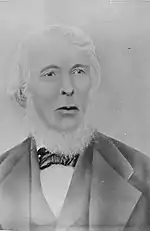
The town was named after Scottish immigrant Robert Mable (1803-1885), who on September 11, 1843, bought 300 acres (approximately 120 hectares or 1.2 km2) of land in southern Cobb County from the Georgia Land Lottery of 1832. Mable was a millwright and farmer who grew cotton, corn, potatoes, and sorghum in the area; he owned between 11 and 48 slaves by 1860. According to oral interviews, Mable was a "fair and kind" slavemaster who educated slave children alongside his own, and eventually also liberated his slaves before any government mandate ordered him to.[3] The Robert Mable House and Cemetery, located off U.S. 78 on Floyd Road just north of Clay Road, now includes an amphitheater which hosts public events.[5]
More white settlers moved into the northern edge of Mableton by Nickajack Creek, near Smyrna, in the mid-1800s. They formed a community initially known as 'Mill Grove', and later 'Nickajack.' The creek provided ample power to run grist, saw, cotton, and woolen mills. A covered bridge, originally built c. 1848-1850, traverses the stream and is now part of a historical district. It is one of the few remaining covered bridges in Georgia, and still highly active today after it was later buttressed to handle automobile traffic. A notable resident of the area during that period was John Gann, Cobb County's first state senator. His home, built in 1841, still stands today and is also part of the historical district.[4]
During the Atlanta campaign of the Civil War, Union officers Walter Q. Gresham and Francis P. Blair Jr. of the XVII Corps reached Mableton on July 3, 1864 after the Union defeat at Kennesaw. Gresham replenished his troops' supplies and received medical care at Robert Mable's house, and camped for the night before advancing to Atlanta.[6] The house was spared from the carnage of Sherman's March to the Sea.[7]
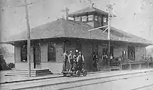
The Georgia Pacific Railway (later absorbed by Southern Railway and today known as the Norfolk Southern Railway) opened a railroad station in Mableton in December 1881. The chief engineer erected a sign displaying 'Mableton' upon completion of the station in honor of Robert. The first train from Atlanta arrived at the station just before Christmas. Shortly after, the post office was established on June 28, 1882. This replaced the post office in Bryantville, a former settlement about two miles (3.2 km) southeast. The arrival of the railroad allowed Mableton to act as a commercial hub for then-rural Cobb County.[8] Cotton export flourished throughout the county from the 1890s until the Great Depression.[9]
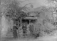
On August 19, 1912, Mableton was incorporated as a town but was disincorporated on August 17, 1916.[10] In that year, the town suffered from a heavy flood, resulting in an unexpected tax burden being placed upon the residents for repairs.[11] But after locals successfully demanded that a tax on storm drains be shared by all of Cobb County instead, the town's charter was revoked and Mableton was disincorporated.[12] H.A. Glore, a medical doctor from Atlanta Medical College (now Emory University), served as the town's mayor during this time.[3][13]
Geography
Mableton is located at 33°48′48″N 84°34′18″W (33.813355, -84.571691).[14] The Chattahoochee River acts as the southeast border, separating Cobb County from west Fulton County — where the historic African-American neighborhood of Collier Heights and the former site of the Bankhead Courts housing project are nearby. Two suburban cities directly border Mableton: Austell in the west and Smyrna in the north. Lithia Springs, an unincorporated community, is directly southwest.
Mableton is approximately 15 miles west-northwest from the city of Atlanta, and approximately 20 miles from Hartsfield-Jackson Atlanta International Airport.
Topography
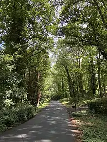
According to the United States Census Bureau, the CDP has a total area of 20.8 square miles (54 km2), of which 20.6 square miles (53 km2) is land and 0.2 square miles (0.52 km2), or 0.82%, is water. Nickajack Creek, a tributary of the Chattahoochee, runs near the Smyrna-Mableton line. Mableton and most of Atlanta is in the Piedmont region, characterized by rolling hills and gentle slopes that make for narrow roads.
Demographics
As of the census of 2010, there were 37,115 people in Mableton, with a population density of 1,804.5 people per square mile.[15] The 2018 American Community Survey estimates the population at 40,464.[15] Mableton is the most populous unincorporated census-designated place (CDP) in the Metro Atlanta area. East Cobb - with a population estimate of around 208,000 in 2019 - is technically the most populous unincorporated area in the metro, though it is not recognized as a CDP in the Census Bureau.[16]
The 5-year estimates of the 2018 ACS[15] state that 39.2% of the population was White, 48.5% African American, 0.2% Native American/Alaska Native, 2.2% Asian, 0.0% Native Hawaiian/Pacific Islander, 6.2% from some other race alone, and 3.7% from two or more races. Hispanic or Latino of any race were 18.0% of the population. Individuals who identified as White alone, not Hispanic or Latino, were 30.3% of the population.
There were 2,115 identified veterans in the area as of 2018. Foreign born persons (non-U.S. citizens or U.S. nationals at birth) made up 18.1% of the population.
As of 2018, the median income for a household in the CDP was $64,790. Males had a median income of $50,610 versus $46,239 for females. The per capita income for the CDP was $31,474. About 11.9% of the population was below the poverty line.
In 2018, the estimated median age was 35 years, with 27% under 18 years old, 64% from 18 to 64 years old, and 9% 65 years and older. For every 100 females in all age groups, there were 88.3 males. For every 100 females age 18 and over, there were 82.6 males; for every 100 age 65 and over, there were 47.6 males.
Among those aged 25 or older in 2018, 87.2% graduated from high school and 36.5% obtained a bachelor's degree or higher.
As of the census[1] of 2000, there were 11,339 housing units at an average density of 550.8/sq mi (212.6/km2). There were 10,894 households, out of which 34.9% had children under the age of 18 living with them, 53.5% were married couples living together, 14.5% had a female householder with no husband present, and 26.9% were non-families. 21.2% of all households were made up of individuals, and 6.7% had someone living alone who was 65 years of age or older. The average household size was 2.72 and the average family size was 3.12.
Government
Mableton is a part of Cobb County's District 4, along with Austell, Powder Springs, south Marietta, and sections of Smyrna. The district will be led by Monique Sheffield, after former District 4 Commissioner Lisa Cupid defeated incumbent Mike Boyce for Cobb County Commission Chair in the 2020 election.
At the federal level, Mableton is a part of Georgia's 13th congressional district, currently served by Rep. David Scott (D) since 2003. The majority of the district voted for Democrats in the 2004, 2008, 2012, 2016, and 2020 presidential elections, as well as for Stacey Abrams in the 2018 gubernatorial election.
Transportation
The East-West Connector, Mableton Parkway (SR 139), and Veterans' Memorial Highway (U.S. 78) are major roads that run through Mableton, with the latter two directly connecting to Atlanta. Veterans' Memorial Highway connects to Atlanta via Bankhead as the Donald Lee Hollowell Parkway, while Mableton Parkway connects via the Westview/West End neighborhoods as M.L.K. Jr. Drive and the Ralph David Abernathy Parkway.
Nearby highways include the western segment of I-285 (about 6 mi away) and I-20 (about 5 mi away).
The public-use, general aviation Fulton County Airport (Brown Field) is adjacent to Mableton's southeast border with Fulton County. It includes two runways and handles approximately 65,000 operations annually.[17]
Public transportation via bus is run by CobbLinc.
Recreation
Trails
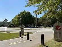
The Silver Comet Trail runs through Mableton.[18] It is a 61.5 mile paved trail with a 2% grade, beginning in Smyrna and ending at the Georgia-Alabama state line near Cedartown, GA.

Heritage Park is a smaller trail running along Nickajack Creek that ultimately connects to the Comet. A notable landmark includes the ruins of a woolen mill built in the 1860s.[19]

Parks
- Lions Park
- Thompson Park
- Nickajack Park
- Riverline Park
- Wallace Park
Community Garden
The Historic Mableton Community Garden is located at 5178 Floyd Road.[20]
Amphitheater
Governor Roy Barnes provided a state grant for construction of a 2,500-seat amphitheater shortly after his appointment in 2000, fulfilling residents' desire dating back from the 1970s. The Mable House Barnes Amphitheater is a $7 million state and local investment and attracts numerous high-profile acts.[21]
Amusement Park
Six Flags Over Georgia is located near Mableton's border with Austell, adjacent to I-20. The park is home to 11 roller coasters, the first "floorless" freefall tower ride in the world, and a fully-functional carousel from 1908 listed in the National Register of Historic Places.
Education
The Cobb County School District operates several public schools in the area:
Elementary Schools
- Mableton Elementary School
- Harmony-Leland Elementary School
- Clay Elementary School
- Bryant Elementary School
- Riverside Elementary School
- H.A.V.E.N. Academy at Skyview
Middle Schools
- Floyd Middle School
- Lindley Middle School
High School
- Pebblebrook High School - famous alumni include Glee actress Becca Tobin, Cleveland Cavaliers player Colin Sexton, and Lil Yachty
Private Schools
The Georgia Japanese Language School (GJLS; ジョージア日本語学校 Jōjia Nihongo Gakkō), a part-time supplementary Japanese school, holds its classes at the Lindley 6th Grade Academy in Mableton;[22][23] Lindley was previously occupied by the W. H. Barnes Education Center.[24] The GJLS originally opened with nine students in 1974 at Oglethorpe University, serving grades 1 through 9. The school moved to W.H. Barnes in 2002.[23]
Whitefield Academy, a Christ-centered college preparatory school in Smyrna, is near Mableton.[25]
The SAE School is an "independent project-based learning school" for pre-school to 8th grade students located in Mableton.[26]
Primrose Schools, a private school for early preschool children, is in the Providence neighborhood of Mableton.[27]
Public Library
- South Cobb Regional Library
Redevelopment
In the summer of 2010, more than a hundred residents, bureaucrats, politicians, architects, designers and traffic engineers spent a week designing a vision for a redeveloped downtown Mableton. It was then formalized by Duany Plater-Zyberk into a plan that was unanimously approved by Cobb County's Board of Commissioners in 2013.[28] The establishment of the new Mableton Town Center (MTC) is part of the county's 2040 Comprehensive Plan.[29]

As of late 2020, Embry Development Company is in talks with the Cobb County Board of Commissioners to begin construction of a 31-acre mixed-use commercial/residential plaza at Mableton Parkway and Old Powder Springs Road.[30] The development calls for 81 town homes, 46 "courtyard cottage" style houses, 21 detached single-family homes, and 13,500 square feet of retail and restaurant space. The particular area, in addition to establishments along Veterans Memorial Highway (U.S. 78), is largely dated and rundown, with some businesses failing to adhere to building codes.[31]
Another company, Garner Group, is also redeveloping a nearly 40 year old strip mall along Floyd Road and East-West Connector into a mixed-use, pedestrian-friendly plaza. There will be 360 luxury apartments and 42 townhomes on the 60-acre site, with the entire development occupying about 720,000 square feet. Planning Commission Chair Galt Porter, proponent of the plan, stated of the recent growth in the area: "It’s probably been 15 to 20 years since there’s been a market rate development of apartments anywhere close to this...you have to go to Smyrna to get something, or you have to go out all the way into Powder Springs to get something. There’s just nothing in this area."[32] The project was approved by the Cobb County Board of Commissioners on October 21, 2020.[33]
Cityhood
As of 2020, a local initiative known as the South Cobb Alliance is fostering a debate for cityhood.[34] A feasibility study conducted by the Carl Vinson Institute of Government stated that the potential city would generate $11.3 million in operating expenses and $14.6 million in revenue.[35] Alternatively, nearby Smyrna is considering annexing parts of Mableton. This move would make Smyrna the largest city in Cobb County, surpassing the county seat of Marietta, and ultimately disrupt Mableton's cityhood efforts.[36]
Notable people/residents
- Roy Barnes, Governor of Georgia from 1999 to 2003
- Erica Thomas, Georgia State Representative
- Anna Benson, glamour model and ex-wife of baseball player Kris Benson
- Big K.R.I.T., rapper
- AR Fox, pro wrestler
- T.J. Holmes, CNN News Anchor
- Kenny McKinley, former wide receiver for Denver Broncos
- Michael King, television producer/reporter and commentator
- Ne-Yo, R&B singer
- Lil Yachty, rapper who featured on the #1 hit Broccoli (D.R.A.M. song)
- Collin Sexton, basketball player for the Cleveland Cavaliers
- Ronnie DeVoe, Member of New Edition
Gallery
 Sen. John Gann's home, the Boxwood Cottage, built 1841
.jpg.webp) The Concord Covered Bridge spanning Nickajack Creek, largely unchanged in appearance from 1872
The Concord Covered Bridge spanning Nickajack Creek, largely unchanged in appearance from 1872 Dr. H.A. Glore (right), mayor of incorporated Mableton, with his family in 1894
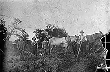 Cotton workers in Mableton, around 1900
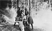 Swimmers in Nickajack Creek, 1916
References
- "U.S. Census website". United States Census Bureau. Retrieved 2008-01-31.
- "US Board on Geographic Names". United States Geological Survey. 2007-10-25. Retrieved 2008-01-31.
- "The Mable House: Historic Structure Report" (PDF). 2014.
- "Home, Gann Historical Society & Library, Inc". Gann Historical Society & Library, Inc. Retrieved 2020-09-14.
- "MABLETON, Cobb County. Incorporated as a town, August 19, 1912 to August 17, 1916. The post office was established June 28, 1882". Archive.is. Archived from the original on 2012-12-05. Retrieved 2019-04-04.
- "The Mable House". Georgia Historical Society. Retrieved 2020-09-09.
- Tiller, Katie. "Mableton's namesake still has ties to community". ajc. Retrieved 2020-09-09.
- "Mission & Vision Statement". Mableton Improvement Coalition. Retrieved 2020-09-08.
- Acworth. Acworth Society for Historic Preservation, Inc. Charleston, SC: Arcadia. 2003. ISBN 0-7385-1479-9. OCLC 52982944.CS1 maint: others (link)
- Krakow, Kenneth K. (1975). Georgia Place-Names: Their History and Origins (PDF). Macon, GA: Winship Press. p. 139. ISBN 0-915430-00-2.
- Tiller, Katie. "Mableton's namesake still has ties to community". ajc. Retrieved 2020-09-09.
- "Historical Sites - Taste of South Cobb". Retrieved 2020-09-09.
- "[Photograph of the Glore family, Mableton, Cobb County, Georgia, 1894] - Digital Library of Georgia". dlg.usg.edu. Retrieved 2020-09-19.
- "US Gazetteer files: 2010, 2000, and 1990". United States Census Bureau. 2011-02-12. Retrieved 2011-04-23.
- "U.S. Census Bureau QuickFacts: Mableton CDP, Georgia". www.census.gov. Retrieved 2020-07-09.
- "East Cobb population Archives". East Cobb News. Retrieved 2020-09-20.
- "Airport". www.fultoncountyga.gov. Retrieved 2020-10-15.
- "Silver Comet Trail, Cobb County Information - Georgia". Silvercometga.com. Retrieved 11 July 2018.
- "Heritage Park | Cobb County Georgia". www.cobbcounty.org. Retrieved 2020-09-27.
- "Mableton Community Garden". mableton.org. Retrieved 8 June 2020.
- "About Us". mablehouse.org. Retrieved 2020-07-19.
- "ジョージア日本語学校/Georgia Japanese Language School". Georgia Japanese Language School. Retrieved 2020-10-11.
- "13handbook_en09.pdf" (Archive). Georgia Japanese Language Academy. Retrieved on May 11, 2014. "C/O Lindley 6th Grade Academy 1550 Pebblebrook Circle Mableton, GA 30126 U.S.A."
- "03yoran_english.pdf" (). Georgia Japanese Language Academy. Retrieved on May 11, 2014. "C/O W. H. Barnes Education Center 1550-B Pebblebrook Circle Mableton, GA 30126 U.S.A."
- "Welcome to Whitefield Academy". www.whitefieldacademy.com. Retrieved 2020-10-11.
- "Home Page". The SAE School. Retrieved 2020-10-11.
- "The Leader in Early Education and Care". www.primroseschools.com. Retrieved 2020-10-11.
- "Mableton Redevelopment District Now Has Master Plan". Patch. Retrieved 2020-01-12.
- "Ongoing and Completed Projects | Cobb County Georgia". www.cobbcounty.org. Retrieved 2020-10-23.
- agilbert@mdjonline.com, Aleks Gilbert. "Cobb Planning Commission to hear mixed-used, single-family proposals". Northwest Georgia News. Retrieved 2020-08-06.
- Johnson, Larry Felton (2020-08-05). "Cobb Planning Commission holds decision on Mableton Parkway mixed-use development until September". Cobb County Courier. Retrieved 2020-08-06.
- agilbert@mdjonline.com, Aleks Gilbert. "Mixed-use development could give Mableton a boost, Planning Commissioners say". MDJOnline.com. Retrieved 2020-10-11.
- Lutz, Meris; Journal-Constitution, The Atlanta. "Cobb approves major redevelopment of South Cobb shopping center". ajc. Retrieved 2020-10-23.
- "South Cobb Alliance". sites.google.com. Retrieved 2020-06-10.
- Kristal Dixon, The Atlanta Journal-Constitution. "Study shows proposed city of Mableton is financially feasible". ajc. Retrieved 2020-06-10.
- Kristal Dixon, The Atlanta Journal-Constitution. "Smyrna annexation could make it largest Cobb city, but stymie Mableton". ajc. Retrieved 2020-06-10.
