Pickens County, Georgia
Pickens County is a county located in the north-central portion of the U.S. state of Georgia. As of the 2010 census, the population was 29,431.[1] The county seat is Jasper.[2]
Pickens County | |
|---|---|
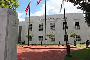 Pickens County Courthouse, Jasper | |
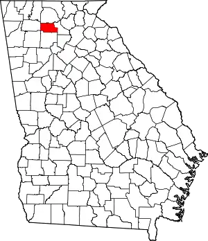 Location within the U.S. state of Georgia | |
 Georgia's location within the U.S. | |
| Coordinates: 34°28′N 84°28′W | |
| Country | |
| State | |
| Founded | December 5, 1853 |
| Named for | Andrew Pickens |
| Seat | Jasper |
| Largest city | Jasper |
| Area | |
| • Total | 233 sq mi (600 km2) |
| • Land | 232 sq mi (600 km2) |
| • Water | 0.7 sq mi (2 km2) 0.3%% |
| Population | |
| • Estimate (2018) | 31,980 |
| • Density | 127/sq mi (49/km2) |
| Time zone | UTC−5 (Eastern) |
| • Summer (DST) | UTC−4 (EDT) |
| Congressional districts | 9th, 14th |
| Website | pickenscountyga |
Pickens County is part of the Atlanta-Sandy Springs-Roswell, Georgia metropolitan statistical area.
History
The Georgia General Assembly passed an act on December 5, 1853, to create Pickens County from portions of Cherokee and Gilmer Counties.[3] Pickens received several more land additions from Cherokee (1869) and Gilmer Counties (1858 and 1863); however, several sections of Pickens County have also been transferred to other counties: Dawson County (1857), Gordon County (1860), and Cherokee County (1870).
Pickens County is named for American Revolutionary War General Andrew Pickens.[4]
During the Civil War, Company D of the 1st Georgia Infantry Battalion of the Union Army was raised in Pickens County.
Most of Pickens County's early industry revolved around marble. Georgia Marble Company is located in Marble Hill near Tate. The Tate elementary school is built out of marble. The marble was also used to make the statue of Abraham Lincoln in the Lincoln Memorial. Most of the marble is white, but it is one of the few places in the world where pink marble is found. The marble is also used for tombstones for the United States military.
Pickens County has seen very rapid growth with the building of Georgia State Route 515, locally referred to as the "four-lane". Many new businesses and residents continue to move to Pickens County.
Pickens County is home the Georgia Marble Festival.
Geography

According to the U.S. Census Bureau, the county has a total area of 233 square miles (600 km2), of which 232 square miles (600 km2) are land and 0.7 square miles (1.8 km2) (0.3%) is covered by water.[5]
The county is located in the Blue Ridge Mountains. The highest point in Pickens County is the 3,288-ft summit of Mount Oglethorpe, the southernmost peak in the Blue Ridge Mountains, and for a number of years, the southern terminus of the Appalachian Trail. Other notable peaks in Pickens County include Sharp Top Mountain and Sharp Mountain. One of the best viewpoints of Sharp Top Mountain is from Grandview Lake Dam on Grandview Road.
The eastern half of Pickens County is located in the Etowah River subbasin of the ACT River Basin (Coosa-Tallapoosa River Basin). The western half of the county is located in the Coosawattee River sub-basin of the same larger ACT River Basin.[6]
Adjacent counties
- Gilmer County - north
- Dawson County - east
- Cherokee County - south
- Bartow County - southwest
- Gordon County - west
Government
Robert Jones is the chairman of the board of county commissioners; Jerry Barnes and Becky Denney serve as commissioners.
| Year | Republican | Democratic | Third parties |
|---|---|---|---|
| 2020 | 82.2% 14,075 | 16.4% 2,808 | 1.4% 233 |
| 2016 | 82.9% 11,651 | 14.1% 1,979 | 3.1% 428 |
| 2012 | 83.0% 10,547 | 15.6% 1,975 | 1.4% 180 |
| 2008 | 78.1% 10,004 | 20.3% 2,595 | 1.7% 214 |
| 2004 | 76.3% 8,115 | 23.0% 2,444 | 0.8% 80 |
| 2000 | 66.9% 5,488 | 30.4% 2,489 | 2.7% 224 |
| 1996 | 46.3% 3,041 | 41.0% 2,693 | 12.7% 832 |
| 1992 | 40.6% 2,332 | 41.0% 2,359 | 18.4% 1,057 |
| 1988 | 67.5% 3,021 | 32.0% 1,430 | 0.5% 23 |
| 1984 | 67.8% 2,801 | 32.2% 1,329 | |
| 1980 | 39.5% 1,612 | 57.8% 2,358 | 2.6% 107 |
| 1976 | 27.5% 973 | 72.6% 2,571 | |
| 1972 | 80.2% 2,101 | 19.8% 520 | |
| 1968 | 44.5% 1,659 | 18.2% 677 | 37.3% 1,392 |
| 1964 | 50.3% 1,955 | 49.7% 1,930 | |
| 1960 | 56.9% 1,943 | 43.1% 1,473 | |
| 1956 | 65.5% 2,341 | 34.6% 1,236 | |
| 1952 | 50.3% 1,328 | 49.7% 1,312 | |
| 1948 | 46.2% 1,258 | 45.5% 1,239 | 8.3% 225 |
| 1944 | 50.5% 795 | 49.5% 780 | |
| 1940 | 43.8% 884 | 55.6% 1,124 | 0.6% 12 |
| 1936 | 46.3% 1,053 | 53.7% 1,223 | |
| 1932 | 33.5% 743 | 66.5% 1,472 | |
| 1928 | 70.8% 1,319 | 29.2% 543 | |
| 1924 | 60.3% 1,149 | 39.5% 754 | 0.2% 4 |
| 1920 | 65.5% 830 | 34.5% 437 | |
| 1916 | 27.3% 344 | 39.4% 497 | 33.3% 420 |
| 1912 | 47.0% 456 | 32.7% 317 | 20.3% 197 |
Transportation
Major highways
 Interstate 575
 State Route 5
 State Route 53
 State Route 53 Business
 State Route 108
 State Route 136
 State Route 136 Connector
 State Route 372
 State Route 417 (unsigned designation for I-575)
 State Route 515
Demographics
| Historical population | |||
|---|---|---|---|
| Census | Pop. | %± | |
| 1860 | 4,951 | — | |
| 1870 | 5,317 | 7.4% | |
| 1880 | 6,790 | 27.7% | |
| 1890 | 8,182 | 20.5% | |
| 1900 | 8,641 | 5.6% | |
| 1910 | 9,041 | 4.6% | |
| 1920 | 8,222 | −9.1% | |
| 1930 | 9,687 | 17.8% | |
| 1940 | 9,136 | −5.7% | |
| 1950 | 8,855 | −3.1% | |
| 1960 | 8,903 | 0.5% | |
| 1970 | 9,620 | 8.1% | |
| 1980 | 11,652 | 21.1% | |
| 1990 | 14,432 | 23.9% | |
| 2000 | 22,983 | 59.3% | |
| 2010 | 29,431 | 28.1% | |
| 2018 (est.) | 31,980 | [8] | 8.7% |
| U.S. Decennial Census[9] 1790-1960[10] 1900-1990[11] 1990-2000[12] 2010-2013[1] | |||
2000 census
As of the census[13] of 2000, 22,983 people, 8,960 households, and 6,791 families lived in the county. The population density was 99 people per square mile (38/km2). The10,687 housing units averaged 46 per square mile (18/km2). The racial makeup of the county was 96.21% White, 1.27% African American, 0.38% Native American, 0.23% Asian, 0.03% Pacific Islander, 1.04% from other races, and 0.84% from two or more races. About 2.03% of the population were Hispanics or Latinos of any race.
Of the 8,960 households, 31.10% had children under the age of 18 living with them, 63.50% were married couples living together, 8.80% had a female householder with no husband present, and 24.20% were not families. About20.50% of all households were made up of individuals, and 7.70% had someone living alone who was 65 years of age or older. The average household size was 2.54 and the average family size was 2.91.
In the county, the population was distributed as 23.60% under the age of 18, 7.70% from 18 to 24, 29.80% from 25 to 44, 25.80% from 45 to 64, and 13.20% who were 65 years of age or older. The median age was 38 years. For every 100 females, there were 95.80 males. For every 100 females age 18 and over, there were 94.20 males.
The median income for a household in the county was $41,387, and for a family was $47,123. Males had a median income of $32,039 versus $22,866 for females. The per capita income for the county was $19,774. About 6.20% of families and 9.20% of the population were below the poverty line, including 13.20% of those under age 18 and 7.40% of those age 65 or over.
2010 census
As of the 2010 United States Census, 29,431 people, 11,291 households, and 8,423 families resided in the county.[14] The population density was 126.8 inhabitants per square mile (49.0/km2). The 13,692 housing units averaged 59.0 per square mile (22.8/km2).[15] The racial makeup of the county was 95.7% White, 1.1% African American, 0.4% Asian, 0.3% American Indian, 1.3% from other races, and 1.2% from two or more races. Those of Hispanic or Latino origin made up 2.8% of the population.[14] In terms of ancestry, 17.8% were American, 13.2% were English, 12.3% were Irish, and 10.0% were German.[16]
Of the 11,291 households, 32.1% had children under the age of 18 living with them, 60.7% were married couples living together, 9.9% had a female householder with no husband present, 25.4% were not families, and 21.2% of all households were made up of individuals. The average household size was 2.57 and the average family size was 2.97. The median age was 42.1 years.[14]
The median income for a household in the county was $49,945 and for a family was $59,955. Males had a median income of $46,773 versus $34,394 for females. The per capita income for the county was $25,892. About 8.9% of families and 11.6% of the population were below the poverty line, including 15.9% of those under age 18 and 11.4% of those age 65 or over.[17]
Cities and communities
Incorporated cities
- Jasper
- Nelson (part is in Cherokee County)
- Talking Rock
Unincorporated communities
- Tate
- Hinton
- Marble Hill
- Blaine
- Ludville
- Whitestone (part is in Gilmer County)
- Jerusalem
Private communities
A significant portion of the county population resides in these large, gated, private communities that function similar to a municipality, providing many municipal-type services that operate independently of county government.
- Bent Tree[18]
- Big Canoe (part is in Dawson County)
- The Preserve at Sharp Mountain
Notable residents
- Farish Carter Tate, U.S. congressman
- John Bozeman, frontiersman; co-founder of Bozeman, Montana
References
The weekly newspaper for Pickens County is the Pickens Progress, a family-owned newspaper published since 1887 in Jasper.
- "State & County QuickFacts". United States Census Bureau. Archived from the original on June 7, 2011. Retrieved February 18, 2014.
- "Find a County". National Association of Counties. Retrieved June 7, 2011.
- "Pickens County". Retrieved June 28, 2014.
- Krakow, Kenneth K. (1975). Georgia Place-Names: Their History and Origins (PDF). Macon, GA: Winship Press. p. 175. ISBN 0-915430-00-2.
- "US Gazetteer files: 2010, 2000, and 1990". United States Census Bureau. February 12, 2011. Retrieved April 23, 2011.
- "Georgia Soil and Water Conservation Commission Interactive Mapping Experience". Georgia Soil and Water Conservation Commission. Retrieved November 19, 2015.
- Leip, David. "Dave Leip's Atlas of U.S. Presidential Elections". uselectionatlas.org. Retrieved March 22, 2018.
- "Population and Housing Unit Estimates". Retrieved July 31, 2019.
- "U.S. Decennial Census". United States Census Bureau. Retrieved June 25, 2014.
- "Historical Census Browser". University of Virginia Library. Retrieved June 25, 2014.
- "Population of Counties by Decennial Census: 1900 to 1990". United States Census Bureau. Retrieved June 25, 2014.
- "Census 2000 PHC-T-4. Ranking Tables for Counties: 1990 and 2000" (PDF). United States Census Bureau. Retrieved June 25, 2014.
- "U.S. Census website". United States Census Bureau. Retrieved January 31, 2008.
- "DP-1 Profile of General Population and Housing Characteristics: 2010 Demographic Profile Data". United States Census Bureau. Archived from the original on February 13, 2020. Retrieved December 30, 2015.
- "Population, Housing Units, Area, and Density: 2010 - County". United States Census Bureau. Archived from the original on February 13, 2020. Retrieved December 30, 2015.
- "DP02 SELECTED SOCIAL CHARACTERISTICS IN THE UNITED STATES – 2006-2010 American Community Survey 5-Year Estimates". United States Census Bureau. Archived from the original on February 13, 2020. Retrieved December 30, 2015.
- "DP03 SELECTED ECONOMIC CHARACTERISTICS – 2006-2010 American Community Survey 5-Year Estimates". United States Census Bureau. Archived from the original on February 13, 2020. Retrieved December 30, 2015.
- "Bent Tree | North Georgia Mountains Real Estate Properties | 18-Hole Golf Course, Year-Round Tennis, and 110-Acre Lake | Buildable Real Estate Lots for Sale in Bent Tree. | Bent Tree Community". www.benttree.com.
External links
![]() Media related to Pickens County, Georgia at Wikimedia Commons
Media related to Pickens County, Georgia at Wikimedia Commons
Places adjacent to Pickens County, Georgia | ||||||||||
|---|---|---|---|---|---|---|---|---|---|---|
| ||||||||||
Municipalities and communities of Pickens County, Georgia, United States | ||
|---|---|---|
| Cities | Map of Georgia highlighting Pickens County | |
| Town | ||
| Unincorporated communities | ||
| Ghost town | ||
| Footnotes | ‡This populated place also has portions in an adjacent county or counties | |
| ||
|  | |||||
|
| ||||||

| Authority control |
|---|