Barrow County, Georgia
Barrow County is a county located in the north central portion of the U.S. state of Georgia. As of the 2010 census, the population was 69,367.[1] The county seat is Winder.[2]
Barrow County | |
|---|---|
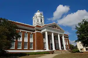 Barrow County Courthouse in Winder | |
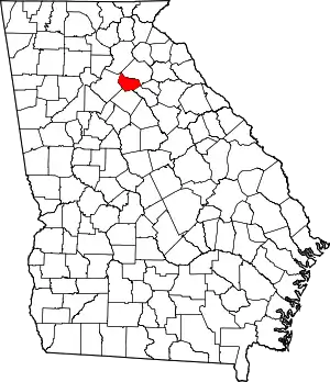 Location within the U.S. state of Georgia | |
 Georgia's location within the U.S. | |
| Coordinates: 33°59′N 83°43′W | |
| Country | |
| State | |
| Founded | July 7, 1914 |
| Named for | David Crenshaw Barrow, Jr. |
| Seat | Winder |
| Largest city | Winder |
| Area | |
| • Total | 163 sq mi (420 km2) |
| • Land | 160 sq mi (400 km2) |
| • Water | 2.6 sq mi (7 km2) 1.6%% |
| Population | |
| • Estimate (2019) | 83,240 |
| • Density | 284/sq mi (110/km2) |
| Time zone | UTC−5 (Eastern) |
| • Summer (DST) | UTC−4 (EDT) |
| Congressional district | 10th |
| Website | www |
Barrow County is included in the Atlanta-Sandy Springs-Roswell, GA Metropolitan Statistical Area.
History
The Georgia General Assembly approved a joint resolution on July 7, 1914, to place an amendment on the November 3, 1914, election ballot that proposed the creation of Barrow County. The approval of the amendment by Georgia voters officially created the new county. The land for the county came from parts of Jackson, Gwinnett and Walton Counties.
Barrow County is named after David Crenshaw Barrow Jr., alumnus, professor and chancellor of the University of Georgia.[3]
Barrow County's county seat Winder, Georgia is home of Georgia Senator Richard B. Russell
Barrow is home of the Bethlehem Christian Academy Knights, Winder-Barrow Bulldoggs, and Apalachee Wildcats. Barrow county is home to four middle schools, and recently built Bear Creek Middle School, a new middle school in the City of Statham.
Barrow county and Gwinnett county are the homes of the Chateau Elan resort, winery, and estate, which is also Georgia's largest winery. It is located in Braselton.
Geography
According to the U.S. Census Bureau, the county has a total area of 163 square miles (420 km2), of which 160 square miles (410 km2) is land and 2.6 square miles (6.7 km2) (1.6%) is water.[4] The entirety of Barrow County is located in the Upper Oconee River sub-basin of the Altamaha River basin.[5]
Adjacent counties
- Hall County – north
- Clarke County – east
- Jackson County – east
- Oconee County – southeast
- Walton County – south
- Gwinnett County – west
Transportation
Major highways
 Interstate 85
 U.S. Route 29
- U.S. Route 29 Business
 State Route 8
 State Route 11
 State Route 53
 State Route 81
 State Route 82
 State Route 124
 State Route 211
 State Route 316
 State Route 324
 State Route 330
 State Route 403 (unsigned designation for I-85)
Pedestrians and cycling
There are limited walkability options available currently. However, neighboring Clarke, Gwinnett and Hall counties have accessible trails available.
Demographics
| Historical population | |||
|---|---|---|---|
| Census | Pop. | %± | |
| 1920 | 13,188 | — | |
| 1930 | 12,401 | −6.0% | |
| 1940 | 13,064 | 5.3% | |
| 1950 | 13,115 | 0.4% | |
| 1960 | 14,485 | 10.4% | |
| 1970 | 16,859 | 16.4% | |
| 1980 | 21,354 | 26.7% | |
| 1990 | 29,721 | 39.2% | |
| 2000 | 46,144 | 55.3% | |
| 2010 | 69,367 | 50.3% | |
| 2019 (est.) | 83,240 | [6] | 20.0% |
| U.S. Decennial Census[7] 1790-1960[8] 1900-1990[9] 1990-2000[10] 2010-2019[1] | |||
2000 census
As of the census of 2000, there were 46,144 people, 16,354 households, and 12,543 families living in the county. The population density was 284 people per square mile (110/km2). There were 17,304 housing units at an average density of 107 per square mile (41/km2). The racial makeup of the county was 84.84% White, 10.72% Black or African American, 0.30% Native American, 2.20% Asian, 0.04% Pacific Islander, 1.50% from other races, and 1.40% from two or more races. 3.16% of the population were Hispanic or Latino of any race. Barrow County is considered a part of the Atlanta, GA combined statistical area despite its comparatively small population.
There were 16,354 households, out of which 39.90% had children under the age of 18 living with them, 60.30% were married couples living together, 11.60% had a female householder with no husband present, and 23.30% were non-families. 18.60% of all households were made up of individuals, and 6.70% had someone living alone who was 65 years of age or older. The average household size was 2.79 and the average family size was 3.17.
In the county, the population was spread out, with 28.40% under the age of 18, 8.50% from 18 to 24, 34.50% from 25 to 44, 19.50% from 45 to 64, and 9.10% who were 65 years of age or older. The median age was 32 years. For every 100 females, there were 98.90 males. For every 100 females age 18 and over, there were 95.70 males.
The median income for a household in the county was $47,019, and the median income for a family was $50,722. Males had a median income of $34,510 versus $23,369 for females. The per capita income for the county was $18,350. About 6.20% of families and 8.30% of the population were below the poverty line, including 9.10% of those under age 18 and 14.40% of those age 65 or over.
2010 census
As of the 2010 United States Census, there were 69,367 people, 23,971 households, and 18,214 families living in the county.[11] The population density was 432.7 inhabitants per square mile (167.1/km2). There were 26,400 housing units at an average density of 164.7 per square mile (63.6/km2).[12] The racial makeup of the county was 78.8% white, 11.4% black or African American, 3.4% Asian, 0.3% American Indian, 0.1% Pacific islander, 3.7% from other races, and 2.3% from two or more races. Those of Hispanic or Latino origin made up 8.7% of the population.[11] In terms of ancestry, 20.6% were American, 10.7% were Irish, 9.1% were German, and 8.5% were English.[13]
Of the 23,971 households, 42.6% had children under the age of 18 living with them, 57.0% were married couples living together, 13.4% had a female householder with no husband present, 24.0% were non-families, and 18.8% of all households were made up of individuals. The average household size was 2.88 and the average family size was 3.28. The median age was 33.6 years.[11]
The median income for a household in the county was $48,958 and the median income for a family was $55,415. Males had a median income of $42,869 versus $33,175 for females. The per capita income for the county was $20,882. About 9.4% of families and 12.6% of the population were below the poverty line, including 16.0% of those under age 18 and 14.2% of those age 65 or over.[14]
Education
Winder-Barrow Cluster:
- Winder-Barrow High School
- Richard B. Russell Middle School
- Winder-Barrow Middle School (1956-2013)
- Bear Creek Middle School (WBMS replacement)
- Holsenbeck Elementary School
- Bramlett Elementary School
- Statham Elementary School
- County Line Elementary
Apalachee Cluster:
- Apalachee High School
- Westside Middle School
- Haymon-Morris Middle School
- Auburn Elementary School
- Kennedy Elementary School
- Bethlehem Elementary School
- Yargo Elementary School
Politics
| Year | Republican | Democratic | Third parties |
|---|---|---|---|
| 2020 | 70.7% 26,804 | 27.6% 10,453 | 1.7% 664 |
| 2016 | 72.6% 21,108 | 22.6% 6,580 | 4.7% 1,373 |
| 2012 | 74.1% 18,725 | 23.9% 6,028 | 2.1% 517 |
| 2008 | 71.6% 17,625 | 27.0% 6,657 | 1.4% 351 |
| 2004 | 76.2% 13,520 | 23.1% 4,095 | 0.8% 135 |
| 2000 | 65.5% 7,925 | 30.2% 3,657 | 4.3% 520 |
| 1996 | 51.7% 5,342 | 38.0% 3,928 | 10.4% 1,072 |
| 1992 | 43.4% 4,328 | 40.0% 3,991 | 16.7% 1,663 |
| 1988 | 65.6% 4,738 | 33.8% 2,442 | 0.5% 38 |
| 1984 | 63.5% 4,123 | 36.5% 2,367 | |
| 1980 | 36.2% 2,284 | 61.4% 3,876 | 2.4% 149 |
| 1976 | 22.3% 1,364 | 77.7% 4,756 | |
| 1972 | 79.8% 3,423 | 20.2% 867 | |
| 1968 | 26.5% 1,372 | 20.7% 1,070 | 52.8% 2,731 |
| 1964 | 50.4% 2,316 | 49.6% 2,277 | |
| 1960 | 17.3% 577 | 82.7% 2,759 | |
| 1956 | 16.3% 442 | 83.7% 2,266 | |
| 1952 | 9.1% 236 | 90.9% 2,367 | |
| 1948 | 7.6% 155 | 75.7% 1,554 | 16.8% 344 |
| 1944 | 14.5% 257 | 85.5% 1,513 | |
| 1940 | 11.9% 219 | 87.8% 1,615 | 0.3% 5 |
| 1936 | 12.7% 172 | 87.2% 1,181 | 0.2% 2 |
| 1932 | 2.0% 23 | 97.0% 1,111 | 1.0% 11 |
| 1928 | 58.8% 684 | 41.2% 479 | |
| 1924 | 11.6% 88 | 65.8% 501 | 22.7% 173 |
| 1920 | 36.1% 412 | 64.0% 731 | |
| 1916 | 10.6% 102 | 74.0% 712 | 15.4% 148 |
References
- "State & County QuickFacts". United States Census Bureau. Archived from the original on July 6, 2011. Retrieved June 18, 2014.
- "Find a County". National Association of Counties. Archived from the original on July 12, 2012. Retrieved June 7, 2011.
- Krakow, Kenneth K. (1975). Georgia Place-Names: Their History and Origins (PDF). Macon, GA: Winship Press. p. 14. ISBN 0-915430-00-2.
- "US Gazetteer files: 2010, 2000, and 1990". United States Census Bureau. February 12, 2011. Retrieved April 23, 2011.
- "Georgia Soil and Water Conservation Commission Interactive Mapping Experience". Georgia Soil and Water Conservation Commission. Retrieved November 18, 2015.
- "Population and Housing Unit Estimates". Retrieved May 21, 2020.
- "U.S. Decennial Census". United States Census Bureau. Retrieved June 18, 2014.
- "Historical Census Browser". University of Virginia Library. Retrieved June 18, 2014.
- "Population of Counties by Decennial Census: 1900 to 1990". United States Census Bureau. Retrieved June 18, 2014.
- "Census 2000 PHC-T-4. Ranking Tables for Counties: 1990 and 2000" (PDF). United States Census Bureau. Retrieved June 18, 2014.
- "DP-1 Profile of General Population and Housing Characteristics: 2010 Demographic Profile Data". United States Census Bureau. Archived from the original on February 13, 2020. Retrieved December 27, 2015.
- "Population, Housing Units, Area, and Density: 2010 - County". United States Census Bureau. Archived from the original on February 13, 2020. Retrieved December 27, 2015.
- "DP02 SELECTED SOCIAL CHARACTERISTICS IN THE UNITED STATES – 2006-2010 American Community Survey 5-Year Estimates". United States Census Bureau. Archived from the original on February 13, 2020. Retrieved December 27, 2015.
- "DP03 SELECTED ECONOMIC CHARACTERISTICS – 2006-2010 American Community Survey 5-Year Estimates". United States Census Bureau. Archived from the original on February 13, 2020. Retrieved December 27, 2015.
- Leip, David. "Dave Leip's Atlas of U.S. Presidential Elections". uselectionatlas.org. Retrieved March 18, 2018.
External links
- Georgia Encyclopedia - Barrow County entry
- Barrow County Georgia website
- Barrow County Chamber of Commerce
- Barrow County News
- Barrow County historical marker
- Bethabra Baptist Church historical marker
Places adjacent to Barrow County, Georgia | ||||||||||
|---|---|---|---|---|---|---|---|---|---|---|
| ||||||||||
Municipalities and communities of Barrow County, Georgia, United States | ||
|---|---|---|
| City | Map of Georgia highlighting Barrow County | |
| Towns | ||
| CDP | ||
| Unincorporated community | ||
| Footnotes | ‡This populated place also has portions in an adjacent county or counties | |
| ||
|  | |||||
|
| ||||||

| Authority control |
|---|