Meriwether County, Georgia
Meriwether County is a county located in the west central portion of the U.S. state of Georgia. As of the 2010 census, the population was 21,992.[1] The county seat is Greenville,[2] home of the Meriwether County Courthouse. The county was formed on December 14, 1827 as the 73rd county in Georgia. It was named for David Meriwether, a general in the American Revolutionary War and member of Congress from Georgia.[3]
Meriwether County | |
|---|---|
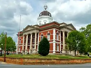 Meriwether County Courthouse in Greenville | |
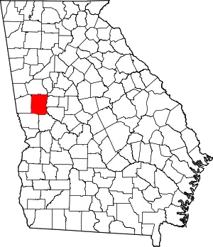 Location within the U.S. state of Georgia | |
 Georgia's location within the U.S. | |
| Coordinates: 33°02′N 84°41′W | |
| Country | |
| State | |
| Founded | 1827 |
| Named for | David Meriwether |
| Seat | Greenville |
| Largest city | Manchester |
| Area | |
| • Total | 505 sq mi (1,310 km2) |
| • Land | 501 sq mi (1,300 km2) |
| • Water | 4.2 sq mi (11 km2) 0.8%% |
| Population | |
| • Estimate (2018) | 21,068 |
| • Density | 44/sq mi (17/km2) |
| Time zone | UTC−5 (Eastern) |
| • Summer (DST) | UTC−4 (EDT) |
| Congressional district | 3rd |
| Website | meriwethercountyga |
Meriwether County is part of the Atlanta-Sandy Springs-Roswell, GA Metropolitan Statistical Area.
Geography
According to the U.S. Census Bureau, the county has a total area of 505 square miles (1,310 km2), of which 501 square miles (1,300 km2) is land and 4.2 square miles (11 km2) (0.8%) is water.[4]
The county is located in the Piedmont region of the state. Portions of the Pine Mountain Range are found in the southern parts of the county near the cities of Warm Springs and Manchester.
The eastern two-thirds of Meriwether County, going east from just west of U.S. Route 27 Alternate, is located in the Upper Flint River sub-basin of the ACF River Basin (Apalachicola-Chattahoochee-Flint River Basin). The western third of the county is located in the Middle Chattahoochee River-Lake Harding sub-basin of the same ACF River Basin.[5]
Major highways
 Interstate 85
 U.S. Route 27 Alternate
 State Route 18
 State Route 41
 State Route 54
 State Route 54 Spur
 State Route 74
 State Route 85
 State Route 85 Alternate
 State Route 85 Spur
 State Route 100
 State Route 109
 State Route 109 Spur
 State Route 173
 State Route 190
 State Route 194
 State Route 362
 State Route 403 (unsigned designation for I-85)
Adjacent counties
- Coweta County (north)
- Spalding County (northeast)
- Pike County (east)
- Upson County (southeast)
- Talbot County (south)
- Harris County (southwest)
- Troup County (west)
Demographics
| Historical population | |||
|---|---|---|---|
| Census | Pop. | %± | |
| 1830 | 4,422 | — | |
| 1840 | 14,132 | 219.6% | |
| 1850 | 16,476 | 16.6% | |
| 1860 | 15,330 | −7.0% | |
| 1870 | 13,756 | −10.3% | |
| 1880 | 17,651 | 28.3% | |
| 1890 | 20,740 | 17.5% | |
| 1900 | 23,339 | 12.5% | |
| 1910 | 25,180 | 7.9% | |
| 1920 | 26,167 | 3.9% | |
| 1930 | 22,437 | −14.3% | |
| 1940 | 22,055 | −1.7% | |
| 1950 | 21,055 | −4.5% | |
| 1960 | 19,756 | −6.2% | |
| 1970 | 19,461 | −1.5% | |
| 1980 | 21,229 | 9.1% | |
| 1990 | 22,411 | 5.6% | |
| 2000 | 22,534 | 0.5% | |
| 2010 | 21,992 | −2.4% | |
| 2018 (est.) | 21,068 | [6] | −4.2% |
| U.S. Decennial Census[7] 1790–1960[8] 1900–1990[9] 1990–2000[10] 2010–2013[1] | |||
2000 census
As of the census[11] of 2000, there were 22,534 people, 8,248 households, and 6,012 families living in the county. The population density was 45 people per square mile (17/km2). There were 9,211 housing units at an average density of 18 per square mile (7/km2). The racial makeup of the county was 58.9% White, 40.4% Black or African American, 0.6% Native American, 0.1% Asian, 0.07% Pacific Islander, 0.34% from other races, and 0.71% from two or more races. Of the population 0.85% were Hispanic or Latino of any race.
There were 8,248 households, out of which 31.50% had children under the age of 18 living with them, 49.00% were married couples living together, 18.40% had a female householder with no husband present, and 27.10% were non-families. 23.80% of all households were made up of individuals, and 10.60% had someone living alone who was 65 years of age or older. The average household size was 2.68 and the average family size was 3.18.
In the county, the population was spread out, with 26.60% under the age of 18, 9.00% from 18 to 24, 27.20% from 25 to 44, 23.60% from 45 to 64, and 13.60% who were 65 years of age or older. The median age was 36 years. For every 100 females, there were 91.40 males. For every 100 females age 18 and over, there were 86.50 males.
The median income for a household in the county was $31,870, and the median income for a family was $37,931. Males had a median income of $29,766 versus $21,444 for females. The per capita income for the county was $15,708. About 13.60% of families and 17.80% of the population were below the poverty line, including 25.90% of those under age 18 and 16.30% of those age 65 or over.
2010 census
As of the 2010 United States Census, there were 21,992 people, 8,522 households, and 5,906 families living in the county.[12] The population density was 43.9 inhabitants per square mile (16.9/km2). There were 9,957 housing units at an average density of 19.9 per square mile (7.7/km2).[13] The racial makeup of the county was 57.9% white, 39.1% African American, 0.6% Asian, 0.4% American Indian, 0.7% from other races, and 1.2% from two or more races. Those of Hispanic or Latino origin made up 1.6% of the population.[12] In terms of ancestry, 14.3% were American, 12.7% were English, and 9.8% were Irish.[14]
Of the 8,522 households, 32.1% had children under the age of 18 living with them, 45.1% were married couples living together, 18.7% had a female householder with no husband present, 30.7% were non-families, and 26.8% of all households were made up of individuals. The average household size was 2.55 and the average family size was 3.09. The median age was 41.0 years.[12]
The median income for a household in the county was $37,845 and the median income for a family was $47,126. Males had a median income of $36,164 versus $28,873 for females. The per capita income for the county was $18,295. About 12.8% of families and 16.8% of the population were below the poverty line, including 24.5% of those under age 18 and 11.9% of those age 65 or over.[15]
Politics
Meriwether County is a moderately Republican county. The last Democrat to win the county was Al Gore.
| Year | Republican | Democratic | Third parties |
|---|---|---|---|
| 2020 | 60.0% 6,524 | 39.4% 4,287 | 0.6% 66 |
| 2016 | 56.7% 5,222 | 41.3% 3,804 | 2.1% 191 |
| 2012 | 52.4% 4,856 | 46.7% 4,331 | 0.9% 87 |
| 2008 | 52.3% 4,982 | 46.9% 4,465 | 0.8% 71 |
| 2004 | 54.0% 4,402 | 45.5% 3,709 | 0.5% 44 |
| 2000 | 47.1% 3,162 | 51.3% 3,441 | 1.6% 106 |
| 1996 | 36.1% 2,259 | 55.9% 3,492 | 8.0% 502 |
| 1992 | 32.3% 2,364 | 54.7% 4,002 | 13.0% 954 |
| 1988 | 51.3% 3,101 | 48.5% 2,934 | 0.2% 9 |
| 1984 | 52.7% 3,195 | 47.3% 2,864 | |
| 1980 | 31.7% 1,838 | 66.8% 3,876 | 1.6% 91 |
| 1976 | 23.1% 1,450 | 76.9% 4,830 | |
| 1972 | 73.8% 3,420 | 26.2% 1,213 | |
| 1968 | 20.6% 1,120 | 32.3% 1760 | 47.2% 2,571 |
| 1964 | 48.1% 2,250 | 51.8% 2,423 | 0.0% 1 |
| 1960 | 18.6% 706 | 81.5% 3,100 | |
| 1956 | 15.9% 592 | 84.1% 3,137 | |
| 1952 | 13.0% 531 | 87.0% 3,551 | |
| 1948 | 8.5% 204 | 81.7% 1,967 | 9.8% 238 |
| 1944 | 8.0% 189 | 92.1% 2,187 | |
| 1940 | 6.0% 174 | 93.7% 2,726 | 0.3% 8 |
| 1936 | 5.4% 138 | 94.6% 2,438 | 0.0% 1 |
| 1932 | 2.0% 53 | 97.8% 2,604 | 0.2% 5 |
| 1928 | 15.9% 287 | 84.1% 1,515 | |
| 1924 | 7.7% 103 | 66.6% 886 | 25.7% 342 |
| 1920 | 14.9% 186 | 85.1% 1,059 | |
| 1916 | 7.7% 96 | 89.4% 1,118 | 2.9% 36 |
| 1912 | 9.3% 91 | 88.1% 862 | 2.7% 26 |
Communities
References
- "State & County QuickFacts". United States Census Bureau. Archived from the original on June 7, 2011. Retrieved June 24, 2014.
- "Find a County". National Association of Counties. Retrieved June 7, 2011.
- Gannett, Henry (1905). The Origin of Certain Place Names in the United States. U.S. Government Printing Office. p. 206.
- "US Gazetteer files: 2010, 2000, and 1990". United States Census Bureau. February 12, 2011. Retrieved April 23, 2011.
- "Georgia Soil and Water Conservation Commission Interactive Mapping Experience". Georgia Soil and Water Conservation Commission. Retrieved November 19, 2015.
- "Population and Housing Unit Estimates". Retrieved July 31, 2019.
- "U.S. Decennial Census". United States Census Bureau. Retrieved June 24, 2014.
- "Historical Census Browser". University of Virginia Library. Retrieved June 24, 2014.
- "Population of Counties by Decennial Census: 1900 to 1990". United States Census Bureau. Retrieved June 24, 2014.
- "Census 2000 PHC-T-4. Ranking Tables for Counties: 1990 and 2000" (PDF). United States Census Bureau. Retrieved June 24, 2014.
- "U.S. Census website". United States Census Bureau. Retrieved May 14, 2011.
- "DP-1 Profile of General Population and Housing Characteristics: 2010 Demographic Profile Data". United States Census Bureau. Archived from the original on February 13, 2020. Retrieved December 30, 2015.
- "Population, Housing Units, Area, and Density: 2010 - County". United States Census Bureau. Archived from the original on February 13, 2020. Retrieved December 30, 2015.
- "DP02 SELECTED SOCIAL CHARACTERISTICS IN THE UNITED STATES – 2006-2010 American Community Survey 5-Year Estimates". United States Census Bureau. Archived from the original on February 13, 2020. Retrieved December 30, 2015.
- "DP03 SELECTED ECONOMIC CHARACTERISTICS – 2006-2010 American Community Survey 5-Year Estimates". United States Census Bureau. Archived from the original on February 13, 2020. Retrieved December 30, 2015.
- Leip, David. "Dave Leip's Atlas of U.S. Presidential Elections". uselectionatlas.org. Retrieved March 22, 2018.
External links
Places adjacent to Meriwether County, Georgia | ||||||||||
|---|---|---|---|---|---|---|---|---|---|---|
| ||||||||||
Municipalities and communities of Meriwether County, Georgia, United States | ||
|---|---|---|
| Cities | Map of Georgia highlighting Meriwether County | |
| Towns | ||
| Unincorporated communities | ||
| Footnotes | ‡This populated place also has portions in an adjacent county or counties | |
| ||
|  | |||||
|
| ||||||

| Authority control |
|---|