Chareil-Cintrat
Chareil-Cintrat is a commune in the Allier department in central France.
Chareil-Cintrat | |
|---|---|
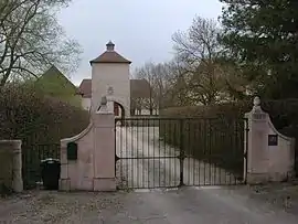 Entrance to La Rivière | |
Location of Chareil-Cintrat 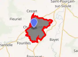
| |
 Chareil-Cintrat  Chareil-Cintrat | |
| Coordinates: 46°16′03″N 3°13′16″E | |
| Country | France |
| Region | Auvergne-Rhône-Alpes |
| Department | Allier |
| Arrondissement | Moulins |
| Canton | Gannat |
| Intercommunality | Pays Saint-Pourcinois |
| Government | |
| • Mayor (2020–2026) | Michel Frisot[1] |
| Area 1 | 12.77 km2 (4.93 sq mi) |
| Population (2017-01-01)[2] | 358 |
| • Density | 28/km2 (73/sq mi) |
| Time zone | UTC+01:00 (CET) |
| • Summer (DST) | UTC+02:00 (CEST) |
| INSEE/Postal code | 03059 /03140 |
| Elevation | 241–342 m (791–1,122 ft) (avg. 231 m or 758 ft) |
| 1 French Land Register data, which excludes lakes, ponds, glaciers > 1 km2 (0.386 sq mi or 247 acres) and river estuaries. | |
Geography
The river Bouble flows northeast through the commune.
Population
| Year | Pop. | ±% |
|---|---|---|
| 1962 | 445 | — |
| 1968 | 479 | +7.6% |
| 1975 | 378 | −21.1% |
| 1982 | 316 | −16.4% |
| 1990 | 311 | −1.6% |
| 1999 | 317 | +1.9% |
| 2008 | 334 | +5.4% |
| 2012 | 359 | +7.5% |
See also
References
- "Liste nominative des communes de l'Allier" [Nominative list of communes of Allier] (PDF) (in French). Association of Mayors and Presidents of Communities of Allier. 8 July 2020. Retrieved 6 December 2020.
- "Populations légales 2017". INSEE. Retrieved 6 January 2020.
| Wikimedia Commons has media related to Chareil-Cintrat. |
This article is issued from Wikipedia. The text is licensed under Creative Commons - Attribution - Sharealike. Additional terms may apply for the media files.