Monestier, Allier
Monestier is a commune in the Allier department in central France.
Monestier | |
|---|---|
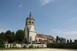 The church in Monestier | |
Location of Monestier 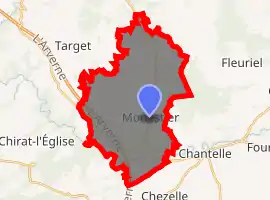
| |
 Monestier  Monestier | |
| Coordinates: 46°15′22″N 3°06′51″E | |
| Country | France |
| Region | Auvergne-Rhône-Alpes |
| Department | Allier |
| Arrondissement | Vichy |
| Canton | Gannat |
| Intercommunality | Sioule, Colettes et Bouble |
| Government | |
| • Mayor (2014–2020) | Yves Maupoil[1] |
| Area 1 | 29.68 km2 (11.46 sq mi) |
| Population (2017-01-01)[2] | 282 |
| • Density | 9.5/km2 (25/sq mi) |
| Time zone | UTC+01:00 (CET) |
| • Summer (DST) | UTC+02:00 (CEST) |
| INSEE/Postal code | 03175 /03140 |
| Elevation | 290–413 m (951–1,355 ft) (avg. 323 m or 1,060 ft) |
| 1 French Land Register data, which excludes lakes, ponds, glaciers > 1 km2 (0.386 sq mi or 247 acres) and river estuaries. | |
Geography
The river Bouble forms most of the commune's southwestern border, then flows east through its southern part.
Population
| Year | Pop. | ±% |
|---|---|---|
| 1962 | 436 | — |
| 1968 | 437 | +0.2% |
| 1975 | 359 | −17.8% |
| 1982 | 274 | −23.7% |
| 1990 | 282 | +2.9% |
| 1999 | 266 | −5.7% |
| 2008 | 268 | +0.8% |
| 2012 | 293 | +9.3% |
| Source: INSEE (1968–2012) | ||
See also
References
- "Liste nominative des communes de l'Allier" [Nominative list of communes of Allier] (PDF). Association of Mayors and Presidents of Communities of Allier (in French). 1 April 2015. Archived from the original (PDF) on 18 May 2015. Retrieved 23 October 2015.
- "Populations légales 2017". INSEE. Retrieved 6 January 2020.
| Wikimedia Commons has media related to Monestier. |
This article is issued from Wikipedia. The text is licensed under Creative Commons - Attribution - Sharealike. Additional terms may apply for the media files.