Creuzier-le-Neuf
Creuzier-le-Neuf (French pronunciation: [kʁøzje lə nœf]) is a commune in the Allier department in central France.
Creuzier-le-Neuf | |
|---|---|
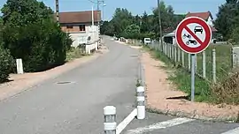 A street of Creuzier-le-Neuf | |
.svg.png.webp) Coat of arms | |
Location of Creuzier-le-Neuf 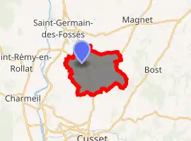
| |
 Creuzier-le-Neuf  Creuzier-le-Neuf | |
| Coordinates: 46°11′00″N 3°27′02″E | |
| Country | France |
| Region | Auvergne-Rhône-Alpes |
| Department | Allier |
| Arrondissement | Vichy |
| Canton | Cusset |
| Intercommunality | Vichy Communauté |
| Government | |
| • Mayor (2020–2026) | Thierry Laplace[1] |
| Area 1 | 10.88 km2 (4.20 sq mi) |
| Population (2017-01-01)[2] | 1,166 |
| • Density | 110/km2 (280/sq mi) |
| Time zone | UTC+01:00 (CET) |
| • Summer (DST) | UTC+02:00 (CEST) |
| INSEE/Postal code | 03093 /03300 |
| Elevation | 246–400 m (807–1,312 ft) (avg. 300 m or 980 ft) |
| 1 French Land Register data, which excludes lakes, ponds, glaciers > 1 km2 (0.386 sq mi or 247 acres) and river estuaries. | |
Geography
Location
Creuzier-le-Neuf is located 9 kilometers north of Vichy which it is a part of the agglomeration and about 20 km from Varennes-sur-Allier and Lapalisse.
Transportation
It is accessible by the route nationale (RN) 209 from Varennes-sur-Allier and Moulins,[3] route départementale (RD) 67 (Vichy bypass) from suburban districts located on the left bank, RD 907 from Lapalisse, RD 77 from Saint-Germain-des-Fossés, RD 558 and RD 174.
Carpool area has been created with the participation of the community of agglomeration of Vichy Val d'Allier and the General Council of Allier. It is part of the Community scheme areas carpooling.[4]
Administration
List of successive mayors:
- 1965-2008: André Buissonniere
- 2008-2014: Jean-Pierre Mongaret
- 2014-2020: Léopold Nunez[5]
- 2020-2026: Thierry Laplace[1]
Population
| Year | Pop. | ±% |
|---|---|---|
| 1962 | 535 | — |
| 1968 | 564 | +5.4% |
| 1975 | 617 | +9.4% |
| 1982 | 733 | +18.8% |
| 1990 | 937 | +27.8% |
| 1999 | 959 | +2.3% |
| 2008 | 1,007 | +5.0% |
| 2012 | 1,073 | +6.6% |
Culture & Heritage
- Classic vintage home in Celzat
- Chermont ruined castle of the 18th century
- Saint-Front Church of the 11th and 12th centuries, rebuilt in the 19th century
- Gothic chapel Chermont
- Banks of Mourgon
See also
References
- "Liste nominative des communes de l'Allier" [Nominative list of communes of Allier] (PDF) (in French). Association of Mayors and Presidents of Communities of Allier. 8 July 2020. Retrieved 6 December 2020.
- "Populations légales 2017". INSEE. Retrieved 6 January 2020.
- Part of this road was decommissioned in 2008 as RD 2209
- "A carpool area near the activity area of Ancises". vichy-economie.com (in French). Vichy Val d'Allier Development. 12 February 2014.
- "Liste nominative des communes de l'Allier (avec maire, arrondissement et canton)" [Nominative list of communes of Allier (with mayor, arrondissement and canton)] (PDF). Association of Mayors and Presidents of Communities of Allier (in French). 1 April 2015. Archived from the original (PDF) on 18 May 2015. Retrieved 19 July 2015.
| Wikimedia Commons has media related to Creuzier-le-Neuf. |
