Fleuriel
Fleuriel is a commune in the Allier department in central France.
Fleuriel | |
|---|---|
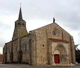 The church in Fleuriel | |
Location of Fleuriel 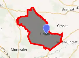
| |
 Fleuriel  Fleuriel | |
| Coordinates: 46°16′57″N 3°10′44″E | |
| Country | France |
| Region | Auvergne-Rhône-Alpes |
| Department | Allier |
| Arrondissement | Moulins |
| Canton | Gannat |
| Government | |
| • Mayor (2020–2026) | Gérard Laplanche[1] |
| Area 1 | 28.05 km2 (10.83 sq mi) |
| Population (2017-01-01)[2] | 335 |
| • Density | 12/km2 (31/sq mi) |
| Time zone | UTC+01:00 (CET) |
| • Summer (DST) | UTC+02:00 (CEST) |
| INSEE/Postal code | 03115 /03140 |
| Elevation | 255–446 m (837–1,463 ft) (avg. 430 m or 1,410 ft) |
| 1 French Land Register data, which excludes lakes, ponds, glaciers > 1 km2 (0.386 sq mi or 247 acres) and river estuaries. | |
Geology and relief
Two parts of its territory are wooded: the forest of Mosières, in the north, and the end of the forest of the Abbaye-Giverzat, in the southwest.
Hydrography
The town is watered by the Veauvre, stream that flows into the Bouble
Routes of communication and transport
The municipality is crossed by the provincial road 36, which provides access to Montmarault by the RD 46 northwest of the town, or to Chantelle by the RD 986 southeast.[3]
Population
| Year | Pop. | ±% |
|---|---|---|
| 1962 | 331 | — |
| 1968 | 429 | +29.6% |
| 1975 | 335 | −21.9% |
| 1982 | 330 | −1.5% |
| 1990 | 330 | +0.0% |
| 1999 | 311 | −5.8% |
| 2008 | 358 | +15.1% |
| 2012 | 342 | −4.5% |
| Source: INSEE | ||
See also
References
- "Répertoire national des élus: les maires". data.gouv.fr, Plateforme ouverte des données publiques françaises (in French). 2 December 2020. Retrieved 7 December 2020.
- "Populations légales 2017". INSEE. Retrieved 6 January 2020.
- "Géoportail". www.geoportail.gouv.fr. Retrieved 2017-10-28.
External links
| Wikimedia Commons has media related to Fleuriel. |
This article is issued from Wikipedia. The text is licensed under Creative Commons - Attribution - Sharealike. Additional terms may apply for the media files.