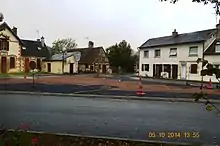
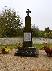
Aurouër
Aurouër is a commune in the Allier department in the Auvergne-Rhône-Alpes region of central France.
Aurouër | |
|---|---|
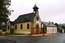
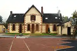 The town hall in Aurouër | |
Location of Aurouër 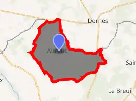
| |
 Aurouër  Aurouër | |
| Coordinates: 46°41′16″N 3°18′01″E | |
| Country | France |
| Region | Auvergne-Rhône-Alpes |
| Department | Allier |
| Arrondissement | Moulins |
| Canton | Yzeure |
| Intercommunality | Moulins Communauté |
| Government | |
| • Mayor (2020–2026) | Alain Borde |
| Area 1 | 27.06 km2 (10.45 sq mi) |
| Population (2017-01-01)[1] | 413 |
| • Density | 15/km2 (40/sq mi) |
| Time zone | UTC+01:00 (CET) |
| • Summer (DST) | UTC+02:00 (CEST) |
| INSEE/Postal code | 03011 /03460 |
| Elevation | 215–262 m (705–860 ft) (avg. 247 m or 810 ft) |
| 1 French Land Register data, which excludes lakes, ponds, glaciers > 1 km2 (0.386 sq mi or 247 acres) and river estuaries. | |
The inhabitants of the commune are known as Aurouërois or Aurouëroises.[2]
Geography
Aurouër is located some 15 kilometres (9.3 mi) north by north-east of Moulins and 20 kilometres (12 mi) south-east of Saint-Pierre-le-Moûtier. The whole eastern border of the commune is the departmental boundary between Allier and Nièvre. Access to the commune is by the D133 road from Villeneuve-sur-Allier in the south-west which passes through the commune and the village and continues east to Saint-Ennemond. The D228 goes north-east from the village to Dornes. Apart from the village there are the hamlets of:
- Les Berthomiers
- Le Bois Canot
- Bonnefond
- Les Cantes
- Champfroid
- Le Charlet
- Les Chenes
- Le Choulton
- Le Domaine Chateau
- Domaine Martin
- Les Durands
- Les Forets
- Les Gallets
- Les Gouffats
- Les Grillets
- La Joubarde
- Lafat
- Lardillat
- La Motte
- La Motte-Ponay
- La Niziere
- La Noue
- Le Ponay
- Les Simonets
- Les Torterats
- Vaucoulmin
- Les Vernes
There are large forested areas in the south-east of the commune with most of the rest farmland.[3]
There are many ponds scattered across the commune from which streams flow towards the west to join the Allier.[3]
Neighbouring communes and villages
Places adjacent to Aurouër | |
|---|---|
Administration
List of Successive Mayors[4]
| From | To | Name | Party | Position |
|---|---|---|---|---|
| 2001 | Current | Alain Borde[5][6] |
(Not all data is known)
Demography
In 2017 the commune had 413 inhabitants.[7] Between 1837 and 1879 it was part of the commune Villeneuve-sur-Allier.[8]
|
| ||||||||||||||||||||||||||||||||||||||||||||||||||||||||||||||||||||||||||||||||||||||||||
| Source: EHESS[8] and INSEE[7] | |||||||||||||||||||||||||||||||||||||||||||||||||||||||||||||||||||||||||||||||||||||||||||
See also
References
- "Populations légales 2017". INSEE. Retrieved 6 January 2020.
- "Aurouër (03460)". habitants.fr (in French). SARL Patagos. Retrieved 24 January 2016.
- Google Maps
- List of Mayors of France (in French)
- Re-elected in 2014: "Liste nominative des communes de l'Allier (avec maire, arrondissement et canton)" [Nominative list of communes of Allier (with mayor, arrondissement and canton)] (PDF). Association of Mayors and Presidents of Communities of Allier. 1 April 2015. Archived from the original (PDF) on 18 May 2015. Retrieved 13 May 2015.
- "Liste nominative des communes de l'Allier" [Nominative list of communes of Allier] (PDF). maires-allier.fr (in French). Association of Mayors and Presidents of Communities of Allier. 8 July 2020. p. 1. Retrieved 29 July 2020.
- Population en historique depuis 1968, INSEE
- Des villages de Cassini aux communes d'aujourd'hui: Commune data sheet Aurouër, EHESS. (in French)
External links
- Aurouër on the old IGN website (in French)
- Aurouër on Lion1906
- Aurouër on Géoportail, National Geographic Institute (IGN) website (in French)
- Aurouer on the 1750 Cassini Map
| Wikimedia Commons has media related to Aurouër. |