Montmarault
Montmarault is a commune in the Allier department in central France.
Montmarault | |
|---|---|
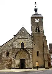 The church in Montmarault | |
 Coat of arms | |
Location of Montmarault 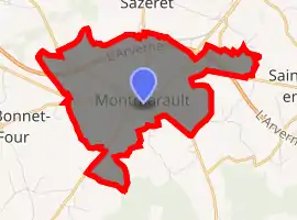
| |
 Montmarault  Montmarault | |
| Coordinates: 46°19′06″N 2°57′20″E | |
| Country | France |
| Region | Auvergne-Rhône-Alpes |
| Department | Allier |
| Arrondissement | Montluçon |
| Canton | Commentry |
| Intercommunality | Région de Montmarault |
| Government | |
| • Mayor (2014–2020) | Bernard Martin[1] |
| Area 1 | 9 km2 (3 sq mi) |
| Population (2017-01-01)[2] | 1,521 |
| • Density | 170/km2 (440/sq mi) |
| Time zone | UTC+01:00 (CET) |
| • Summer (DST) | UTC+02:00 (CEST) |
| INSEE/Postal code | 03186 /03390 |
| Elevation | 394–498 m (1,293–1,634 ft) (avg. 487 m or 1,598 ft) |
| 1 French Land Register data, which excludes lakes, ponds, glaciers > 1 km2 (0.386 sq mi or 247 acres) and river estuaries. | |
Population
| Year | Pop. | ±% |
|---|---|---|
| 1962 | 1,409 | — |
| 1968 | 1,446 | +2.6% |
| 1975 | 1,366 | −5.5% |
| 1982 | 1,443 | +5.6% |
| 1990 | 1,597 | +10.7% |
| 1999 | 1,663 | +4.1% |
| 2008 | 1,571 | −5.5% |
| 2012 | 1,503 | −4.3% |
| Source: INSEE (1968–2012) | ||
Tourism
The Petite Valette campground has been named the best camping of the Auvergne by the German ADAC.
See also
References
- "Liste nominative des communes de l'Allier" [Nominative list of communes of Allier] (PDF). Association of Mayors and Presidents of Communities of Allier (in French). 1 April 2015. Archived from the original (PDF) on 18 May 2015. Retrieved 24 November 2015.
- "Populations légales 2017". INSEE. Retrieved 6 January 2020.
| Wikimedia Commons has media related to Montmarault. |
| Authority control |
|
|---|
This article is issued from Wikipedia. The text is licensed under Creative Commons - Attribution - Sharealike. Additional terms may apply for the media files.