La Ferté-Hauterive
La Ferté-Hauterive is a commune in the Allier department in central France.
La Ferté-Hauterive | |
|---|---|
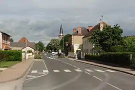 The main road in La Ferté-Hauterive | |
 Coat of arms | |
Location of La Ferté-Hauterive 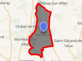
| |
 La Ferté-Hauterive  La Ferté-Hauterive | |
| Coordinates: 46°23′51″N 3°20′28″E | |
| Country | France |
| Region | Auvergne-Rhône-Alpes |
| Department | Allier |
| Arrondissement | Moulins |
| Canton | Moulins-2 |
| Intercommunality | Pays Saint-Pourcinois |
| Government | |
| • Mayor (2014–2020) | Rolande Sarrazin[1] |
| Area 1 | 18.88 km2 (7.29 sq mi) |
| Population (2017-01-01)[2] | 296 |
| • Density | 16/km2 (41/sq mi) |
| Time zone | UTC+01:00 (CET) |
| • Summer (DST) | UTC+02:00 (CEST) |
| INSEE/Postal code | 03114 /03340 |
| Elevation | 214–239 m (702–784 ft) (avg. 234 m or 768 ft) |
| 1 French Land Register data, which excludes lakes, ponds, glaciers > 1 km2 (0.386 sq mi or 247 acres) and river estuaries. | |
Population
| Year | Pop. | ±% |
|---|---|---|
| 1962 | 396 | — |
| 1968 | 415 | +4.8% |
| 1975 | 338 | −18.6% |
| 1982 | 355 | +5.0% |
| 1990 | 273 | −23.1% |
| 1999 | 285 | +4.4% |
| 2008 | 278 | −2.5% |
| 2012 | 290 | +4.3% |
| Source: INSEE | ||
See also
References
- "Liste nominative des communes de l'Allier (avec maire, arrondissement et canton)" [Nominative list of communes of Allier (with mayor, arrondissement and canton)] (PDF). Association of Mayors and Presidents of Communities of Allier (in French). 1 April 2015. Archived from the original (PDF) on 18 May 2015. Retrieved 1 August 2015.
- "Populations légales 2017". INSEE. Retrieved 6 January 2020.
| Wikimedia Commons has media related to La Ferté-Hauterive. |
This article is issued from Wikipedia. The text is licensed under Creative Commons - Attribution - Sharealike. Additional terms may apply for the media files.
