Cox's Bazar District
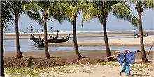
Cox's Bazar (Bengali: কক্সবাজার জেলা, Cox's Bazar Jela also Cox's Bazar Zila) is a district in the Chittagong Division of Bangladesh.[2] It is named after Cox's Bazar town. It is located 150 kilometres (93 mi) south of Chittagong. Cox's Bazar is also known by the name Panowa ("yellow flower"). Another old name was Palongkee. The modern Cox's Bazar derives its name from Captain Hiram Cox (died 1798), an army officer who served in British India. It is one of the fishing ports of Bangladesh. At Cox's Bazar is one of the world's longest natural sea beaches (120 kilometres (75 mi) long including mud flats).
Cox's Bazar
কক্সবাজার জেলা | |
|---|---|
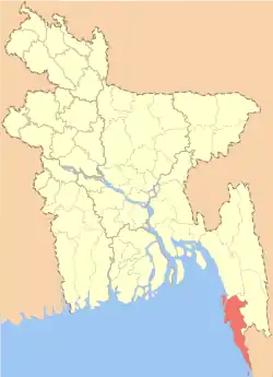 Location of Cox's Bazar District within Bangladesh | |
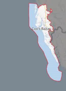
Expandable map of Cox's Bazar District | |
| Coordinates: 21.25°N 91.59°E | |
| Country | |
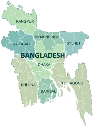
| Division | Chittagong Division |
| Government | |
| • Deputy Commissioner | Md. Kamal Hossain |
| Area | |
| • Total | 2,491.85 km2 (962.11 sq mi) |
| Population (2011 census) | |
| • Total | 2,289,990 |
| • Density | 920/km2 (2,400/sq mi) |
| Time zone | UTC+06:00 (BST) |
| HDI (2018) | 0.538[1] low · 20th of 21 |
| Website | http://www.coxsbazar.gov.bd/ |
Geography
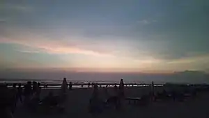
Often termed as the world's longest beach, Cox's Bazar is a major tourist destination within Bangladesh.
Cox's Bazar District has an area of 2,491.86 km2 (962.11 sq mi). It is bounded by Chittagong District on the north, Bay of Bengal in the south, Bandarban District on the east, and the Bay of Bengal on the west. Major rivers include Matamuhuri, Bakkhali, Reju Khal, Naf River, Maheshkhali channel and Kutubdia channel. The area of the city of Cox's Bazar is 6.85 km2 (2.64 sq mi).
History
The history of Cox's Bazar begins in the Mughal period. On his way to Arakan, when the Mughal Prince Shah Shuja (1616–1660) passed through the hilly terrain of the present day Cox's Bazar, he was attracted to the scenic nature of the region. He commanded his forces to camp there. A place named Dulahazara, meaning "one thousand palanquins", still exists in the area.
After the Mughals, the place came under the control of the Tipras and the Arakanese, followed by the Portuguese and then the British.
Cox's Bazar is named after Captain Hiram Cox, an officer of the East India Company, who was assigned with the charges of the current day Cox's Bazar and its adjacent areas.[3][4] The town of Cox's Bazar was established in 1799 as a market town to honour Captain Cox. In 1854, Cox's Bazar was made a Sub Divisional headquarter in Chittagong district under the Bengal Presidency of British India.
After the end of British rule in 1947, Cox's Bazar remained a part of East Pakistan under the Dominion of Pakistan till 1971. Captain Advocate Fazlul Karim was the first chairman after independence from the British of Cox's Bazar municipality. He established the Tamarisk Forest along the beach to draw tourism to the town and to protect the beach from the tide. He donated many of his father-in-law's and his own lands to establish a public library and town hall. In 1971, the wharf was used as a naval port by the Pakistan Navy's gunboats. This and the nearby airstrip of the Pakistan Air Force were the scene of intense shelling by the Indian Navy during the Bangladesh Liberation War in 1971.
In the year 1984, Cox's Bazar was upgraded into a District from a Sub Division under the Chittagong Division.
Starting in 2017, a "mass human exodus" of the Rohingya Muslim minority group from neighboring Myanmar's Rakhine State led to the creation, in Cox's Bazar, of the "world’s largest refugee settlement" over the following year. In the first year, the UNHCR estimated that 725,000 refugees had sought safety in Bangladesh.[5]
Education
- Cox's Bazar Medical College
- Cox's Bazar Polytechnic Institute
- Cox's Bazar Govt. College
- Cox's Bazar City College
- Cox's Bazar International University
Climate
The annual average temperature in Cox's Bazar is 32.8 °C (91.0 °F) and a minimum of 16.1 °C (61.0 °F). The climate remains hot and humid with some seasons of temperate weather. The average amount of rainfall is 4,285 mm (168.7 in).
Economy
The major livelihood of Cox's Bazar district is tourism. Millions of foreign and Bangladeshi natives visit this coastal city every year. A number of hotels, guest houses, and motels have been built in the city and coastal region and the hospitality industry is a major employer in the area.
A number of people are involved in the fishing and collection of seafoods and sea products. Oysters, snails, pearls and jewelry made from shells are popular with the tourists in the seaside and city stores. A number of people are also involved in the transportation business for tourists. Many people of the district are farmers.
In 2002, a surfing club was initiated at Cox's Bazar by a local Bangladeshi. It has now extended to holding an annual competition including locals and foreign tourists. This is the first surfing initiative in Bangladesh's history.
Places of interest
Cox's Bazar, mostly known for its beach and sunsets, has several other attractions, including:
- Aggmeda Khyang, a large Buddhist monastery, and a place revered by around 400,000 Buddhist people of Cox's Bazar Hill Tracts.
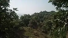
- Himchori, located about 8 km (5 mi) south of Cox's Bazar, is a picnic spot with waterfalls and hill top from where views of the sea can be seen. Birds and animals roam near the road.
- Inani Beach has interesting rocks and coral boulders. It is 32 km (20 mi) from the main beach.
- Coxsbazar Circuit House, located 2 km (1.2 mi) from Laboni Point, has a viewpoint from which the ocean can be seen. There are also views of Cox's Bazar city.
- St. Martin's Island, the only coral island in Bangladesh, is situated at 9 km (5.6 mi) south of Teknaf. It is a tourist spot.
- Dulhazra Safari Park, a safari park in Bangladesh which is situated at Chakaria Upazila. It has a range of exotic animals such as birds, snakes, and water beasts.
- Ukhiya Central Ananda Bhavan Vihar, a renowned Buddhist temple dated back from 1782Estd located at Patabari, Ukhia (3-minute distance from the Arakan highway) 33 km away from the main town of Cox's Bazar.[6]
Notable people
- Mohammad Nurul Huda , Mohammad Nurul Huda (born September 30, 1949) is a Bangladeshi poet and novelist. He was awarded the Ekushey Padak in 2015.
- Aye Thein Rakhaine (born 16 July 1962) former MP.
- Shaimum Sarwar Kamal , Shaimum Sarwar Kamal is the elected MP in Coxes Bazaar.
References
| Wikimedia Commons has media related to Cox's Bazar District. |
- "Sub-national HDI - Area Database - Global Data Lab". hdi.globaldatalab.org. Retrieved 2020-03-18.
- Mohammad Mahibbullah Siddiqi (2012). "Cox's Bazar District". In Sirajul Islam and Ahmed A. Jamal (ed.). Banglapedia: National Encyclopedia of Bangladesh (Second ed.). Asiatic Society of Bangladesh.
- G. P. Ramachandra (September 1981). "Captain Hiram Cox's Mission to Burma, 1796-1798: A Case of Irrational Behaviour in Diplomacy". Journal of Southeast Asian Studies. Cambridge University Press. 12 (2): 433–451. doi:10.1017/s0022463400009966. JSTOR 20070440.
- Jerdan, William; Workman, William Ring; Arnold, Frederick; Morley, John; Goodwin, Charles Wycliffe (1842-08-07). Literary Gazette and Journal of Belles Lettres, Arts, Sciences, Volume 8. Retrieved 2013-09-07.
- Kolstad, Kristine, "Cox’s Bazar: The world’s largest refugee settlement", Norwegian Refugee Council, 24 August 2018. Retrieved 2019-05-26.
- https://ucabv.webs.com/