Fleurance
Fleurance is a commune in the Gers department in southwestern France.
Fleurance | |
|---|---|
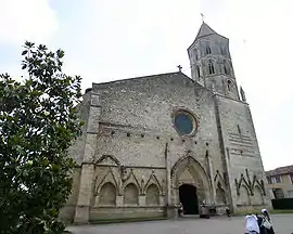 Saint-Laurent | |
.svg.png.webp) Coat of arms | |
Location of Fleurance 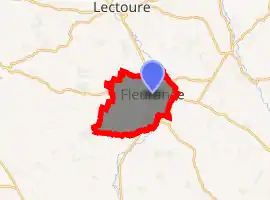
| |
 Fleurance  Fleurance | |
| Coordinates: 43°51′01″N 0°39′52″E | |
| Country | France |
| Region | Occitanie |
| Department | Gers |
| Arrondissement | Condom |
| Canton | Fleurance-Lomagne |
| Intercommunality | Lomagne Gersoise |
| Government | |
| • Mayor (2008–2014) | Raymond Vall |
| Area 1 | 43.32 km2 (16.73 sq mi) |
| Population (2017-01-01)[1] | 6,021 |
| • Density | 140/km2 (360/sq mi) |
| Time zone | UTC+01:00 (CET) |
| • Summer (DST) | UTC+02:00 (CEST) |
| INSEE/Postal code | 32132 /32500 |
| Elevation | 83–181 m (272–594 ft) (avg. 98 m or 322 ft) |
| 1 French Land Register data, which excludes lakes, ponds, glaciers > 1 km2 (0.386 sq mi or 247 acres) and river estuaries. | |
Geography
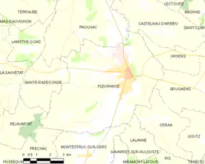
Fleurance and its surrounding communes
Population
|
|
See also
References
- "Populations légales 2017". INSEE. Retrieved 6 January 2020.
| Wikimedia Commons has media related to Fleurance. |
| Authority control |
|
|---|
This article is issued from Wikipedia. The text is licensed under Creative Commons - Attribution - Sharealike. Additional terms may apply for the media files.