Montadet
Montadet is a commune in the Gers department in southwestern France.
Montadet | |
|---|---|
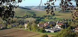 A general view of Montadet | |
Location of Montadet 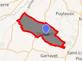
| |
 Montadet  Montadet | |
| Coordinates: 43°25′58″N 0°54′41″E | |
| Country | France |
| Region | Occitanie |
| Department | Gers |
| Arrondissement | Auch |
| Canton | Val de Save |
| Government | |
| • Mayor (2008–2014) | Pierre Lacomme |
| Area 1 | 5.11 km2 (1.97 sq mi) |
| Population (2017-01-01)[1] | 74 |
| • Density | 14/km2 (38/sq mi) |
| Time zone | UTC+01:00 (CET) |
| • Summer (DST) | UTC+02:00 (CEST) |
| INSEE/Postal code | 32276 /32220 |
| Elevation | 174–304 m (571–997 ft) (avg. 250 m or 820 ft) |
| 1 French Land Register data, which excludes lakes, ponds, glaciers > 1 km2 (0.386 sq mi or 247 acres) and river estuaries. | |
Geography
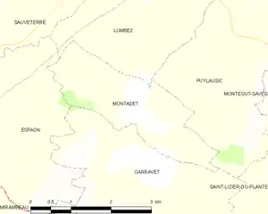
Montadet and its surrounding communes
Population
| Year | Pop. | ±% |
|---|---|---|
| 1962 | 104 | — |
| 1968 | 101 | −2.9% |
| 1975 | 115 | +13.9% |
| 1982 | 103 | −10.4% |
| 1990 | 98 | −4.9% |
| 1999 | 72 | −26.5% |
| 2008 | 81 | +12.5% |
See also
References
- "Populations légales 2017". INSEE. Retrieved 6 January 2020.
| Wikimedia Commons has media related to Montadet. |
| Authority control |
|---|
This article is issued from Wikipedia. The text is licensed under Creative Commons - Attribution - Sharealike. Additional terms may apply for the media files.