Montégut, Gers
Montégut is a commune in the Gers department in southwestern France.
Montégut | |
|---|---|
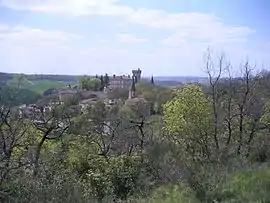 A general view of Montégut | |
Location of Montégut 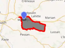
| |
 Montégut  Montégut | |
| Coordinates: 43°39′11″N 0°38′47″E | |
| Country | France |
| Region | Occitanie |
| Department | Gers |
| Arrondissement | Auch |
| Canton | Auch-2 |
| Intercommunality | Grand Auch |
| Government | |
| • Mayor (2008–2014) | Roger Tramont |
| Area 1 | 11.42 km2 (4.41 sq mi) |
| Population (2017-01-01)[1] | 667 |
| • Density | 58/km2 (150/sq mi) |
| Time zone | UTC+01:00 (CET) |
| • Summer (DST) | UTC+02:00 (CEST) |
| INSEE/Postal code | 32282 /32550 |
| Elevation | 135–257 m (443–843 ft) (avg. 200 m or 660 ft) |
| 1 French Land Register data, which excludes lakes, ponds, glaciers > 1 km2 (0.386 sq mi or 247 acres) and river estuaries. | |
Geography
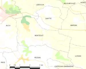
Montégut and its surrounding communes
Population
| Year | Pop. | ±% |
|---|---|---|
| 1962 | 182 | — |
| 1968 | 191 | +4.9% |
| 1975 | 234 | +22.5% |
| 1982 | 311 | +32.9% |
| 1990 | 317 | +1.9% |
| 1999 | 397 | +25.2% |
| 2008 | 473 | +19.1% |
See also
References
- "Populations légales 2017". INSEE. Retrieved 6 January 2020.
| Wikimedia Commons has media related to Montégut (Gers). |
| Authority control |
|---|
This article is issued from Wikipedia. The text is licensed under Creative Commons - Attribution - Sharealike. Additional terms may apply for the media files.