Sabaillan
Sabaillan is a commune in the Gers department in southwestern France.
Sabaillan | |
|---|---|
Location of Sabaillan 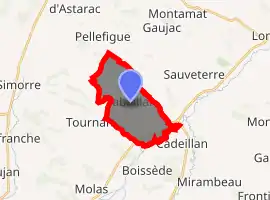
| |
 Sabaillan  Sabaillan | |
| Coordinates: 43°26′34″N 0°48′47″E | |
| Country | France |
| Region | Occitanie |
| Department | Gers |
| Arrondissement | Auch |
| Canton | Val de Save |
| Intercommunality | Savès |
| Government | |
| • Mayor (2014-2020) | Frédéric Danflous |
| Area 1 | 11.21 km2 (4.33 sq mi) |
| Population (2017-01-01)[1] | 148 |
| • Density | 13/km2 (34/sq mi) |
| Time zone | UTC+01:00 (CET) |
| • Summer (DST) | UTC+02:00 (CEST) |
| INSEE/Postal code | 32353 /32420 |
| Elevation | 179–307 m (587–1,007 ft) (avg. 250 m or 820 ft) |
| 1 French Land Register data, which excludes lakes, ponds, glaciers > 1 km2 (0.386 sq mi or 247 acres) and river estuaries. | |
The village is notable for the presence of several duck and geese farms specialising in the production of foie gras, one of the main products of the region.
Geography
The river Gesse forms all of the commune's southeastern border.
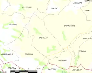
Sabaillan and its surrounding communes
Population
| Year | Pop. | ±% |
|---|---|---|
| 2006 | 156 | — |
| 2007 | 156 | +0.0% |
| 2008 | 157 | +0.6% |
| 2009 | 156 | −0.6% |
| 2010 | 156 | +0.0% |
| 2011 | 155 | −0.6% |
| 2012 | 155 | +0.0% |
| 2013 | 156 | +0.6% |
| 2014 | 154 | −1.3% |
| 2015 | 151 | −1.9% |
| 2016 | 149 | −1.3% |
See also
References
- "Populations légales 2017". INSEE. Retrieved 6 January 2020.
| Wikimedia Commons has media related to Sabaillan. |
| Authority control |
|---|
This article is issued from Wikipedia. The text is licensed under Creative Commons - Attribution - Sharealike. Additional terms may apply for the media files.
