Saint-Antonin, Gers
Saint-Antonin (Sent Antonin in Occitan) is a commune in the Gers department in southwestern France. It is located near Auch and Mauvezin.
Saint-Antonin | |
|---|---|
_-_1.jpg.webp) The town hall in Saint-Antonin | |
Location of Saint-Antonin 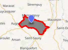
| |
 Saint-Antonin  Saint-Antonin | |
| Coordinates: 43°43′28″N 0°48′56″E | |
| Country | France |
| Region | Occitanie |
| Department | Gers |
| Arrondissement | Condom |
| Canton | Gimone-Arrats |
| Government | |
| • Mayor (2008–2014) | Christian Luci |
| Area 1 | 11.19 km2 (4.32 sq mi) |
| Population (2017-01-01)[1] | 159 |
| • Density | 14/km2 (37/sq mi) |
| Time zone | UTC+01:00 (CET) |
| • Summer (DST) | UTC+02:00 (CEST) |
| INSEE/Postal code | 32359 /32120 |
| Elevation | 125–203 m (410–666 ft) (avg. 180 m or 590 ft) |
| 1 French Land Register data, which excludes lakes, ponds, glaciers > 1 km2 (0.386 sq mi or 247 acres) and river estuaries. | |
Geography
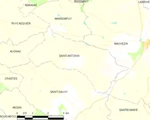
Saint-Antonin and its surrounding communes
Population
| Year | Pop. | ±% |
|---|---|---|
| 1962 | 207 | — |
| 1968 | 174 | −15.9% |
| 1975 | 137 | −21.3% |
| 1982 | 138 | +0.7% |
| 1990 | 118 | −14.5% |
| 1999 | 130 | +10.2% |
| 2008 | 136 | +4.6% |
| 2010 | 145 | +6.6% |
See also
References
- "Populations légales 2017". INSEE. Retrieved 6 January 2020.
| Wikimedia Commons has media related to Saint-Antonin (Gers). |
Landscape
It is mostly made up farms and has a lot of fields. Some crops that are grown are corn, sunflowers, and wheat. There are some people who live yearly in the village. There is 145 people but the village is spread and could fit over 750 people. There is a tennis court in the middle of the village. Since the village is spread, so are the houses and farms (in the middle of this is fields for the crops). This is the reason why the center of the village has fewer than ten buildings.
| Authority control |
|---|
This article is issued from Wikipedia. The text is licensed under Creative Commons - Attribution - Sharealike. Additional terms may apply for the media files.