Frontenac Provincial Park
Frontenac Provincial Park is located near the town of Sydenham, north of the city of Kingston, Ontario, Canada. The Government of Ontario has classified Frontenac Provincial Park as a natural environment park. The park lies on the Frontenac Axis, a topographic extension of the Canadian Shield, which connects to the Adirondack Mountains, and consists of mixed forest, lakes, wetlands, and granite outcrops. Recreational opportunities include hiking, canoeing, and backcountry camping. Wilderness courses are offered to teach wilderness skills in a semi-wilderness setting.
| Frontenac Provincial Park | |
|---|---|
IUCN category II (national park) | |
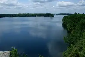 View of Big Salmon Lake | |
 | |
| Location | Frontenac County, Ontario, Canada |
| Nearest city | Kingston, Ontario |
| Coordinates | 44°32′N 76°29′W |
| Area | 52.14 km2 (20.13 sq mi) |
| Established | 1974 |
| Governing body | Ontario Parks |
Historically, the park provided important resources for local communities through the logging and mining industries.
Frontenac Provincial Park is home to a native population of grey wolves. Other animals that call the park home are American black bear, red fox, mink, northern river otter, white-tailed deer, porcupine, and fisher.
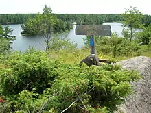
Trails
Frontenac contains many hiking trails totaling about 160 kilometres (99 mi) in length.[1]
- Arab Lake Gorge Trail is a short, 1.5-kilometre (0.93 mi) trail that traverses the Arab Lake Gorge.
- Doe Lake Trail is three kilometres (1.9 mi) in length. It goes from South Otter Lake to Doe Lake and back. A highlight of the trail is the abandoned Kemp Mine.
- Slide Lake Loop measures 21 kilometres (13 mi) in length and encircles Slide Lake and parts of Buck Lake.
- The Rideau Trail runs through the southern portion of the park.
References
- "Frontenac Provincial Park Hiking Trails". frontenacpark.ca. 27 February 2015. Retrieved 29 September 2015.
External links
| Wikimedia Commons has media related to Frontenac Provincial Park. |