Muswellbrook Shire
Muswellbrook Shire is a local government area in the Upper Hunter region of New South Wales, Australia. The Shire is situated adjacent to the New England Highway and the Hunter railway line.
| Muswellbrook Shire New South Wales | |||||||||||||||
|---|---|---|---|---|---|---|---|---|---|---|---|---|---|---|---|
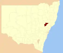 Location in New South Wales | |||||||||||||||
| Coordinates | 32°16′S 150°54′E | ||||||||||||||
| Population |
| ||||||||||||||
| • Density | 5.05/km2 (13.1/sq mi) | ||||||||||||||
| Established | 1 July 1979 | ||||||||||||||
| Area | 3,405 km2 (1,314.7 sq mi)[3] | ||||||||||||||
| Time zone | AEST (UTC+10) | ||||||||||||||
| • Summer (DST) | AEDT (UTC+11) | ||||||||||||||
| Mayor | Martin Rush | ||||||||||||||
| Council seat | Muswellbrook[4] | ||||||||||||||
| Region | Hunter[5] | ||||||||||||||
| State electorate(s) | Upper Hunter[6] | ||||||||||||||
| Federal Division(s) | Hunter[7] | ||||||||||||||
 | |||||||||||||||
| Website | Muswellbrook Shire | ||||||||||||||
| |||||||||||||||
Muswellbrook Shire was established on 1 July 1979 from the amalgamation of the Municipality of Muswellbrook with the adjacent Denman Shire.[8]
The Mayor of the Muswellbrook Shire Council is Cr. Martin Rush.
Main towns and villages
The Shire includes Muswellbrook, Denman, Baerami, McCullys Gap, Martindale, Muscle Creek, Sandy Hollow, Widden and Wybong.[9]
Coal Mining
Muswellbrook started as coal mining town in late 1800's and began open cut mining in 1944. The oldest coal was opened in 1906. [10]
Heritage listings
The Muswellbrook Shire has a number of heritage-listed sites, including:
- Denman, 4883 Jerrys Plains Road: Merton[11]
- Muswellbrook, Denman Road: Rous Lench[12]
- Muswellbrook, 132 Bridge Street: Weidmann Cottage[13]
- Muswellbrook, 142-144 Bridge Street: Loxton House[14]
- Muswellbrook, 178, 180-188 Bridge Street: Eatons Group[15]
- Muswellbrook, 710 Denman Road: Edinglassie[16]
- Muswellbrook, Hunter Terrace: St Alban's Anglican Church[17]
- Muswellbrook, Main Northern railway: Muswellbrook railway station [18]
Demographics
At the 2011 census, there were 15,791 people in the Muswellbrook Shire local government area, of these 51.7 per cent were male and 48.3 per cent were female. Aboriginal and Torres Strait Islander people made up 5.4 per cent of the population, which was significantly higher than the national and state averages of 2.5 per cent. The median age of people in the Muswellbrook Shire was 34 years, which was lower than the national median of 37 years. Children aged 0 – 14 years made up 22.8 per cent of the population and people aged 65 years and over made up 10.6 per cent of the population. Of people in the area aged 15 years and over, 47.0 per cent were married and 11.8 per cent were either divorced or separated.[3]
Population growth in the Muswellbrook Shire between the 2001 census and the 2006 census was 3.25 per cent; and in the subsequent five years to the 2011 census, population growth was 3.64 per cent. When compared with total population growth of Australia for the same periods, being 5.78 per cent and 8.32 per cent respectively, population growth in the Muswellbrook Shire local government area was approximately half the national average.[19][20] The median weekly income for residents within the Muswellbrook Shire was marginally higher than the national average.[3]
At the 2011 census, the proportion of residents in the Muswellbrook Shire local government area who stated their ancestry as Australian or Anglo-Saxon exceeded 81 per cent of all residents (national average was 65.2 per cent). In excess of 68% of all residents in the Muswellbrook Shire nominated a religious affiliation with Christianity at the 2011 census, which was considerably higher than the national average of 50.2 per cent. Meanwhile, as at the census date, compared to the national average, households in the Muswellbrook Shire local government area had a significantly lower than average proportion (4.3 per cent) where two or more languages are spoken (national average was 20.4 per cent); and a significantly higher proportion (89.7 per cent) where English only was spoken at home (national average was 76.8 per cent).[3]
| Selected historical census data for the Muswellbrook Shire local government area | |||||
|---|---|---|---|---|---|
| Census year | 2001[19] | 2006[20] | 2011[3] | ||
| Population | Estimated residents on Census night | 14,756 | 15,236 | 15,791 | |
| LGA rank in terms of size within New South Wales | |||||
| % of New South Wales population | 0.23% | ||||
| % of Australian population | 0.08% | ||||
| Cultural and language diversity | |||||
| Ancestry, top responses | Australian | 36.2% | |||
| English | 30.4% | ||||
| Irish | 8.1% | ||||
| Scottish | 6.6% | ||||
| German | 2.9% | ||||
| Language, top responses (other than English) | Shona | n/c | |||
| Cantonese | 0.1% | ||||
| Italian | 0.1% | ||||
| Thai | n/c | ||||
| Mandarin | n/c | ||||
| Religious affiliation | |||||
| Religious affiliation, top responses | Anglican | 40.3% | |||
| Catholic | 28.0% | ||||
| No Religion | 7.6% | ||||
| Uniting Church | 5.2% | ||||
| Presbyterian and Reformed | 3.8% | ||||
| Median weekly incomes | |||||
| Personal income | Median weekly personal income | A$453 | A$619 | ||
| % of Australian median income | 97.2% | ||||
| Family income | Median weekly family income | A$1,213 | A$1,697 | ||
| % of Australian median income | 103.6% | ||||
| Household income | Median weekly household income | A$1,060 | A$1,399 | ||
| % of Australian median income | 103.2% | ||||
Council
Current composition and election method
Muswellbrook Shire Council is composed of twelve Councillors elected proportionally as a single ward. All Councillors are elected for a fixed four-year term of office. The Mayor is elected by the Councillors at the first meeting of the Council. The most recent election was held on 10 September 2016 and the makeup of the Council is as follows:[21]
| Party | Councillors | |
|---|---|---|
| Independents and Unaligned | 12 | |
| Total | 12 | |
The current Council, elected in 2016, in order of election, is:[21]
| Councillor | Party | Notes | |
|---|---|---|---|
| Martin Rush | Independent | Mayor[22] | |
| Steve Reynolds | Independent | ||
| Jason Foy | Independent | ||
| Graeme McNeill | Independent | ||
| Stephen Ward | Unaligned | ||
| Scott Bailey | Independent | ||
| Brett Woodruff | Independent | ||
| Rod Scholes | Independent | ||
| Janelle Risby | Independent | ||
| Mark Bowditch | Independent | ||
| Michelle Green | Unaligned | ||
| Jacinta Ledlin | Independent | ||
Mayors
The following is a list of mayors since the Shire of Denman amalgamated with the Municipality of Muswellbrook to form Muswellbrook Shire Council on 1 July 1979.[23]
| Councillor | Party | Term of office | |
|---|---|---|---|
| J.H. Jobling | Unaligned | 1979–1986 | |
| E.I. Wolfgang | Unaligned | 1986–1989 | |
| I.E. Seymour | Unaligned | 1989–1999 | |
| J.E. Colvin | Unaligned | 1999–2008 | |
| Martin Rush | Unaligned | 2008–present | |
References
- Australian Bureau of Statistics (27 June 2017). "Muswellbrook (A)". 2016 Census QuickStats. Retrieved 27 November 2017.

- "3218.0 – Regional Population Growth, Australia, 2017-18". Australian Bureau of Statistics. 27 March 2019. Retrieved 27 March 2019. Estimated resident population (ERP) at 30 June 2018.
- Australian Bureau of Statistics (31 October 2012). "Muswellbrook (Local Government Area)". 2011 Census QuickStats. Retrieved 7 October 2012.
- "Muswellbrook Shire Council". New South Wales Division of Local Government. Retrieved 7 October 2012.
- "Suburb Search – Local Council Boundaries – Hunter (HT) – Muswellbrook Shire Council". New South Wales Division of Local Government. Retrieved 7 October 2012.
- "Upper Hunter". New South Wales Electoral Commission. Retrieved 23 November 2019.
- "Hunter". Australian Electoral Commission. 26 July 2012. Archived from the original on 5 October 2013. Retrieved 7 October 2012.
- "Local Government Act 1919. Proclamation (79)". Government Gazette of the State of New South Wales. 15 June 1979. p. 2887. Retrieved 14 February 2020 – via National Library of Australia.
- "About Muswellbrook Shire". Muswellbrook Shire Council. Retrieved 28 August 2009.
- "Coal Industry - Muswellbrook Shire Council". www.muswellbrook.nsw.gov.au. Retrieved 16 September 2020.
- "Merton". New South Wales State Heritage Register. Office of Environment and Heritage. H00159. Retrieved 18 May 2018.
- "Rous Lench". New South Wales State Heritage Register. Office of Environment and Heritage. H00211. Retrieved 18 May 2018.
- "Weidmann Cottage". New South Wales State Heritage Register. Office of Environment and Heritage. H00260. Retrieved 18 May 2018.
- "Loxton House". New South Wales State Heritage Register. Office of Environment and Heritage. H00185. Retrieved 18 May 2018.
- "Eatons Hotel & St Vincent De Paul Group". New South Wales State Heritage Register. Office of Environment and Heritage. H00331. Retrieved 18 May 2018.
- "Edinglassie". New South Wales State Heritage Register. Office of Environment and Heritage. H00170. Retrieved 18 May 2018.
- "St. Alban's Anglican Church". New South Wales State Heritage Register. Office of Environment and Heritage. H00458. Retrieved 18 May 2018.
- "Muswellbrook Railway Station and yard group". New South Wales State Heritage Register. Office of Environment and Heritage. H01208. Retrieved 18 May 2018.
- Australian Bureau of Statistics (9 March 2006). "Muswellbrook (A)". 2001 Census QuickStats. Retrieved 23 December 2013.
- Australian Bureau of Statistics (25 October 2007). "Muswellbrook (A)". 2006 Census QuickStats. Retrieved 23 December 2013.
- "Muswellbrook Shire Council: Summary of First Preference and Group Votes for each Candidate". Local Government Elections 2016. Electoral Commission of New South Wales. 17 September 2016. Retrieved 19 October 2016.
- Hughes, Betina (22 September 2016). "The new Muswellbrook Shire councillors elected Cr Martin Rush as mayor". Muswellbrook Chronicle. Retrieved 19 October 2016.
- Bill Spicer (18 June 2004). "Mayors, Alderman, Shire Presidents, Councillors and Staff" (PDF). Muswellbrook Shire Council. Retrieved 16 August 2009.