Kindersley
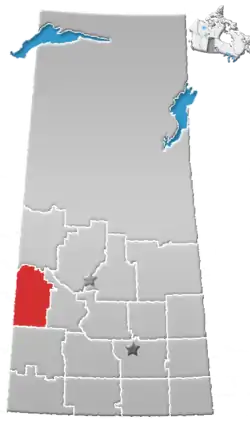
Kindersley is a town surrounded by the Rural Municipality of Kindersley No. 290 in west-central Saskatchewan, Canada. It is located along Highway 7, a primary highway linking Calgary, Alberta and Saskatoon, Saskatchewan. At a population of 4,597 in 2016, it is an established industrial base for the resource-rich west-central region of the province and a service centre to the oil and gas industry and agriculture production.
Kindersley | |
|---|---|
Town | |
| Town of Kindersley | |
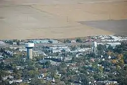
 Aerial view of Kindersley | |
 Seal | |
| Nickname(s): The Hub of West Central Saskatchewan | |
| Motto(s): "Experience Our Energy" | |
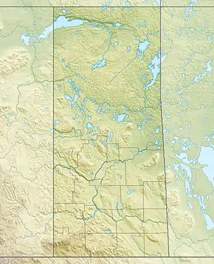
 Kindersley Location of Kindersley within Saskatchewan | |
| Coordinates: 51°28′04″N 109°09′24″W | |
| Country | Canada |
| Province | Saskatchewan |
| Census division | Division No. 13 |
| Rural Municipality | RM No. 290 Kindersley |
| Incorporated Town | 1910 |
| Government | |
| • Mayor | Rod Perkins |
| • Governing body | Kindersley Town Council |
| • MLA | Ken Francis |
| • MP | Jeremy Patzer |
| Area | |
| • Total | 13.23 km2 (5.11 sq mi) |
| Population (2016)[1] | |
| • Total | 4,597 |
| • Density | 347.5/km2 (900/sq mi) |
| Time zone | UTC−6 (CST) |
| Postal Codes | S0L 1S0 & S0L 1S1 |
| Area code(s) | 306 |
| Highways | |
| Website | www |
History
It was incorporated in 1910, and named after Sir Robert Kindersley, a major shareholder in the Canadian Northern Railway (later merged into Canadian National Railways).
Demographics
| Canada census – Kindersley community profile | |||
|---|---|---|---|
| 2016 | 2011 | 2006 | |
| Population: | 4,597 (-2.3% from 2011) | 4,678 (6.0% from 2006) | 4,412 (-3.0% from 2001) |
| Land area: | 13.23 km2 (5.11 sq mi) | 12.55 km2 (4.85 sq mi) | 12.55 km2 (4.85 sq mi) |
| Population density: | 347.5/km2 (900/sq mi) | 347/km2 (900/sq mi) | 351.6/km2 (911/sq mi) |
| Median age: | 36.8 (M: 34.3, F: 39.3) | ||
| Total private dwellings: | 2,078 | 2,083 | 1,924 |
| Median household income: | $55,111 | ||
| Notes: Statistics Canada has revised its 2016 census results for Kindersley.[2] – References: 2016[3] 2011[4] 2006[5] earlier[6] | |||
In the 2016 Census of Population conducted by Statistics Canada, the Town of Kindersley originally recorded a population of 4,571 living in 1,879 of its 2,063 total private dwellings, a -2.3% change from its 2011 population of 4,678. With a land area of 13.23 km2 (5.11 sq mi), it had a population density of 345.5/km2 (894.8/sq mi) in 2016.[1] The results from the 2016 census were subsequently revised to a population of 4,597 living in 1,892 of its 2,078 total private dwellings, a -1.7% change from 2011.[1][2] Its revised 2016 population density is therefore 347.5/km2 (899.9/sq mi).[1][2]
Climate
Kindersley experiences a semi-arid climate (Köppen climate classification BSk). Winters are long, cold and dry, while summers are short and warm. Precipitation is low, with an annual average of 325 mm, and is heavily concentrated in the warmer months.
The highest temperature ever recorded in Kindersley was 41.7 °C (107 °F) on 5 July 1937.[7] The coldest temperature ever recorded was −45.0 °C (−49 °F) on 30 January 1969.[8]
The record one-day rainfall is 77.2 mm (3 inches) on July 6, 1991. The record one-day snowfall is 21 cm (8.3 inches) on December 27, 1990.
| Climate data for Kindersley Regional Airport, 1981−2010 normals, extremes 1912−present[lower-alpha 1] | |||||||||||||
|---|---|---|---|---|---|---|---|---|---|---|---|---|---|
| Month | Jan | Feb | Mar | Apr | May | Jun | Jul | Aug | Sep | Oct | Nov | Dec | Year |
| Record high °C (°F) | 10.8 (51.4) |
10.7 (51.3) |
25.7 (78.3) |
34.4 (93.9) |
38.9 (102.0) |
40.6 (105.1) |
41.7 (107.1) |
40.0 (104.0) |
37.2 (99.0) |
32.8 (91.0) |
23.3 (73.9) |
12.9 (55.2) |
41.7 (107.1) |
| Average high °C (°F) | −8.5 (16.7) |
−6.2 (20.8) |
1.2 (34.2) |
11.6 (52.9) |
18.1 (64.6) |
22.1 (71.8) |
25.2 (77.4) |
24.6 (76.3) |
18.8 (65.8) |
10.9 (51.6) |
−0.1 (31.8) |
−6.8 (19.8) |
9.2 (48.6) |
| Daily mean °C (°F) | −13.8 (7.2) |
−11.7 (10.9) |
−4.1 (24.6) |
4.8 (40.6) |
11.0 (51.8) |
15.5 (59.9) |
18.1 (64.6) |
17.3 (63.1) |
11.6 (52.9) |
4.2 (39.6) |
−5.3 (22.5) |
−12.0 (10.4) |
3.0 (37.4) |
| Average low °C (°F) | −19.0 (−2.2) |
−17.0 (1.4) |
−9.4 (15.1) |
−2.1 (28.2) |
3.8 (38.8) |
8.8 (47.8) |
11.0 (51.8) |
10.0 (50.0) |
4.4 (39.9) |
−2.5 (27.5) |
−10.5 (13.1) |
−17.1 (1.2) |
−3.3 (26.1) |
| Record low °C (°F) | −45.0 (−49.0) |
−43.4 (−46.1) |
−37.2 (−35.0) |
−30.0 (−22.0) |
−15.6 (3.9) |
−6.7 (19.9) |
−4.4 (24.1) |
−2.2 (28.0) |
−12.2 (10.0) |
−28.3 (−18.9) |
−36.1 (−33.0) |
−41.2 (−42.2) |
−45.0 (−49.0) |
| Average precipitation mm (inches) | 10.9 (0.43) |
7.4 (0.29) |
11.7 (0.46) |
23.5 (0.93) |
40.3 (1.59) |
67.0 (2.64) |
55.8 (2.20) |
43.9 (1.73) |
28.8 (1.13) |
12.8 (0.50) |
10.7 (0.42) |
12.4 (0.49) |
325.1 (12.80) |
| Average rainfall mm (inches) | 0.4 (0.02) |
0.2 (0.01) |
1.7 (0.07) |
15.6 (0.61) |
38.3 (1.51) |
67.0 (2.64) |
55.8 (2.20) |
43.9 (1.73) |
28.5 (1.12) |
8.0 (0.31) |
1.9 (0.07) |
0.2 (0.01) |
261.2 (10.28) |
| Average snowfall cm (inches) | 15.6 (6.1) |
10.3 (4.1) |
12.9 (5.1) |
9.5 (3.7) |
2.1 (0.8) |
0.0 (0.0) |
0.0 (0.0) |
0.0 (0.0) |
0.8 (0.3) |
6.3 (2.5) |
12.3 (4.8) |
17.2 (6.8) |
86.9 (34.2) |
| Mean monthly sunshine hours | 103.5 | 132.3 | 177.1 | 231.6 | 276.6 | 276.8 | 335.7 | 291.6 | 223.3 | 169.1 | 106.2 | 92.4 | 2,416.3 |
| Percent possible sunshine | 39.8 | 46.9 | 48.2 | 55.8 | 57.2 | 55.8 | 67.2 | 64.4 | 58.7 | 50.9 | 39.7 | 37.6 | 51.8 |
| Source: Environment Canada[9][10][11] | |||||||||||||
Economy
The Bakken shale oil and gas play, driven by hydraulic fracturing technologies, has contributed to Kindersley's economy since 2009. Kindersley sells its treated municipal wastewater to a local oilfield service company to use in hydraulic fracturing.[12]
Events
Annual events in Kindersley include the Indoor Rodeo and Trade Show in June and the four-day Goose Festival in September, among numerous sports and cultural activities throughout the rest of the year. Kindersley was chosen as the launch site for the da Vinci Project, Canada's entry to win the Ansari X Prize. The flight was scheduled for October 2004, but circumstances related to the project prevented the flight from taking place. Kindersley celebrated its 100th birthday in 2010.
Education
Kindersley has three schools, all operating within the Sun West School Division. Westberry is an elementary school, Elizabeth is a middle school and the Kindersley Composite School is 9-12. There is also a regional college at the Great Plains Regional College location.
Sports
Kindersley is home to a full-service 9-hole golf course; two world class, fully irrigated baseball diamonds; a .3 mile, tri-oval speedway and the West Central Events Center (WCEC), with two ice surfaces and a curling rink. The WCEC is home to the local SJHL Klippers hockey team. Part of the WCEC, an older arena called Exhibition Stadium, was destroyed by fire on January 8, 2010.
Kindersley has also hosted many sporting events including the 1984 World Youth Baseball Championships, 1990 Men's Provincial Curling Championship, 1994 Saskatchewan Winter Games, 1997 Canadian Mixed Curling Championships, 2001 Men's Provincial Curling Championships, 2007 Provincial Mixed Curling Championships, 2008 Junior Men's and Women's Provincial Curling Championships, 2009 and 2010 Baseball Canada Cup and the 2010 Provincial Scotties Tournament of Hearts (the tournament was moved to Eston because of the fire on January 8, 2010). The arena also hosted Team Canada's World Juniors for the 1991 World Junior Championships in Saskatoon. They used the rink as a practice facility and it was also the venue for a game between Czechoslovakia and Switzerland. The most recent event was the 2014 World Jr. A Challenge put on by Hockey Canada that displayed the best Jr. A players from around the world. Teams from Canada, USA, Russia, Switzerland and Denmark participated
Media
Local media includes The Kindersley Clarion, a weekly newspaper owned by Jamac Publishing Ltd., and two radio stations owned by Golden West Broadcasting: CKVX 104.9 FM and CFYM 1210 AM.
Notable people
- Bill Baker — Canadian football
- Bob Bourne - ice hockey
- Derek Dorsett — ice hockey
- John-James Ford — writer
- Curtis Glencross — ice hockey
- Glenda Goertzen — author
- Gordon Hahn (1919–2001) — California politician, born in Kindersley
- Dave Lewis — National Hockey League coach
- Greg Paslawski — ice hockey
References
- "Population and dwelling counts, for Canada, provinces and territories, and census subdivisions (municipalities), 2016 and 2011 censuses – 100% data (Saskatchewan)". Statistics Canada. February 8, 2018. Retrieved April 29, 2018.
- "Population and dwelling count amendments, 2016 Census". Statistics Canada. April 20, 2018. Retrieved April 29, 2018.
- "2016 Community Profiles". 2016 Canadian Census. Statistics Canada. February 21, 2017. Retrieved 2017-04-29.
- "2011 Community Profiles". 2011 Canadian Census. Statistics Canada. July 5, 2013. Retrieved 2012-03-02.
- "2006 Community Profiles". 2006 Canadian Census. Statistics Canada. March 30, 2011. Retrieved 2009-02-24.
- "2001 Community Profiles". 2001 Canadian Census. Statistics Canada. February 17, 2012.
- "Environment Canada". Climate.weatheroffice.gc.ca. September 22, 2015. Retrieved February 29, 2016.
- "Environment Canada". Climate.weatheroffice.gc.ca. September 22, 2015. Retrieved February 29, 2016.
- "Kindersley A". Environment Canada. 22 September 2015. Retrieved 30 April 2016.
- "Kindersley KY". Environment Canada. 22 September 2015. Retrieved 30 April 2016.
- "Kindersley". Environment Canada. 22 September 2015. Retrieved 30 April 2016.
- Ewart, Stephen (25 November 2014). "Small producers, towns could feel pinch as fracking boom puts pressure on oil prices". Calgary Herald. Retrieved 9 January 2015.
Notes
- Extremes in the table below are from Kindersley (August 1912 to December 1971), and Kindersley Regional Airport (January 1972 to present).
