Assiniboia, Saskatchewan
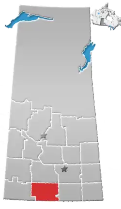
Assiniboia is a town in Southern Saskatchewan, Canada. It is located 110 km (68 mi) south-southwest of Moose Jaw beside Highway 2 and Highway 13.
Assiniboia | |
|---|---|
Town | |
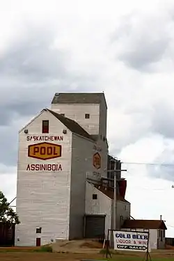 Assiniboia Grain Elevator | |
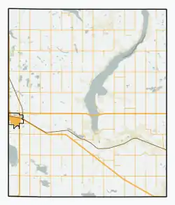 Assiniboia Location of Assiniboia  Assiniboia Assiniboia (Saskatchewan) | |
| Coordinates: 49.6328°N 105.9921°W | |
| Country | Canada |
| Province | Saskatchewan |
| Federal Electoral District | Cypress Hills-Grasslands |
| Provincial Constituency | Wood River |
| Village | 22 December 1912 |
| Town | 1913 |
| Government | |
| • Mayor | Bob Himbeault |
| • MLA | Dave Marit |
| • MP | Jeremy Patzer |
| Area | |
| • Land | 3.79 km2 (1.46 sq mi) |
| Population (2016) | |
| • Total | 2,389 |
| • Density | 243.4/km2 (630.3/sq mi) |
| Demonym(s) | Assiniboian |
| Time zone | UTC−06:00 (CST) |
| Website | Town of Assiniboia |
| [1] | |
History
The Dominion Land Survey's description of the area around Assiniboia is Sec.18, Twp.8, R.29, W2. It was first settled by people of English, French, Romanian, Scottish and Scandinavian descent.[2] From 30 March 1908 to 23 November 1912, the post office at this location was named Leeville, Saskatchewan.[3]
The settlement of Assiniboia originated on 12 October 1912, when the Canadian Pacific Railway put 980 lots up for sale at the townsite as it built a branch line through southern Saskatchewan. The community grew rapidly and on 22 December 1912 it was incorporated as a village. In 1913, the population rose from 400 to 1,400, and the community was incorporated as a town. The town's name comes from the former district of Assiniboia, in which the town is located.[4]
During the Great Depression, town officials employed out-of-work men to construct the Assiniboia sewer system. Unfortunately, the town could not afford to operate it until 1948.[2]
The RCAF Station Assiniboia World War II airfield, (now operated as the Assiniboia Airport) is located 6 nautical miles (11 km; 6.9 mi) north of Assiniboia.[5] It was used for elementary flight school training during the World War II years of 1942-1944.[6]
Demographics
| Canada census – Assiniboia, Saskatchewan community profile | |||
|---|---|---|---|
| 2016 | 2011 | 2006 | |
| Population: | 2,389 (-1.2% from 2011) | 2,418 (4.9% from 2006) | 2,305 (-7.2% from 2001) |
| Land area: | 3.79 km2 (1.46 sq mi) | 3.78 km2 (1.46 sq mi) | 3.78 km2 (1.46 sq mi) |
| Population density: | 630.3/km2 (1,632/sq mi) | 639.8/km2 (1,657/sq mi) | 609.9/km2 (1,580/sq mi) |
| Median age: | 50.8 (M: 47.8, F: 54.3) | 46.8 (M: 43.4, F: 49.5) | |
| Total private dwellings: | 1,210 | 1,241 | 1,228 |
| Median household income: | $46,955 | ||
| References: 2016[7] 2011[8] 2006[9] earlier[10] | |||
Climate
| Climate data for Assiniboia Airport, 1981–2010 normals, extremes 1915–present | |||||||||||||
|---|---|---|---|---|---|---|---|---|---|---|---|---|---|
| Month | Jan | Feb | Mar | Apr | May | Jun | Jul | Aug | Sep | Oct | Nov | Dec | Year |
| Record high °C (°F) | 11.2 (52.2) |
18.0 (64.4) |
22.3 (72.1) |
32.0 (89.6) |
37.0 (98.6) |
40.5 (104.9) |
42.8 (109.0) |
40.0 (104.0) |
37.5 (99.5) |
33.5 (92.3) |
24.7 (76.5) |
12.9 (55.2) |
42.8 (109.0) |
| Average high °C (°F) | −6.4 (20.5) |
−3.4 (25.9) |
2.2 (36.0) |
11.8 (53.2) |
18.0 (64.4) |
22.3 (72.1) |
26.3 (79.3) |
26.1 (79.0) |
19.4 (66.9) |
11.6 (52.9) |
1.5 (34.7) |
−4.4 (24.1) |
10.5 (50.9) |
| Daily mean °C (°F) | −11.8 (10.8) |
−8.6 (16.5) |
−3.2 (26.2) |
5.1 (41.2) |
11.0 (51.8) |
15.8 (60.4) |
18.9 (66.0) |
18.3 (64.9) |
12.1 (53.8) |
5.1 (41.2) |
−3.8 (25.2) |
−9.7 (14.5) |
4.2 (39.6) |
| Average low °C (°F) | −17.2 (1.0) |
−13.9 (7.0) |
−8.6 (16.5) |
−1.7 (28.9) |
3.9 (39.0) |
9.3 (48.7) |
11.5 (52.7) |
10.5 (50.9) |
4.8 (40.6) |
−1.5 (29.3) |
−9.1 (15.6) |
−15.0 (5.0) |
−2.2 (28.0) |
| Record low °C (°F) | −43.9 (−47.0) |
−40.6 (−41.1) |
−36.6 (−33.9) |
−30.0 (−22.0) |
−12.8 (9.0) |
−4.4 (24.1) |
0.8 (33.4) |
−2.8 (27.0) |
−13.3 (8.1) |
−23.9 (−11.0) |
−33.0 (−27.4) |
−43.5 (−46.3) |
−43.9 (−47.0) |
| Average precipitation mm (inches) | 16.1 (0.63) |
9.3 (0.37) |
15.1 (0.59) |
21.0 (0.83) |
51.1 (2.01) |
75.9 (2.99) |
60.1 (2.37) |
36.2 (1.43) |
34.0 (1.34) |
20.1 (0.79) |
15.1 (0.59) |
14.8 (0.58) |
374.6 (14.75) |
| Source: Environment Canada[11][12] | |||||||||||||
Education
- Seventh Avenue School (kindergarten - grade 4)
- Assiniboia Elementary School (grades 5 - 8)
- Assiniboia Composite High School (grades 9 - 12)
- Southeast Regional College - Assiniboia Campus (post-secondary)
References
- "Municipality Details". Municipal Directory System. Ministry of Municipal Affairs. 2 November 2009. Archived from the original on 5 April 2012. Retrieved 22 January 2011.
- McLennan, David (2006). "Assiniboia". Encyclopedia of Saskatchewan. Canadian Plains Research Center. Archived from the original on 14 November 2012. Retrieved 22 January 2011.
- "Assiniboia". Post Offices and Postmasters. Library and Archives Canada. 31 January 2007. Retrieved 22 January 2011.
- "Community Profile" (PDF). Town of Assiniboia. 10 October 2006. Archived from the original (PDF) on 21 July 2011. Retrieved 22 January 2011.
- Canada Flight Supplement. Effective 0901Z 16 July 2020 to 0901Z 10 September 2020.
- "BCATP Schools". Flight Ontario. Archived from the original on 12 March 2011. Retrieved 22 January 2011.
- "2016 Community Profiles". 2016 Canadian Census. Statistics Canada. 21 February 2017. Retrieved 18 March 2017.
- "2011 Community Profiles". 2011 Canadian Census. Statistics Canada. 5 July 2013. Retrieved 12 November 2012.
- "2006 Community Profiles". 2006 Canadian Census. Statistics Canada. 30 March 2011. Retrieved 24 February 2009.
- "2001 Community Profiles". 2001 Canadian Census. Statistics Canada. 17 February 2012.
- "Canadian Climate Normals 1981–2010". Environment Canada. Retrieved 15 September 2016.
- "Canadian Climate Data". Environment Canada. Retrieved 15 September 2016.