Redvers, Saskatchewan
Redvers is a town in southeastern Saskatchewan, Canada. It is the first town one passes through travelling west from Manitoba on the Red Coat Trail, once a thoroughfare of the Royal Canadian Mounted Police, and now modern Highway 13. A statue of a Mountie on a horse can be seen just west of the intersection of Highway 13 and Highway 8.
Redvers | |
|---|---|
Town | |
 The Mountie statue, visible from Highway 13 | |
 Redvers  Redvers | |
| Coordinates: 49°34′18″N 101°41′57″W | |
| Country | Canada |
| Province | Saskatchewan |
| Provincial Electoral District | Cannington |
| Federal Electoral District | Souris—Moose Mountain |
| Rural Municipality | Antler No. 61 |
| Post office established | 1902-06-01 |
| Incorporated | 1904 |
| Government | |
| • Type | Mayor/Council |
| • Mayor | Omer Carriere |
| • Administrator | Bonnie Rutten |
| Area | |
| • Total | 2.83 km2 (1.09 sq mi) |
| Elevation | 591 m (1,939 ft) |
| Population (2011)[1] | |
| • Total | 975 |
| • Density | 329.0/km2 (852/sq mi) |
| Postal code | S0C 2H0 |
| Area code(s) | 306 |
| Website | Town of Redvers |
| [2][3] | |
The town has a public school, hospital, two banks, and other businesses and services. Redvers is home to the Redvers Rockets, a senior hockey team in the Big 6 Hockey League. Like most towns in the area, its economy is based on farming, oil drilling, and various services.[4] Grain elevators are active along a Canadian Pacific Railway line paralleling the Redcoat trail.
History
.jpg.webp)
The town was named after General Sir Redvers Buller in 1897. Buller was then fighting in the Second Boer War, and had earlier in his career commanded a company to quell the Red River Rebellion. The town was incorporated in 1904. Its centennial was celebrated on 30 July 2004.
Climate
| Climate data for Redvers | |||||||||||||
|---|---|---|---|---|---|---|---|---|---|---|---|---|---|
| Month | Jan | Feb | Mar | Apr | May | Jun | Jul | Aug | Sep | Oct | Nov | Dec | Year |
| Record high °C (°F) | 8 (46) |
17.5 (63.5) |
18.5 (65.3) |
33.9 (93.0) |
37.2 (99.0) |
38.3 (100.9) |
38 (100) |
39 (102) |
36.7 (98.1) |
33 (91) |
22.5 (72.5) |
11.7 (53.1) |
39 (102) |
| Average high °C (°F) | −10.8 (12.6) |
−7.2 (19.0) |
−0.1 (31.8) |
10.6 (51.1) |
18.7 (65.7) |
22.9 (73.2) |
25.5 (77.9) |
25.2 (77.4) |
18.8 (65.8) |
11.3 (52.3) |
−0.5 (31.1) |
−8.8 (16.2) |
8.8 (47.8) |
| Daily mean °C (°F) | −16.1 (3.0) |
−12.3 (9.9) |
−5.2 (22.6) |
4.2 (39.6) |
11.9 (53.4) |
16.4 (61.5) |
18.7 (65.7) |
17.9 (64.2) |
11.9 (53.4) |
5 (41) |
−5.3 (22.5) |
−13.8 (7.2) |
2.8 (37.0) |
| Average low °C (°F) | −21.5 (−6.7) |
−17.5 (0.5) |
−10.2 (13.6) |
−2.2 (28.0) |
4.9 (40.8) |
9.8 (49.6) |
11.9 (53.4) |
10.5 (50.9) |
5.1 (41.2) |
−1.3 (29.7) |
−10 (14) |
−18.7 (−1.7) |
−3.3 (26.1) |
| Record low °C (°F) | −40 (−40) |
−41 (−42) |
−38.3 (−36.9) |
−24.4 (−11.9) |
−10 (14) |
−1 (30) |
1.5 (34.7) |
−3 (27) |
−8.9 (16.0) |
−21 (−6) |
−32.5 (−26.5) |
−41.5 (−42.7) |
−41.5 (−42.7) |
| Average precipitation mm (inches) | 25 (1.0) |
22.3 (0.88) |
24.6 (0.97) |
33.1 (1.30) |
62 (2.4) |
81.2 (3.20) |
64.3 (2.53) |
54.6 (2.15) |
50.6 (1.99) |
33.4 (1.31) |
25.2 (0.99) |
21.6 (0.85) |
498.1 (19.61) |
| Source: Environment Canada[5] | |||||||||||||
Notable Redvers people
- Dean Kennedy - former NHL player.
- Val Sweeting - Curler
See also
References
- "2011 Community Profiles". Statistics Canada. Government of Canada. Retrieved 2014-08-21.
- National Archives, Archivia Net. "Post Offices and Postmasters". Retrieved 2014-08-21.
- Government of Saskatchewan, MRD Home. "Municipal Directory System". Retrieved 2014-08-21.
- "Town Of Redvers". Archived from the original on 2012-09-30.
- Environment Canada Canadian Climate Normals 1971–2000, accessed 27 July 2010
External links
| Wikimedia Commons has media related to Redvers, Saskatchewan. |
Places adjacent to Redvers, Saskatchewan | |
|---|---|
| Cities | 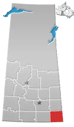 | ||||
|---|---|---|---|---|---|
| Towns | |||||
| Villages | |||||
| Rural municipalities | |||||
| First Nations | |||||
| Indian reserves | |||||
| Unincorporated communities |
| ||||