Kotalipara Upazila
Kotalipara (Bengali: কোটালীপাড়া) is an upazila of Gopalganj District[1] in the Division of Dhaka, Bangladesh.
Kotalipara
কোটালীপাড়া | |
|---|---|
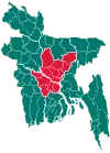
 Kotalipara Location in Bangladesh | |
| Coordinates: 22°59′N 89°59.5′E | |
| Country | |
| Division | Dhaka Division |
| District | Gopalganj District |
| Area | |
| • Total | 362.05 km2 (139.79 sq mi) |
| Population (1991) | |
| • Total | 206,195 |
| • Density | 570/km2 (1,500/sq mi) |
| Time zone | UTC+6 (BST) |
| Website | Official map of Kotalipara |
Geography
Kotalipara is located at 22.9833°N 89.9917°E. It has 37,603 households and a total area of 362.05 km2. It is a mofussil town. It is 4–5 hours from Dhaka via highway by bus (Aricha point) and 3 hours from Mawa point.
Demographics
As of the 1991 Bangladesh census, Kotalipara had a population of 206,195, of whom 102,198 were aged 18 or over. Males constituted 50.48% of the population, and females 49.52%. Kotalipara had an average literacy rate of 34.8% (7+ years), against the national average of 32.4%.[2]
Administration
Kotalipara Upazila is divided into Kotalipara Municipality and 12 union parishads: Amtali, Bandhabari, Ghagar, Hiran, Kalabari, Kandi, Kushla, Pinjuri, Radhaganj, Ramshil, Sadullapur and Suagram. The union parishads are subdivided into 101 mauzas and 208 villages.[3]
Kotalipara Municipality is subdivided into 9 wards and 9 mahallas.[3]
References
- Swapan Kumar Gain (2012). "Kotalipara Upazila". In Sirajul Islam and Ahmed A. Jamal (ed.). Banglapedia: National Encyclopedia of Bangladesh (Second ed.). Asiatic Society of Bangladesh.
- "Population Census Wing, BBS". Archived from the original on 2005-03-27. Retrieved November 10, 2006.
- "District Statistics 2011: Gopalganj" (PDF). Bangladesh Bureau of Statistics. Archived from the original (PDF) on 10 October 2015. Retrieved 14 July 2014.
| Upazila/Thana: | ||
|---|---|---|