Madaripur Sadar Upazila
Madaripur Sadar (Bengali: মাদারিপুর সদর) is an upazila of Madaripur District in the Division of Dhaka, Bangladesh.[1]
Madaripur Sadar
মাদারিপুর সদর | |
|---|---|
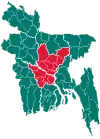
 Madaripur Sadar Location in Bangladesh | |
| Coordinates: 23°10′N 90°12.5′E | |
| Country | |
| Division | Dhaka Division |
| District | Madaripur District |
| Area | |
| • Upazila | 283.14 km2 (109.32 sq mi) |
| • Metro | 13.99 km2 (5.40 sq mi) |
| Population (2011) | |
| • Upazila | 345,764 |
| Time zone | UTC+6 (BST) |
| Postal code | 7900 |
| Telephone area code | 0661 |
| Website | sadar |
Geography
Madaripur Sadar is located at 23.1667°N 90.2083°E. It has 74451 households and total area 283.14 km2. It is bounded by Shibchar and Zanjira Upazilas on the north, Kalkini and Kotalipara Upazilas on the south, Shariatpur Sadar Upazila on the east, Rajoir Upazila on the west.
Demographics
As of the 2011 Bangladesh census, Madaripur Sadar has a Population Total 345,764; male 171,329, female 174,435; Muslim 336,754, Hindu 35,819, Buddhist 12, Christian 103 and others 97. Males constitute49.6% of the population, and females 50.4%. This Upazila's eighteen up population is 187868. Madaripur Sadar has an average literacy rate of 51.1% (7+ years), and the national average of 48.4% literate.[2]
Points of interest
- Shah Madar (RA) Dargah Sharif,
- Algi Kazibari Mosque - Bahadurpur,
- Jhaoudi Giri - Jhaoudi,
- Auliapur Neelkuthi - Chilarchar,
- Mithapur Zamindar Bari - Mithapur
- Mather Bazaar Math - Khoajpur,
- Parboter Bagan - Mastofapur,
- Madaripur Shakuni Lake,
- Charmuguria Bandar,
- Narayan Mandir - Panichatra,
- Kulpadi Zamindar Bari and Weather office.[3]
Administration
Madaripur Sadar Upazila is divided into Madaripur Municipality and 15 union parishads: Bahadurpur, Chilar Char, Dhurail, Dudkhali, Ghatmajhi, Jhaoudi, Kalikapur, Kandua, Khoajpur, Kunia, Mastofapur, Panchkhola, Reyarpur, Rasti, and Sirkhara. The union parishads are subdivided into 159 mauzas and 185 villages.[4]
Madaripur Municipality is subdivided into 9 wards and 34 mahallas.[4]
Education
Currently there have no full-fledged public and/or private universities except few colleges affiliated with national university.
Literacy rate and educational institutions Average literacy 51.1%; male 53.9%, female 48.4%. Noted educational institutions:
- Government Nazimuddin College (1948)
- Charmuguria College (1978)
- Government Sufiya Mahila College (1984)
- Syed Abul Hossain College (1989)
- Donovan Government Girls' High School (1914)
- United Islamia Government High School (1950) [Before Madaripur High School (1885)]
- Madaripur Public Institution (1953)
- Mithapur LS High School (1915)
- Charmuguria Merchants High School (1931)
- Tantibari Islamia High School (1954)
- AC North Kalagachhia High School' (1961)
- Ghatokchar Multilateral High School (1963)
- Bahadurpur High School' (1968)
- Julio Kuri High School (1972)
- Charnachana Fazil Madrasa (1912)
Notable residents
References
- Kazi Nazmul Islam (2012), "Madaripur Sadar Upazila", in Sirajul Islam and Ahmed A. Jamal (ed.), Banglapedia: National Encyclopedia of Bangladesh (Second ed.), Asiatic Society of Bangladesh
- "Population Census Wing, BBS". Archived from the original on 2005-03-27. Retrieved November 10, 2006.
- "Tourist Spot". Madaripur Sadar Upazila (in Bengali). Retrieved 2019-08-04.
- "District Statistics 2011: Madaripur" (PDF). Bangladesh Bureau of Statistics. Archived from the original (PDF) on 13 November 2014. Retrieved 14 July 2014.
Capital: Madaripur | ||
| Upazilas | ||
| Constituencies | ||
| Attractions and sites | ||
| History | ||
| Inhabited areas | ||
| Rivers and transport | ||
| Educational institutions | ||